Stanley Glacier Trail is probably the most popular day hike in Kootenay National Park in British Columbia, and we can easily see why. It’s a medium difficulty trail with lots of different scenery (forest, meadows, rock walls, waterfalls) and a glacier view at the end, so the effort-reward ratio is pretty good. However, save this hike for clear days, because it’s the views that make it really special. Also, save it for calm days, as wind makes it risky.
Why should you hike the Stanley Glacier Trail?
If you’d like to do only one day hike in Kootenay National Park, we recommend choosing the Stanley Glacier hike. We hiked a lot and explored many trails all over the world, and it’s not common to get access to this kind of high mountain views with just a few hours of hiking.
However, if you’re looking for the best panoramic trail in the Canadian Rockies, Parker Ridge Trail to Saskatchewan Glacier in Banff National Park was the absolute winner for us. It offers jaw-dropping 360 degrees views of all the surrounding snow-capped peaks, Saskatchewan Glacier and its valley, and the Icefields Parkway meandering below. The viewpoint at the end of Stanley Glacier Trail doesn’t offer as wide a view, because the rock walls of the valley are towering above you (and they look very dramatic, by the way).
With that said, it’s definitely a worthwhile trail. But Canada and the Canadian Rockies offer so many wonderful mountain trails that you can easily find yourself in a situation when you need to choose only a handful of those. Hopefully, this post helps you with that decision, as well. So let’s see everything you need to know about the Stanley Glacier Trail.
How to access the trailhead?
Like most of the Kootenay National Park attractions, Stanley Glacier Trailhead is along Highway 93, the Banff-Windermere Highway, that leads through the park. It takes a 12 minutes drive to get there from Castle Junction, or 30 minutes from Banff.

There’s a spacious parking lot just off of the road, but size is relative. It can fill up in July or August, but finding an available parking spot in Kootenay is not nearly as challenging as in neighboring Banff National Park. Once you’re parked, cross the Vermillion River Footbridge and start your ascent in the forest. You can’t choose the wrong trail as there’s only one that starts here.
Highlights of the Stanley Glacier Trail
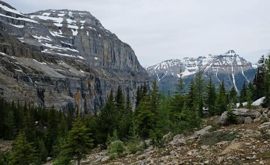
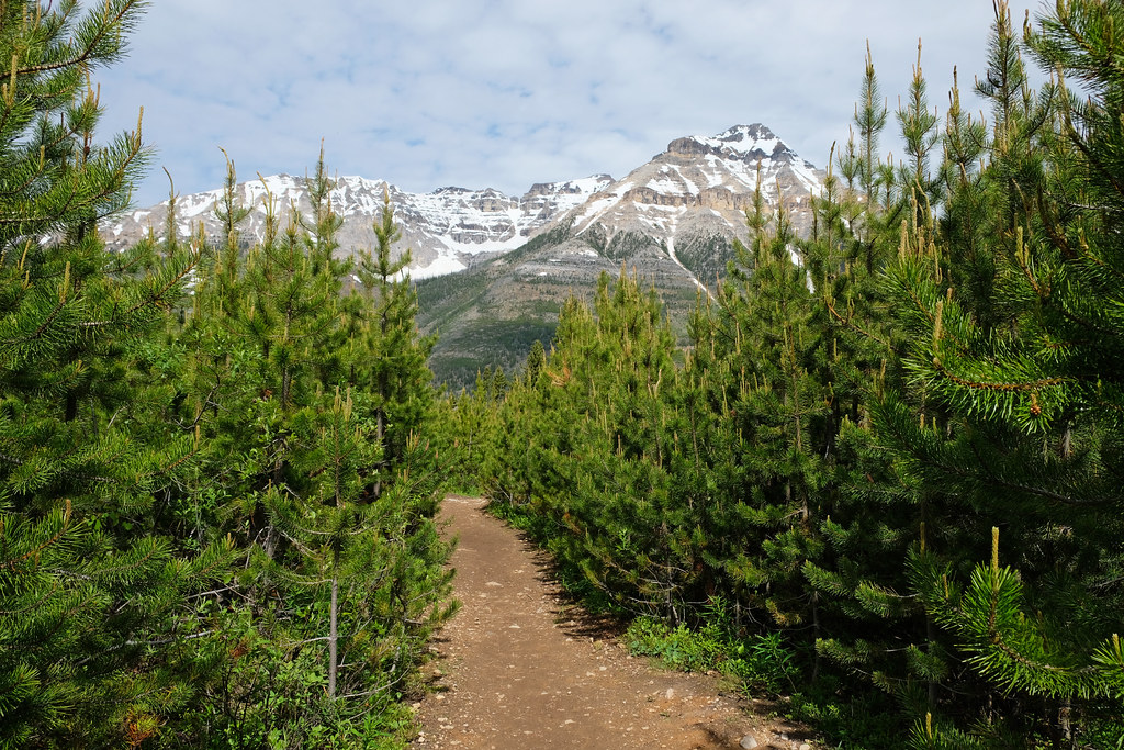
The hike starts in the forest, but most of this forest burnt down in wildfires in 1968 and 2003. It means that you can see the new growth forest, lots of wildflowers (because they get enough sunshine), but you also get panoramic views quite soon, as the trees are still small enough not to block the view. The elevation gain is quite steady during this first section. It’s a series of switchbacks that even kids can easily complete if they have the stamina.
Then you reach an alpine meadow, and even better views. The trail flattens, but not for very long, so enjoy the light walk, and look for waterfalls running down the Guard Wall at the side of the valley in spring and early summer. The view of Stanley Peak is also amazing.
Once you leave the forested area behind, the trail becomes a loop, so you can take either the left or right trail to hike up to the glacier viewpoint. Honestly, both are quite steep at times, and there are also loose rocks which makes both sides of the loop challenging when coming down. There’s no better or worse choice, just climb.
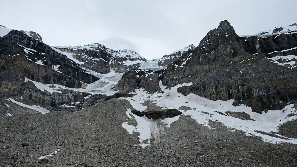
The official trail ends on a forested plateau that offers nice, but not super close views of Stanley Glacier and a stunning view of the valley below. It’s at 2150 meters. You can scramble up to the foot of the glacier (2440 m) to get closer views, but there’s no maintained trail. Otherwise, you can cross the stream and hike down to complete the loop. Once you reach the forested meadow, it’s the same way as you came.
While on the trail keep your eyes open for fossils, as the area is part of the Burgess shale. Don’t touch or move them though – you know: take nothing, but pictures.
How hard is the Stanley Glacier hike?

It’s a medium difficulty trail, with about 600 meters elevation gain altogether. The first half of the trail is steady uphill, then after an almost flat section, the terrain gets steeper, but what makes it tricky is the loose rocks. There’s no exposure, but watch your steps – even more on the way down.
There are still some standing blackened trees after those huge forest fires, and it makes this trail dangerous on windy days. They will fall down eventually.
Is the hike to Stanley Glacier busy?
You’ll be surrounded by fellow hikers on the trail in the summer months, but it’s not nearly as busy as anything that starts from Lake Louise or Lake Moraine in Banff National Park. Early fall is a quieter time in Kootenay National Park, but the chance of stormy days are also higher in the fall, and snow can arrive early, as well.
When is the best time to hike?
The trail is snow free roughly between June and September. Depending on the current year, even June might not be completely snow free. We hiked to Stanley Glacier in August, and there was no snow at all on the trail.
- Trailhead: Stanley Glacier Trailhead (parking lot off of Highway 93)
- Length: 10.8 km return
- Difficulty: medium
- Season to visit: June – early October
- See the trail map here!