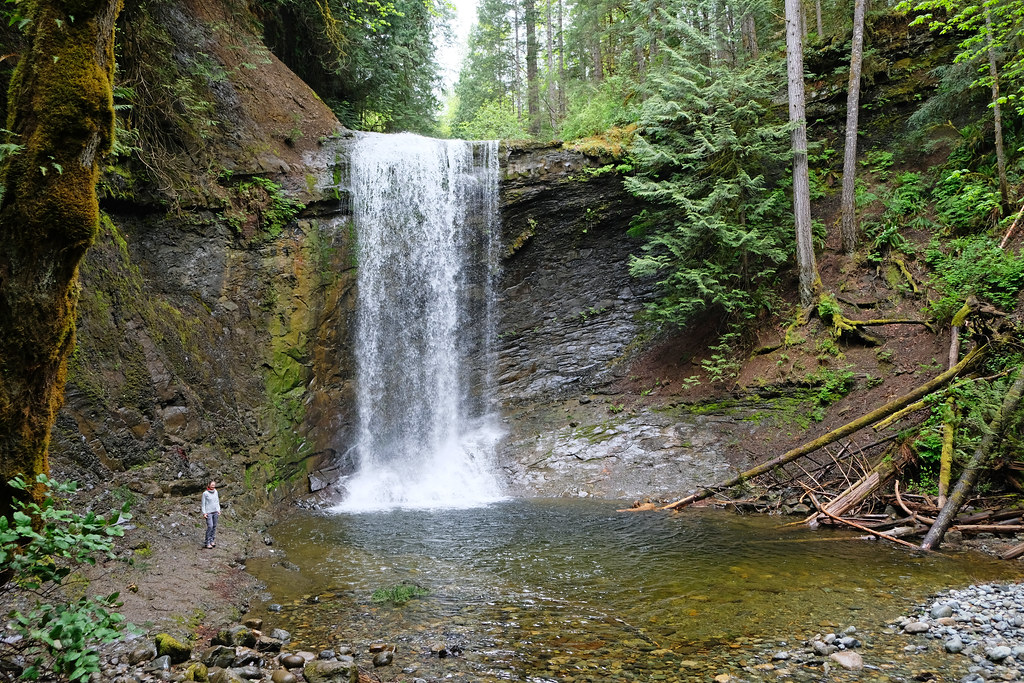
You can’t not notice waterfalls on Vancouver Island. Whichever region we visited, we found countless of them, whether we expected them or not. Not only are they powerful and spectacular, but most of them can be accessed on short, easy trails. They’re great for visiting with kids and also great as short, scenic stops on your Vancouver Island road trip.
So in this post we collected the best Vancouver Island waterfalls, grouped by region (the regions we visited, which don’t cover the northernmost area near Port Hardy).
DO YOU NEED A CAR FOR YOUR ROAD TRIP? SEARCH, COMPARE AND SAVE:
Discover Cars is one of the world’s largest online car rental platforms with vehicles in 10,000+ locations. Compare the best rates here.
Waterfalls near Victoria
Niagara Falls, Goldstream Provincial Park
Though it’s not the world-famous Niagara Falls, and I have no idea why it has the same name, it’s surely worth a stop if you visit Victoria. Only about 20 minutes drive from the city and 10 minutes walk from the trailhead, it’s an easily accessible, pretty waterfall in a lush green setting. It’s narrow, but drops 47.5 meters.
There are two parking lots that you can use for access. The first one is a small gravel pullout on the west side of Highway 1. From here you walk a few minutes along the left bank of Niagara Creek to reach the waterfall. You can carefully walk down to the edge of the creek for the best view. It’s not recommended to venture too close – neither it is easy, especially when the water level is high, because you’d need to walk in the creekbed.
The larger, more convenient day-use parking lot in Goldstream Provincial Park is on the east side of Highway 1, but then you need to go through a tunnel under the highway to join the trail on the left bank of the creek. It’s longer than walking from the gravel pullout, but the real problem is when the tunnel becomes impassable. This happens any time when Niagara Creek runs high, mostly in the winter and spring months, but also after heavy rains.
In this case you can only use the small gravel parking on the other side of the highway. (That’s what we did. It was late spring, after heavy rains.) But you can’t just turn left on the highway, so you need to drive a few kilometers north, until the first U-turn route, to then drive south and park on the other side. Here’s a map where I indicated both parking lots:
- Trailhead: Niagara Falls parking off Highway 1, or day use area parking in Goldstream Provincial Park
- Length: 200 m one-way from the gravel pullout (about 1 km from the day use area parking)
- Difficulty: easy
Sitting Lady Falls, Witty’s Lagoon Regional Park
Witty’s Lagoon Regional Park turned out to be such a pleasant surprise. We didn’t expect much, other than some nice spots for a toddler to run around, and it gave us a beautiful, photogenic waterfall, surrounded by the typical West Coast greenery, and also a large beach and a scenic rocky headland (Tower Point).
Of course, we started with Sitting Lady Falls first. There’s an excellent viewing platform directly across the waterfall, there’s even a bench (for tired toddlers to have yet another snack break). You start at the Nature Center, down the hill. When you reach the wooden bridge, you can look down onto Sitting Lady Falls. But for the best view, don’t cross the bridge, rather turn left and follow the Lagoon Trail which takes you to the viewing platform.
Warning: we saw Sitting Lady Falls in mid-spring, and it was gorgeous! They say it can disappoint in the summer, the amount of water is significantly less.
You can then return to the wooden bridge, cross it and walk to Witty’s Beach. It’s a sandy beach with relatively calm waters, and its size depends on the tide. It’s barely anything at high tide, but it stretches out several hundred meters at low tide. You can see countless birds in the salty lagoon, and thousands of crabs under the rocks on Witty’s Beach.
- Trailhead: Witty’s Lagoon Regional Park Nature House
- Length: ~300m walk one-way
- Difficulty: easy
Mary Vine Creek waterfall, Sea to Sea Regional Park
Sooke Potholes Provincial Park was another lovely find near Victoria, and it spoiled us with several waterfalls and impressive canyon views, with barely any hiking required. That’s where we found Mary Vine Creek waterfall, which is actually not even located in the park, but in neighboring Sea to Sea Regional Park, and it’s relatively unknown. Maybe because it almost disappears during a dry summer.
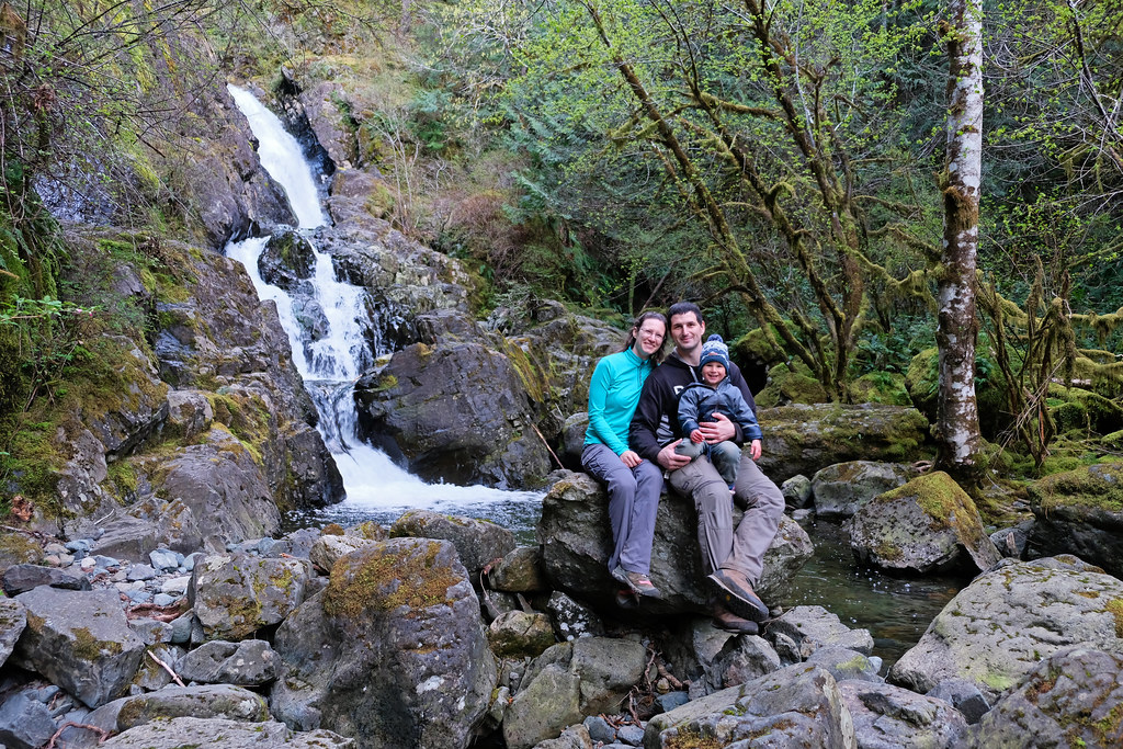
It definitely existed, and with lots of water flowing, when we visited in April though. And you need to drive to Sooke Potholes Provincial Park to find it, all the way to parking lot 2 (or 3). Then follow Peden Lake trail, an easy, steadily ascending forest path along a small creek. Signs indicate the waterfall, and even though I was first confused to leave the creek and start climbing up, that’s what you need to do to end up at the waterfall viewpoint. You can marvel at this gem from very close.
While driving to the parking lot, you’ll notice another waterfall by the road. That’s Todd Creek waterfall, and if you’re lucky, you’ll find the small pullout right by the waterfall empty. Walk closer, it’s also a pretty waterfall after heavy rains.
- Trailhead: near Sooke Potholes parking lot 2
- Length: 1.8 km return (see the trail map here)
- Difficulty: easy
Do you have a place to stay for your trip to Victoria? If you quickly need to book something, here’s what we recommend:
Best accommodations in Victoria:
- Luxury: Fairmont Empress Hotel (top location)
- Mid-range: Beaconsfield Bed and Breakfast
- Budget: James Bay Inn Hotel, Suites & Cottage
Waterfalls near Campbell River
Elk Falls, Elk Falls Provincial Park
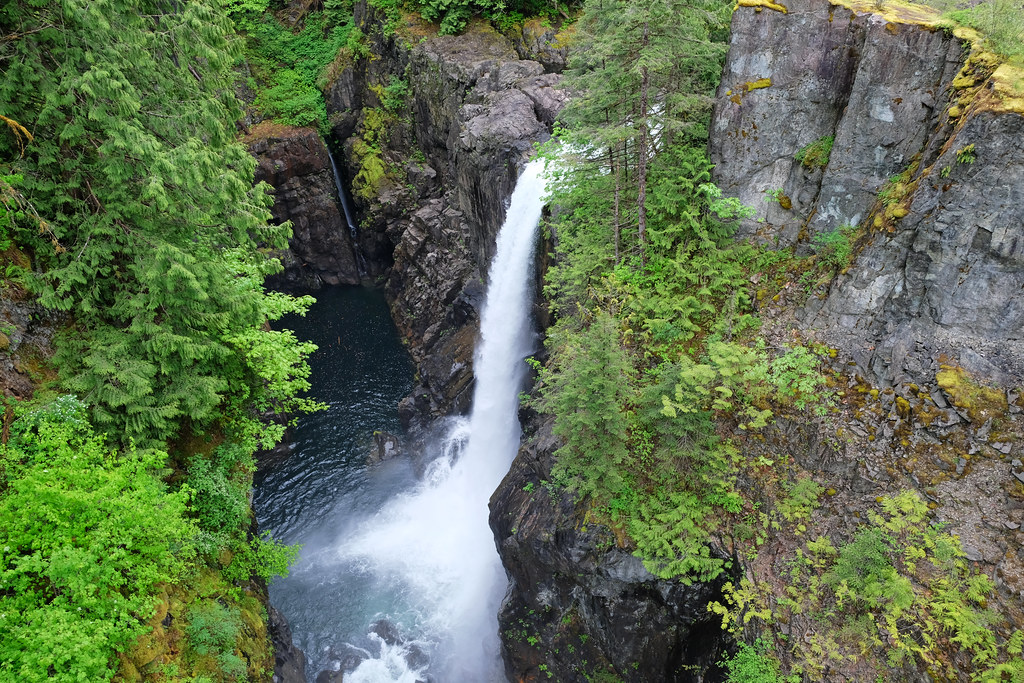
25 meters tall Elk Falls is among the most famous ones on Vancouver Island, and it impresses both with its power and beauty. In addition, you can enjoy the view of the falls, the canyon and the river from Elk Falls Suspension Bridge. It’s 60 meters long and stands 64 meters above Campbell River. It connects two viewing platforms, the lower one offering the closest view of Elk Falls tumbling down from a rocky outcrop.
But it’s worth continuing your hike after the viewing platform at the suspension bridge. Venturing further north, you can get down to Campbell River, then hike along the river and end up at Deer Falls viewpoint. Deer Falls is not nearly as spectacular as Elk Falls, but the river trail would be a pretty addition even without a second waterfall. You can make a loop by returning on the trail through the forest, among old-growth Douglas fir trees.
- Trailhead: Elk Falls Provincial Park day use parking area
- Length: 960 m one-way (2.3 km one-way to the Deer Falls viewpoint)
- Difficulty: easy
Lady Falls, Strathcona Provincial Park
Strathcona Provincial Park lies on a remote, wild land as you drive towards the inside of Vancouver Island from Campbell River. It’s a quiet kingdom of pine forests, lakes and waterfalls, and our road trip through this park turned out to be one of the most magical things we’ve done on the island. In addition to the scenic drive, we had several waterfall stops. What’s common in the waterfalls is their incredible power, and that each one can be reached on a short walk, not even deserve to be called a hike. The terrain can be muddy though, so waterproof hiking boots are still recommended.
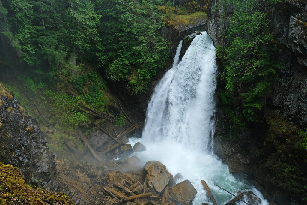
Lady Falls was probably our favorite of the Strathcona waterfalls. The trail starts in the picnic area just off Highway 28 – a minor, average quality, paved road. You hike in an old-growth forest of cedar, Douglas fir and hemlock, and soon end up at a viewing platform that looks down onto 90 foot Lady Falls plunging into a deep canyon. You’ll feel the mist on your face. Take on a rain jacket if the wind is strong, otherwise you’ll get soaked on the platform. It looks the most dramatic in spring. (My picture was taken at the end of May.)
- Trailhead: Lady Falls Picnic Area
- Length: 0.9 km return
- Difficulty: easy
Lower Myra Falls, Strathcona-Westmin Provincial Park
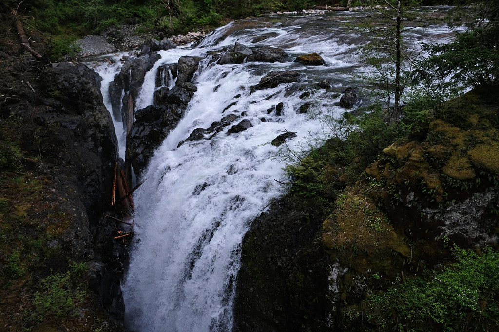
Upper and Lower Myra Falls are another hour drive away from Lady Falls, along the shore of Buttle Lake. Lower Myra Falls can be reached on a short and easy trail (~1.5 km return), and the reward is high: enjoying the powerful cascades with its basalt rock terraces from two viewing areas. The falls drop about 60 meters in three cascades, flowing into Buttle Lake at the end. The lower viewing area is the more spectacular, allowing you to get close to the pools of this pretty waterfall. I imagine them to be amazingly turquoise in the sunshine, but we got rain instead, mixing with the spray of the waterfall, making us feel the power of the water even more.
Nearby Upper Myra Falls requires a 7 km hike (there and back) in the forest, and we didn’t have time to do it with a tired 2-year-old at the end of the day.
- Trailhead: dirt parking lot off Westmin Road
- Length: 1.5 km return
- Difficulty: easy
Lupin Falls, Strathcona Provincial Park
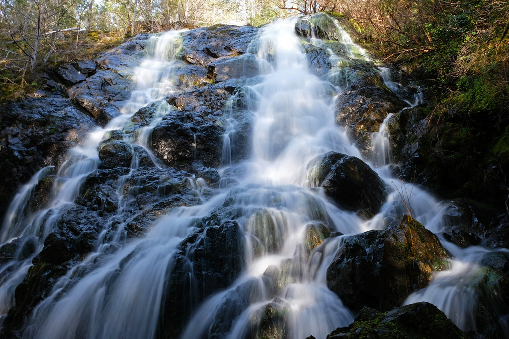
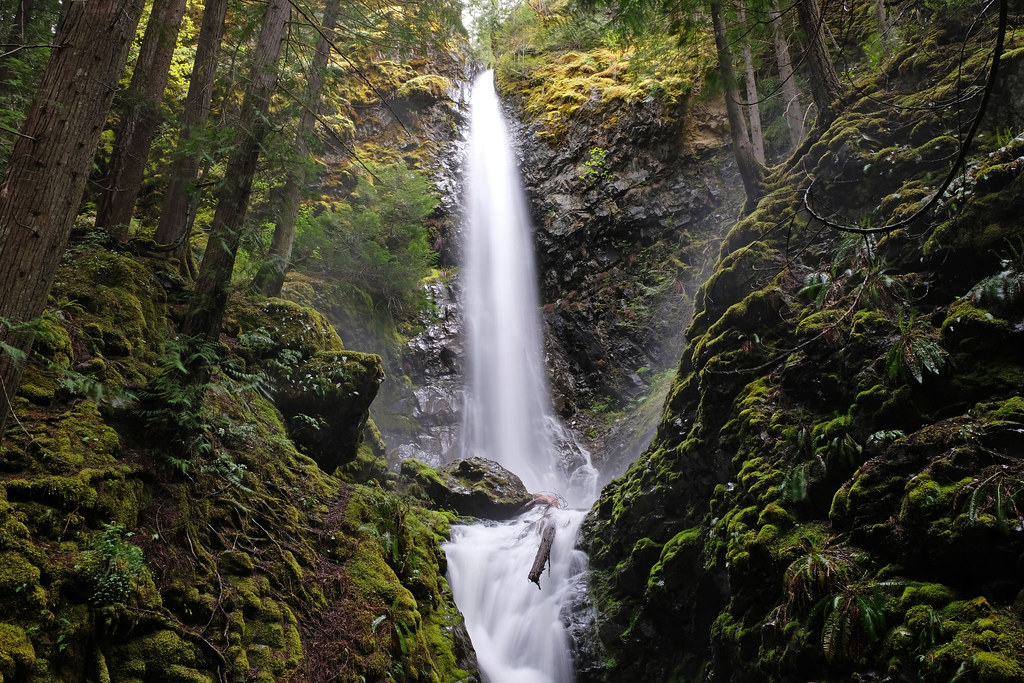
We stopped at Lupin Falls on our way to Lower Myra Falls. It’s not as breathtaking as Lady and Lower Myra Falls, but who’d miss another waterfall that only requires a very short walk? Right, don’t. Lupin Falls is tall and skinny, surrounded by lush greenery. It thunders in spring, but only trickles by the end of summer.
The trail starts from a dirt pullout off Westmin Road, and you can also take a short walking trail to the lakeshore of Buttle Lake from there.
- Trailhead: Lupin Falls Trail parking (off Westmin Road)
- Length: 0.8 km return
- Difficulty: easy
Are you looking for accommodation in Campbell River? Here are the top choices.
Best accommodations in Campbell River:
- Luxury: Brown’s Bay Resort (remote, beachfront location), Chateau Riverside (central location in Campbell River)
- Mid-range: Comfort Inn & Suites
- Budget: Driftwood by the Sea Inn (beachfront cottages)
Waterfalls near Nanaimo
Englishman River Falls, Englishman River Falls Provincial Park
A roaring waterfall near Parksville is Englishman River Falls. The loop trail runs along the river and crosses two bridges, giving you the best view of the upper and lower waterfall. The upper one is closer to the parking area, and it’s larger and more dramatic, while you can enjoy a swimming hole below the lower fall in the summer (ice cold!).
The trail is short, but has some steep uphills and downhills, as the waterfalls tumble into a deep canyon.
- Trailhead: Englishman River Falls Provincial Park parking lot
- Length: 1.3 km loop
- Difficulty: easy
Little Qualicum Falls, Little Qualicum Falls Provincial Park
Unlike its name suggests, Little Qualicum Falls is one of the best and biggest waterfalls on Vancouver Island. Since we camped in Little Qualicum Falls Provincial Park, it was only a short walk away from the campground along the river. The best morning walk ever! You can also park your car and start the loop from the day use area.
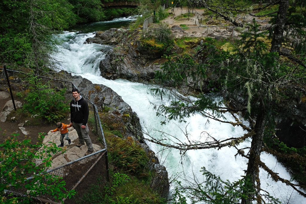
The trail is easy to follow and very well maintained, with security fences all around the waterfall area. Enjoy views of Little Qualicum Falls from both sides of the canyon, then hike down to the second bridge. It’s not just the powerful, multi-tiered upper waterfall and the charming lower one that makes this trail worth it, but also the dramatic gorge views.
It’s an ideal stop on your way from Nanaimo to Tofino.
- Trailhead: Little Qualicum Falls day use area
- Length: 1.5 km loop (see the trail map here)
- Difficulty: easy
Ammonite Falls, Benson Creek Falls Regional Park
We were looking for a nice waterfall hike to do before boarding the ferry back to Vancouver from Nanaimo, and 18 meters high Ammonite Falls was just the perfect choice. Also known as Benson Creek Falls, it’s a beautifully symmetric sheet and raging especially in winter and spring.
Finding it was a bit tricky, but what confused us is that you can hike to the falls from both north and south. We found the northern parking area (called Benson Creek Falls North Parking Lot), from where we could get to the waterfall on the Jail Trail – see the route here. It includes a spectacular creek crossing, as new wooden stairs and bridges have recently been established to provide safe access to the deep ravine of Benson Creek. This means the trail requires climbing some stairs, and the final section to the waterfall viewing platform is also a mix of stairs and rope-assisted descent. You can walk down to the bottom of the falls, too, just be careful, because the ground is slippery and wet.
You can also choose to do a longer loop (about 5-6 km) from Ammonite Falls parking, off Creekside Place.
- Trailhead: Benson Creek Falls North Parking Lot
- Length: 2.8 km return
- Difficulty: medium
Hole-In-The-Wall waterfall, Port Alberni
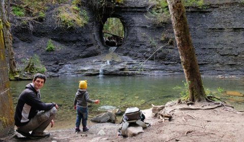
This is not really a waterfall, rather a one of a kind water feature, making for a nice stop on your way to Tofino. It was once an opening for a water pipeline, and today water flows through the hole. It didn’t have much water though when we visited, and I personally think it’s one of those places that look more tempting on photographs than in real life.
- Trailhead: off Alberni Highway, just on the opposite side of Coombs Country Candy
- Length: 1.5 km return
- Difficulty: easy
Christie Falls, Ladysmith
This is the only waterfall in the list that we haven’t hiked to, but it’s a popular hike in the Nanaimo area and a bucket list item for our next visit. Christie Falls is south of Nanaimo, sitting above the Bush Creek Fish Hatchery. A 7 km loop enables access to the waterfall.
Best accommodations in Nanaimo:
- Luxury: Coast Bastion Hotel
- Mid-range: Long Lake Waterfront Bed and Breakfast (lakeside location)
- Budget: Days Inn by Windham Nanaimo
Coastal waterfalls in Juan de Fuca Provincial Park
Finally, a very special selection: coastal waterfalls! Once we thought that waterfalls that flow into the ocean at high tide or onto the beach at low tide are rare and hard to find. Vancouver Island has proved us wrong. These waterfalls are among the most unique ones in British Columbia.
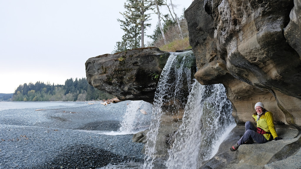
Sandcut Beach waterfall
The beaches of Juan de Fuca Provincial Park require hiking. The coastline in the park is steep, covered by dense forest, so beach walks are somewhat more challenging than you’d expect. The forest trail to the beach can also be extremely muddy. But the beaches are long, untouched and never get crowded. Sandcut Beach is one of them, featuring a few meters high waterfall falling from the coastal cliffs. What makes it special is the setting, the sandstone cliffs and the beach.
To find the trailhead, pull over to the small parking lot by Highway 14 after crossing Sandcut Creek. You can hike down to the beach, then walk on the beach towards Sandcut Creek.
- Trailhead: small pullout after the road crosses Sandcut Creek
- Length: ~2 km return
- Difficulty: medium
Mystic Beach waterfall
Mystic Beach is another one that’s accessible only on a steep (and very muddy) forest trail, descending steadily and crossing a suspension bridge over a creek on the way. Mystic Beach is also one of the access points to Juan de Fuca Marine Trail, a multi-day hike along the coastline. Skinny Mystic Beach waterfall tumbles off a 10 meters high cliff into the ocean (at high tide) or onto the beach (at low tide). Again, it’s not the tallest or the most powerful waterfall on the island, but it offers such an idyllic setting!
- Trailhead: Mystic Beach parking / China Beach parking
- Length: ~4.2 km return (see the trail map here)
- Difficulty: medium
China Beach waterfall
China Beach shares the parking lot with Mystic Beach, and it’s a roughly 800 meters walk from there, steadily descending. The beach is quite similar to Mystic Beach, and even though we read about China Beach waterfall before our visit, we saw no waterfall while walking on the beach. Then I walked past the cliffs at the western end of the beach, and there I noticed a small canyon and heard roaring water. China Beach waterfall is at the back of the beach, hidden in a ravine, and it’s not as spectacular as Mystic Beach waterfall, but it’s worth the short walk once you’re there.
- Trailhead: Mystic Beach parking / China Beach parking
- Length: ~1.6 km return
- Difficulty: easy
Sombrio Beach waterfall
Despite being one of the most unique waterfalls on Vancouver Island, it doesn’t even have a proper name. Most often it’s referred to as Sombrio Beach waterfall, because it’s in a narrow, mossy slot canyon behind Sombrio Beach. It’s as impressive as it sounds, like a piece of land from Jurassic Park.
Finding it takes some effort, but it’s actually a hidden waterfall that’s quite well-known, so you’ll most likely see other hikers. You need to take the short trail to Sombrio Beach (the area east of Sombrio River) from the parking lot first, then walk along the beach until you cross a tiny creek. Follow the water upstream, and you’ll find the canyon entrance. It’s wet and slippery, and you actually hike in the small creek to access the waterfall. But what you find inside is magic. 🙂
- Trailhead: Sombrio Beach parking
- Length: 3 km return (see the trail map here)
- Difficulty: easy
Hidden waterfall between Sombrio Beach & Chin Beach
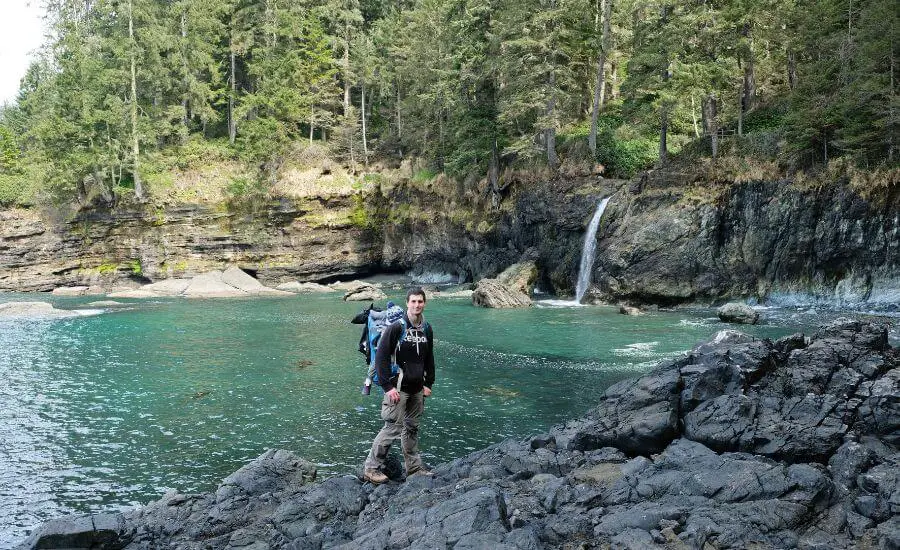
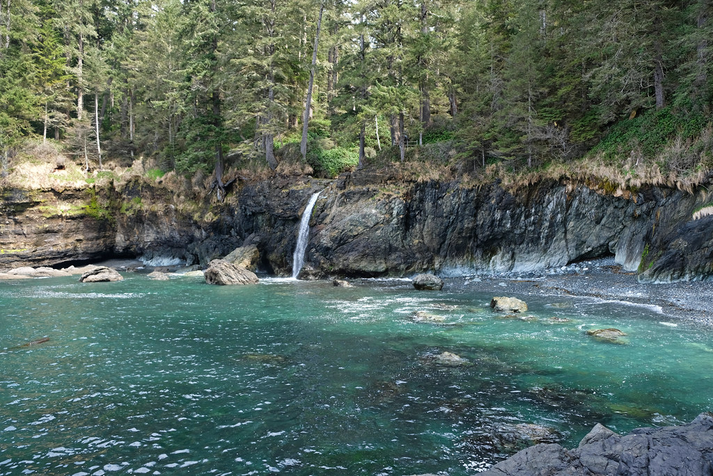
Here’s another unnamed waterfall along the Juan de Fuca Trail, between Sombrio Beach and Chin Beach. It takes about 15 minutes to reach it from Sombrio Beach on a muddy coastal forest trail, and it flows right into an idyllic turquoise bay. I have no idea why no one ever named it, and we’ve never heard about it either. We randomly found it as we hiked the Juan de Fuca Trail from Sombrio Beach towards Chin Beach. What a surprise!
Your first view of this waterfall won’t be the best, but don’t worry, continue on the trail, get past the waterfall, and you’ll get an unobstructed, frontal view from the coastal cliffs.
- Trailhead: Sombrio Beach parking
- Length: ~5 km return
- Difficulty: medium
Best accommodations for visiting Juan de Fuca Provincial Park:
- Luxury: Port Renfrew Oceanfront Retreat (coastal location in Port Renfrew) or Prestige Oceanfront Resort (central location in Sooke)
- Mid-range: Wild Renfrew Seaside Cottages (beachfront location in Port Renfrew) or Arbutus Cove Guesthouse (in Sooke)
- Budget: Sterling Cove B&B (Sooke)
Vancouver Island waterfalls map
Click on the picture to see all the waterfalls on an interactive map:
More fascinating waterfalls in BC:
- 12 Best Waterfalls Near Vancouver
- 12 Best Hikes In North Vancouver, British Columbia
- Which Shannon Falls Hike Is For You?
Is there a best time to visit?
Waterfalls are the most spectacular after heavy rains or when the snow melts. There’s no shortage of rain in the majority of the year on Vancouver Island, the only exception is summer. Waterfall hunting is a great thing to do on a winter visit, as most of these waterfalls are accessible all year, and short waterfall walks can be enjoyed even on rainy winter days.
We visited Vancouver Island several times in spring, and the waterfalls were roaring even at the end of May (and we also got our fair share of rainy days, too). The rainy climate of the coast creates a paradise for waterfall lovers, and even though some waterfalls can disappoint in the summer, they don’t dry out completely.
What to wear hiking in the summer?
Hiking pants, preferably zip-off pants: mornings and evenings are chilly, so you’ll be happy to wear long sleeve pants, but it’s very practical if you can simply zip the sleeves off in the hottest part of the day, or when hiking uphill. Columbia offers affordable, practical and durable models both for women and men.
Waterproof hiking boots: appropriate footwear is very important to have an enjoyable and safe hike. We recommend wearing hiking boots that provide good traction. Waterproofness is also important, because weather in BC is quite rainy for most of the year, and melting snow makes lots of trails muddy well into the summer. Dry feet are key for a happy hike. This Columbia Newton Ridge Plus is a great option for women, and the Newton Ridge Plus II for men.
Long sleeve hiking top: you can wear a lightweight, long sleeve top with sun protection as a standalone wear on high mountain trails (it never gets too hot up there, but the sun will be harsh on your skin on clear days), or you can use it as an additional layer when it gets chilly in the morning or evening at lower elevations. This BALEAF top for women offers UPF 50+ protection, and NAVISKIN has a long sleeve T-shirt with UPF 50+ protection for men.
T-shirt: moisture-wicking and quick-drying technical T-shirts are the best for hiking on a hot day. Here’s a great model for women, and here’s one for men.
Hiking socks: merino wool blends are moisture-wicking and breathable, they keep your feet cozy either when temperatures are warm or cold.
Waterproof rain jacket: a lightweight, easily packable rain jacket should always be in your backpack, just in case. You don’t want to get caught unprepared in a sudden storm. Columbia jackets are affordable and effective for the average hiker, here you find them for women and for men.

