North Vancouver is a city that’s known for its hiking, skiing and snowshoeing trails, the Capilano Suspension Bridge Park, fairy tale Lynn Canyon, lush green, old-growth rainforests and countless waterfalls. It’s connected to Downtown Vancouver by seabus, but its best sights are not the kind you expect from a city, rather from a national park. It tempts everyone to become a hiker, if only for the duration of their visit, and we collected the very best North Vancouver trails in this post, including some easy walks and overrated hikes that are often recommended, but we think it’s better to avoid them. We hope you’ll find some new ideas even if you live and hike here often.

North Vancouver is probably our favorite city in the Greater Vancouver metropolitan area, and we are lucky to live right next to it, in Burnaby, being about a 15-20 minutes drive from most of its hiking trails. We were on these trails year-round, and we collected you the most special ones, so let’s see:
The most picturesque rainforest trails

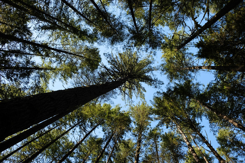
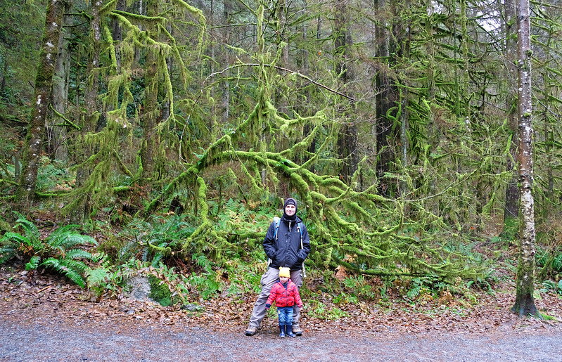
If you think forests are boring, the rainforests of the North Shore will prove you wrong. British Columbia is home to about 1/4 of the world’s temperate rainforests, and Greater Vancouver has its fair share.
But wait, what’s a temperate rainforest? It’s a thing, yes. What all rainforests in the world have in common is one thing: a lot of rain! If a forest receives 140 cm of rain yearly, it can be classified as a rainforest. Vancouver’s annual rainfall is a bit more than that, and North Vancouver, being closer to the mountains, gets even more. And rainforests that are not in the tropics are called temperate rainforests. They’re colder than their tropical siblings, but just as lush green all year, though their flora and fauna is different.

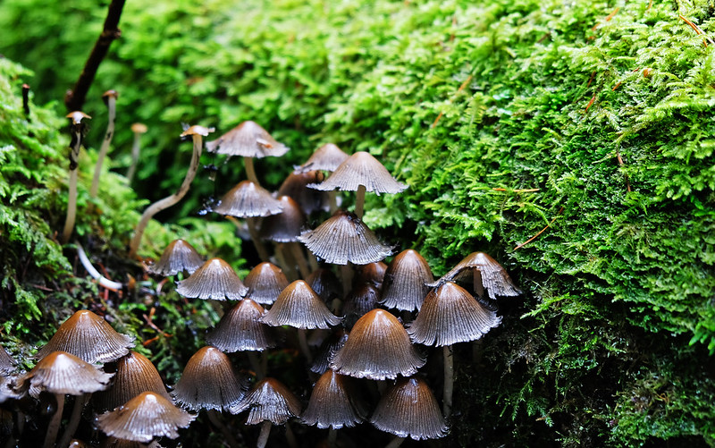
No monkeys or vibrantly-colored frogs here, but several species of salmon in the rushing streams, bald eagle, deer, wolf, grizzly bear and black bear. The greenery is mainly fern, lichen and conifers, the trees that stand the chilly temperatures, like douglas fir, red cedar or western hemlock. Rainforests look pretty in rain or shine, and they’re mostly snow free all year.
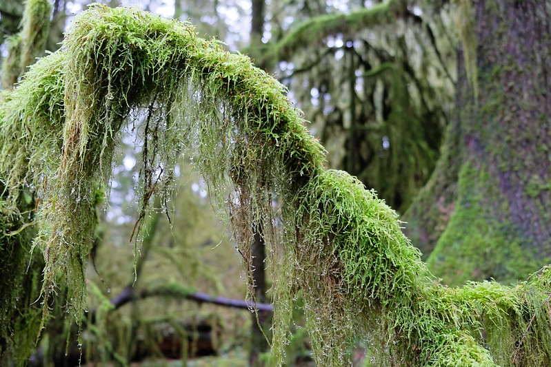
What we have for you below is the trails that offer the most “out of a fairy tale” rainforests, with vibrant green carpet, lichen hanging from the centuries-old trees, cascading streams and picturesque waterfalls. Anyone who visits Vancouver should include a rainforest walk in their itinerary. You just haven’t really seen this area, if you haven’t been to a rainforest.
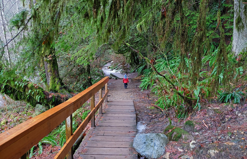
Mystery Creek & Hyannis Loop, Lower Seymour Conservation Reserve

This is one of my very favorite rainforest trails, and it doesn’t even have a waterfall. 😀 But the old-growth forest leans over you like a quiet, green cathedral on this loop walk. I say walk, because it’s short and easy, with minimal elevation change. It might be sunny or cloudy, it might be drizzling, but it hardly matters. The forest is dense, and you’re inside. Your world here is the thick moss and lichen, the giant trees and the pristine creeks. Nothing is special, because everything is.
The trail is wide and well-marked, but make sure to have a map as there are many crossings, and you can get confused about where you are. If you’d hike more, you can even get to Lynn Canyon from here on the Baden Powell Trail, or make a larger loop that includes seasonal Mystery Falls (scroll to the waterfalls below to read more about that option).

| Hiking essentials: |
|---|
| Trailhead & parking: Hyannis Drive (free street parking) |
| Length: 3.6 km loop |
| Difficulty: easy |
| Season: year-round |
| Check out the trail map here! |
Homestead Trail, Lower Seymour Conservation Reserve

The Lower Seymour Conservation Reserve has several short and spectacular rainforest trails, and the 1.2 km long Homestead Trail is another of those. It’s a wide, steadily descending path with trees covered in thick moss and lichen.
You can combine this trail with Fisherman’s Trail and Twin Bridges Trail to make it a loop, but none of the latter are as pretty as Homestead Trail. Also, you can walk to Rice Lake from the same parking lot.
| Hiking essentials: |
|---|
| Trailhead & parking: tourist shelter and parking on Lillooet Road |
| Length: 1.2 km one-way |
| Difficulty: easy |
| Season: year-round |
| Check out the trail map here! |
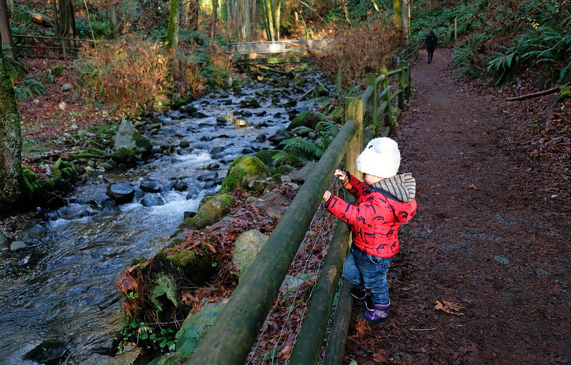
Varley Trail, Lynn Headwaters Regional Park

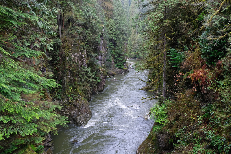
The Varley Trail loop is a great addition to either the Lynn Valley trails or the Lower Seymour Conservation Reserve trails. It’s a jaw-dropping part of the rainforest that’s right by rushing, crystal clear Lynn Creek. The loop actually crosses Lynn Creek twice, and both bridges treat you with stunning views.
Our favorite is the southern bridge called Pipeline Bridge, because it offers a perfect view of Lynn Canyon from above. The pictures we took there look like drone shots with aerial views of Lynn Canyon, but they are not. We shot them from the bridge. If you continue south, you’ll soon reach the Thirty Foot Pool and the Lynn Canyon Suspension Bridge.

| Hiking essentials: |
|---|
| Trailhead & parking: northernmost parking lot of Lynn Headwaters Regional Park (paid parking, no time limit), but you can access the loop from the tourist shelter and parking on Lillooet Road, as well |
| Length: 3.5 km loop |
| Difficulty: easy |
| Season: year-round |
| Check out the trail map here! |
Coho Loop & Second Canyon Viewpoint, Capilano River Regional Park
Capilano River Regional Park is close to its famous sibling, Capilano Suspension Bridge Park. It doesn’t have suspension bridges, but it’s free to visit and a beloved park for families.
The Coho Loop offers fascinating views of rushing Capilano River, a wooden viewing platform and two scenic bridges. It’s short and has hardly any elevation change. We recommend lengthening it to the Second Canyon Viewpoint and Cleveland Dam where you can enjoy views of the Capilano Canyon and the massive amount of water flowing through the dam. It adds some elevation gain, because these additions are steady uphill trails.

| Hiking essentials: |
|---|
| Trailhead & parking: Hatchery parking in Capilano River Regional Park, or the parking at Cleveland Park (to start the trail from the Cleveland Dam) |
| Length: 3.8 km return |
| Difficulty: easy |
| Season: year-round |
| Check out the trail map here! |
Sponge Bob Trail loop, Deep Cove
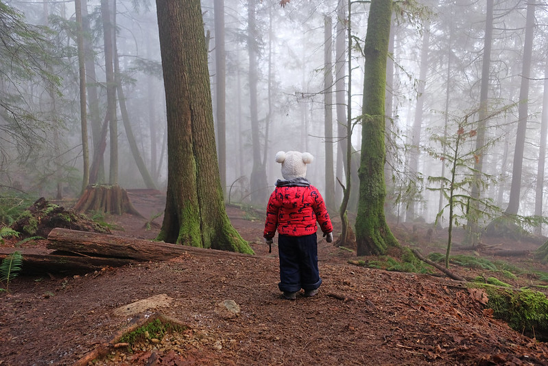
The last short fairy tale rainforest trail we know of is the Sponge Bob Trail in Deep Cove. You can add this short loop to a day spent kayaking in the Deep Cove (it’s one of the best places to kayak in Canada!). It’s located further from popular Lynn Canyon and Capilano Canyon, it’s a quiet trail used mostly by locals, both hikers and bikers.
To make it a loop, you can return on the Boundary Trail and on the streets. I’m not a fan of trails that include streets in general, but these are quiet streets with lots of green and family houses with large yards. We did this loop on a foggy winter day first, and it proved again the fact that rainforests have their charm in any kind weather (which is fortunate, because this area is not famous for endless sunny days).

| Hiking essentials: |
|---|
| Trailhead & parking: Cliffwood Road (free street parking) |
| Length: 3.5 km loop |
| Difficulty: easy |
| Season: year-round |
| Check out the trail map here! |
The best waterfall hikes
British Columbia spoils you with waterfalls. Some of the lovely, easily accessible local waterfalls would be quite famous attractions in other countries. North Vancouver offers an especially large number of those local waterfalls, usually in a lush green setting, hidden in the rainforest. They’re equally beautiful in every season as the temperate rainforest is green all year, and most of them have enough water to impress any time of the year.
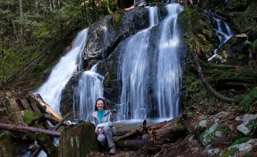
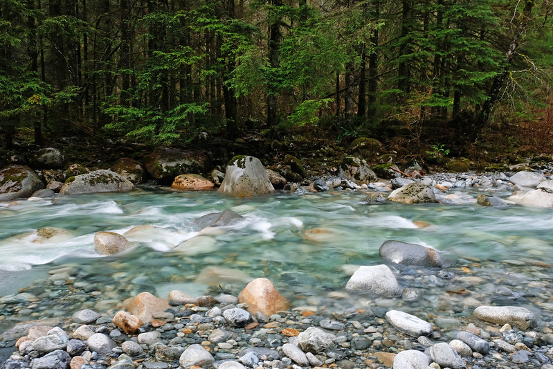
Twin Falls & Thirty Foot Pool Loop, Lynn Canyon Park

Lynn Canyon Park is a popular attraction. Imagine a city park with a waterfall, a canyon and a suspension bridge – no wonder, it’s popular. The trails of Lynn Canyon Park are also pretty rainforest trails. You’d think one wouldn’t notice trees when there’s a waterfall and a picturesque canyon with a suspension bridge, but you do. These trees and ferns get your attention and admiration.
The Twin Falls & Thirty Foot Pool Loop is actually a combination of two loops, and both start from Lynn Canyon Cafe. The Twin Falls Loop is about 45 minutes walk, the Thirty Foot Pool loop is about 20 minutes. Lynn Canyon Suspension Bridge can be included in any of them as it’s in the middle.

Twin Falls is not that high, but it looks very pretty. You can have a view from above from the Twin Falls Bridge, but walk a bit further down on Baden Powell Trail for the best front view. Take a steep, short detour close to Lynn Creek, but don’t climb over the fence, you can see it all well from behind it. If you continue downhill, you can access Lynn Creek safely, and the emerald pools are especially fabulous there (but Twin Falls can’t be seen).
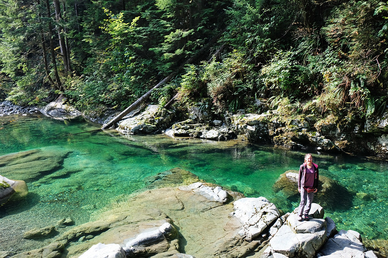
the emerald pools of Lynn Creek, downstream of Twin Falls
If you only have time for one hike, choose this! It’s relatively short and not too difficult, accessible year-round, and the rainforest is lush green in the winter, too. It can get the occasional snowfall in December or January, but it still remains accessible, it just turns into a white wonderland.
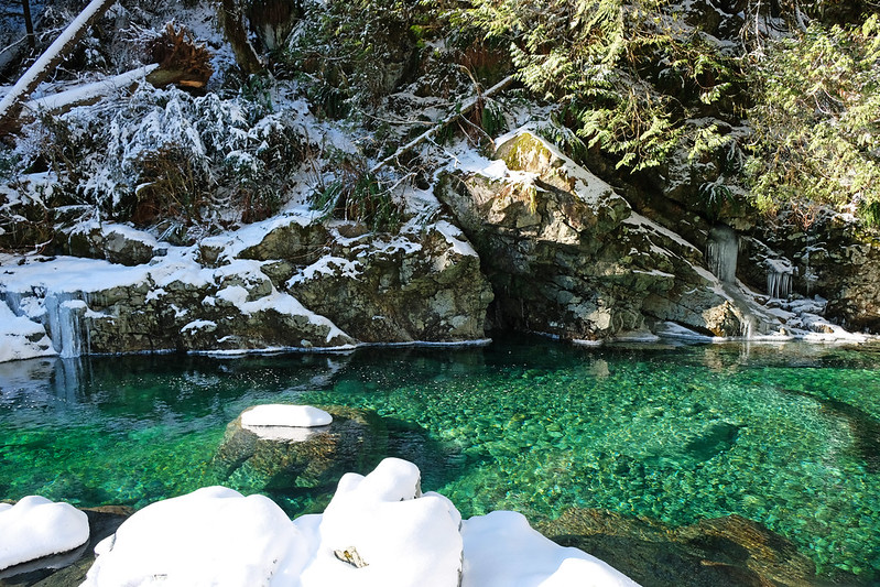
one of the rare snowy days in Lynn Canyon in December
| Hiking essentials: |
|---|
| Trailhead: Lynn Canyon Café |
| Parking: Lynn Canyon Park (paid parking, maximum 3 hours), or you can find free street parking in the area and walk more to the trailhead |
| Length: 2.3 km loop |
| Difficulty: medium (there are some long series of stairs to climb, otherwise it’s a pleasant forest walk) |
| Season: year-round |
| Check out the trail map here! |
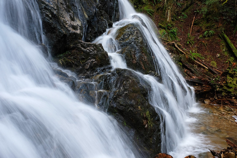
Norvan Falls, Lynn Headwaters Regional Park
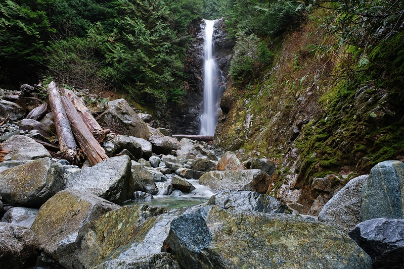
Another trail that impresses both with its rainforest and waterfall. The trail runs along Lynn Creek for the first half of the hike, and it’s in a particularly picturesque old-growth rainforest for the most part. Small creeks cross your way, and cute little wooden bridges lead you over them – that, or you jump.
It’s a very easy trail, because the elevation change is a few hundred meters altogether. There are some steeper creek crossings and large roots you need to step over, but nothing actually difficult. It’s safe to hike year-round, and you get nice views of the snowy mountains towering above Lynn Creek during the winter months.

It ends at 30 metres tall Norvan Falls, and you can cross the creek to get closer if water levels are low enough. Then you get back to the trailhead on the same path.
However, being that easy and accessible all year means that it’s usually a busy trail, and you better get there early to secure your parking spot, ideally in the northernmost parking lot of Lynn Headwaters Regional Park. If that’s already full, you can park in the other lots along the road, then walk to the trailhead. Just like the parking in Lynn Canyon Park, Lynn Headwaters Regional Park has paid parking, except for the winter months.
| Hiking essentials: |
|---|
| Trailhead & parking: northernmost parking lot of Lynn Headwaters Regional Park (paid parking, no time limit) |
| Length: ~7 km one-way |
| Difficulty: easy |
| Season: year-round |
| Check out the trail map here! |
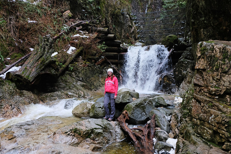
Kennedy Falls Trail & the Big Cedar Tree

It’s not a trail that makes your jaw drop every few steps, but it’s still a nice forest trail, with lots of large roots and creek crossings, and it has two attractions that will undoubtedly impress: Kennedy Falls and the Big Cedar Tree.
The Big Cedar Tree is on your way to the waterfall, and it’s easy to notice, because it stands out with its giant size. It’s estimated to be about 600 years old, and it’s one of the few trees in the area that was not logged. However, its survival is at risk, because of erosion around the base of the tree. Simply saying: keep off the routes of the tree, it’s fenced for a reason.

Kennedy Falls is at the end of the trail, and we were pleasantly surprised, especially considering how barely known this waterfall is. It consists of countless tiny cascades, quite symmetric and surrounded by lush greenery.
It’s accessible (and usually snow free) year-round, but it can get extremely muddy, and you need to cross several small creeks, so waterproof hiking boots are a must to enjoy this hike.
| Hiking essentials: |
|---|
| Trailhead & parking: Mountain Highway parking (dirt parking lot at the very end of Mountain Highway) |
| Length: ~5 km one-way |
| Difficulty: easy |
| Season: year-round |
| Check out the trail map here! |
Mystery Falls Loop, Lower Seymour Conservation Reserve
So the highlight of this relatively long rainforest loop trail is not necessarily Mystery Falls. It’s one of the few seasonal waterfalls in this area, and it’s the prettiest in early spring. It’s worth including it in the hike, but the beginning and the end of the loop, Hyannis Trail and Bridle Trail are among the most spectacular stretches of rainforest trails on the North Shore! Powerlines Trail and Old Buck Trail are quite average, but they connect the aforementioned two with the short detour to Mystery Falls.
It’s not a “must do” trail on a short visit, but if you’d explore the lesser-known, quieter trails, it’s a good choice. I rated the difficulty of the trail as moderate because of the length and the 500+ meters elevation gain.
| Hiking essentials: |
|---|
| Trailhead & parking: Hyannis Drive (free street parking) |
| Length: 10.8 km loop |
| Difficulty: medium |
| Season: year-round, but Mystery Falls is the nicest in early spring |
| Check out the trail map here! |
Mosquito Creek Falls
Mosquito Creek Falls could be a great addition to any day. The trail is not even a kilometer long, though it has some very steep sections where you need to literally climb up on the roots (hence the medium rating). The waterfall is not the most impressive one on the North Shore, but you also won’t meet many people on this trail. With that said, the most spectacular short waterfall trails are Twin Falls and Cypress Falls (in West Vancouver) – and they can get super busy!
| Hiking essentials: |
|---|
| Trailhead & parking: Palisade Drive (free street parking) |
| Length: ~900 m one-way |
| Difficulty: medium |
| Season: year-round |
| Check out the trail map here! |
Challenging hiking trails in North Vancouver

How about conquering a peak from the city? Seymour and Grouse are two of the North Shore Mountains that are accessible from North Vancouver. Between late fall and early spring it’s skiing season, and the highest peaks are covered in snow until June. But there are some trails that can be done in winter, too, and even without snowshoes.
The main hiking season is summer though. Dog Mountain, Mount Seymour and Pump Peak are the famous peaks of Mount Seymour Provincial Park, Little Goat Mountain, Lynn Peak, Coliseum Mountain and Crown Mountain are in Lynn Headwaters Regional Park, Grouse Grind and Mount Fromme are the popular peak trails of Grouse Mountain.
Pump Peak, Mount Seymour Provincial Park

Pump Peak, also known as the First Peak, is the most magical winter hike we’ve ever done. Also, it’s actually easier to do in the snow, because it makes the ground more even. And it offers an unforgettable panoramic view from the top in any season.
The trail has some steep sections, but overall, it’s one of the easiest peaks to conquer, and it’s also well trafficked, which means that snowshoes are not required in the winter, because the snow is not that deep. However, you’ll pass through some avalanche terrain towards the end of the trail, so please check the avalanche ratings before starting this hike.

The final ascent to Pump Peak is seriously steep, but in winter you have the advantage to come down on your butt. 🙂 In any case, the peak has some of the best views of Vancouver and the surrounding mountains. You can continue further to Mount Seymour Peak in the summer.
Access to the trailhead depends on the season. In winter (from December to March), the northern lots are usually reserved for people with skiing passes, and a free day permit is required to visit the park for hiking – more info on the BC parks website. The trailhead is at the northern tip of the main parking lot, so either park close or walk there.
| Hiking essentials: |
|---|
| Trailhead & parking: northern tip of the main parking lot in Mount Seymour Provincial Park |
| Length: ~3.5 km one-way |
| Difficulty: medium |
| Season: year-round, but micropikes are recommended in the winter (snowshoes are optional) |
| Check out the trail map here! |
Baden Powell Trail
Baden Powell Trail is a 45.5 km point to point trail that crosses the entire North Shore from Horseshoe Bay (in West Vancouver) to Deep Cove (in North Vancouver), and runs through all the parks in North and West Vancouver. This historic route was constructed by the Boy Scouts and Girl Guides of Canada in order to celebrate the 100 year anniversary of British Columbia’s entry into Canada.
Completing it in one day (one-way) is a serious challenge, but you can break it into sections. For example, hiking from Deep Cove to Grouse Mountain via Lynn Canyon is a nice, challenging day hike where you can see many beautiful sights of North Vancouver.
4 easy walks in North Vancouver
In addition to the best hikes, we decided to add a bonus section with the nicest easy walks. Most of the trails we recommended were quite short and easy, anyway, but these ones you couldn’t even call hikes, just walks in the park. Because they are walks in the park – in the city parks in North Vancouver, and that’s exactly what we find fascinating about this city.
Panorama Park & Parkside Beach, Deep Cove
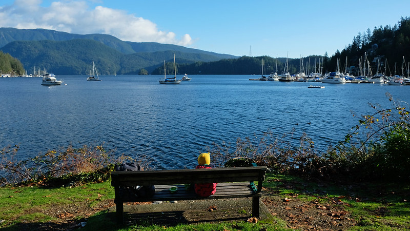
It’s what the name says: a park with a stunning panorama of Deep Cove. It has some walking paths, a large grassy meadow, a small playground and a picnic shelter. You can sit on a bench, gazing at the seals who often pop their head up from the water, or you can walk to nearby Parkside Beach.
Mosquito Creek Trail

Though this is called a trail, it’s rather a walking path and could even be stroller-friendly. The main walking path along Mosquito Creek is a wide, almost completely flat gravel path, suitable for sports strollers. You can venture out on some side trails that have cute little bridges and boardwalks over ponds and small streams (these side trails are not stroller-friendly), and they rejoin the main walking trail later. It’s a particularly pretty walk in early spring when countless snowdrops and crocuses are in bloom.
There’s a little playground, Mosquito Creek playground, at the West 17th Street entrance.
| Walking path info: |
|---|
| Trailhead & parking: either end of the trail – in William Griffin Park or on the West 17th Street |
| Length: ~2 km one-way |
| Difficulty: easy |
| Season: year-round |
| Check out the trail map here! |
Rice Lake Loop, Lower Seymour Conservation Reserve

view from the Rice Lake pier
Another trail that’s an easy walking trail in Lower Seymour Conservation Reserve. It’s about 3 kilometers around Rice Lake, and it’s a wide, flat, accessible dirt path.
Just to manage your expectations, Rice Lake is not an alpine lake, but it’s lovely, surrounded by pine forests. The lakeshore has several access points and benches on the shore, and there’s a small pier where you can get the best view of the lake.
Mahon Park
Mahon Park is one of the largest parks in North Vancouver, encompassing sports fields, grassy meadows, a playground and a forested area. The latter is a delight to explore, with short, connecting ravine trails, two creeks (Wagg and Mission Creeks) and small bridges over them. While the trails are easy and wide, they aren’t stroller-friendly, because they have a number of stairs.
You can access the trails of Mahon Park from several of the surrounding streets, like Jones Ave, 15th Street West, 14th Street West, Keith Road or Wolfe Street. Jones Ave offers the largest parking lot.

3 overrated North Vancouver trails
After telling you about which trails to take, it’s time to mention some that you better avoid. I’m sure many people would disagree, and I get it. But I still advise you to choose different trails instead of the three below. The main reason we don’t really like these trails is because they are insanely popular. You smell other people’s sweat, and you’re surrounded by constant noise and crowd. That, and they don’t offer much more than other trails which are less busy.
Dog Mountain Trail
It’s a 5 kilometers round trip trail from the main parking lot of Mount Seymour Provincial Park. No matter the season, it’s crowded, and by that I mean you walk in line all the way there and back on the trail. It’s the number one trail for beginner snowshoers, and it’s also a number one easy peak view. It does give a nice view of Vancouver, but not as wonderful as the view from Pump Peak which is a less busy, slightly longer and harder trail.
So what should you choose instead? Pump Peak.
Quarry Rock
The large rocky outcrop called Quarry Rock gives a pretty view of the Indian Arms from above. Being a 3.8 km round-trip trail with about 100 meters elevation gain altogether, everybody can do this trail. That’s what makes it so crowded that it’s hardly enjoyable.
Note: the trail to Quarry Rock has been closed since the start of the pandemic, and it’ll likely remain closed until late 2022 due to storm damages.
So what should you choose instead? There’s no straightforward sibling for this trail. If you’d like to enjoy views of the Indian Arms from above, hike the Diez Vistas & Buntzen Lake loop on the other side of the fjord. But note that it’s longer and more strenuous than Quarry Rock Trail (~13 km loop, with 630 m elevation gain). If you’d like a similarly easy one, then opt for Sponge Bob Trail which is a pretty rainforest trail, also located in Deep Cove.
Grouse Grind
Many guides mention the Grouse Grind as a “must do” hike if you visit Vancouver. I disagree. If you only have time for a few hikes, don’t even think of the Grouse Grind, because there are so many better options.
The Grouse Grind is a popular workout trail, because it has ~850 meters elevation gain in about 3 kilometers. It’s strenuous, yes. But don’t expect some breathtaking reward in exchange, it’s simply a forest trail, with no views until the very end, and the forest is quite average, not like the rainforest trails I listed for you above. Yet people stand in line on the trail (which is strictly a one-way trail, you can descend on the BCMC trail or with the Grouse Gondola). Why is it so popular? Mainly because it’s physically challenging to complete. That’s it, a great workout, a good place to exercise for challenging high mountain trails.
So what should you choose instead? Almost any other peak. Like Pump Peak and Mount Seymour in Mount Seymour Provincial Park, Eagle Bluffs or St. Marks Summit in Cypress Provincial Park (West Vancouver) or Tunnels Bluff in Lions Bay, along the Sea to Sky Highway. They’re all challenging enough, but more enjoyable with less people and more wonderful views.
What’s the weather like in North Vancouver?
Greater Vancouver has an oceanic climate, with mild and rainy winters, relatively warm and dry summers. Being right at the foot of the North Shore mountains, North Vancouver gets even more rain than other cities in the region. My point is: it can rain any time, no matter the season you visit, but rain is guaranteed on most days between October and March.
August is the hottest month of the year, with average temperatures between 14°C and 23°C. December is the coldest month of the year, with average temperatures between 2°C and 6°C. There are a few snowy days each year, but it quickly melts and never gets nearly as deep as at higher elevations.
The dense forest gives protection both from sun and rain, but the forest floor is often muddy, because it doesn’t dry up quickly after the rains, and it rains quite frequently for most part of the year, anyway.