Garibaldi Lake hike is one of the most popular (and Insta-famous) ones in British Columbia – and that’s a lot to say, since this giant state has no shortage of scenic trails. The result? Crowds – and mandatory day permit in the summer season. However, taking a look at this turquoise-coloured alpine lake nestled between snow capped peaks, who could resist? Moreover, it can be a day trip from Vancouver.
This hike was among the first ones we did after moving to Metro Vancouver, and in this post we’re sharing all that you need to know about it.
| Essential hiking info |
|---|
| Trailhead: Rubble Creek Trailhead, Garibaldi Provincial Park |
| Length: 18 km round-trip |
| Elevation gain: 975 m |
| Difficulty: moderate |
| Camping: at Taylor Meadows or Garibaldi Lake (reservation required) |
| Toilets: Rubble Creek parking lot, Taylor Meadows, Black Tusk junction, Garibaldi Lake campground |
| Open the Garibaldi Lake trail map here! |
First of all… is the Garibaldi Lake hike really worth the hype?
There is a hike, let’s start with that. Don’t let those “posing in my pretty skirt” pictures fool you, Garibaldi Lake is not a walk away from the parking lot. It’s an alpine lake where you need to hike, and it’s a full day hike to most people.
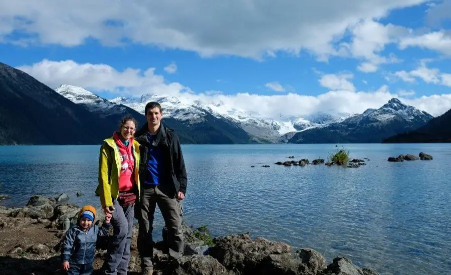
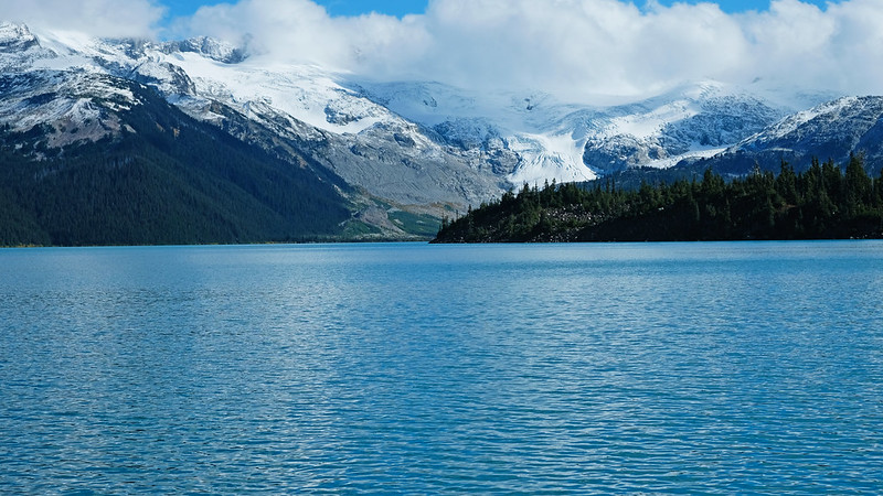
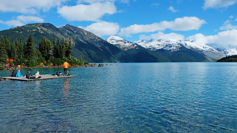
Is it worth it? Yes and no. Garibaldi Lake is totally worthy of all the praise it gets. At almost 1500 meters above sea level it’s a perfectly turquoise alpine lake fed by glaciers – Sphinx Glacier to the east and Sentinel Glacier to the south (you can see them in the distance). It’s over 250 meters deep. (Yes, it’s extremely cold! Yes, we’ve seen some boys dipping in for fun, and running out after a few seconds.) Peaks tower above the lake, and their snowy caps glitter in the sunshine even in the summer.
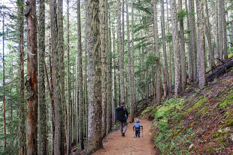
But you better prepare yourself for the hike. It’s one of those trails where the destination is very special, but the path that takes you there is long, demanding and not very rewarding. Garibaldi Lake Trail runs in the forest, with endless switchbacks and barely anything to see until you reach your final destination, magical Garibaldi Lake.
We’ve done many high mountain trails in our lives, and we remember many that offered wonderful scenery almost all the way. Slovakia’s High Tatras has several trails to different alpine lakes that are very scenic and enjoyable, not only because of the final lake views. California’s Sierra Nevada is also full of picturesque high mountain trails to alpine lakes. And we’ve done quite some scenic mountain trails near Vancouver, as well. Garibaldi Lake Trail is not one of them. It’s not that the forest is not nice, but don’t expect mountain vistas on your way up.
With that said, Garibaldi Lake is worth the effort. It’s really, breathtakingly beautiful! Just adjust your expectations about the hike. You have to do some monotonous work to enjoy those fabulous views.
How to access the trailhead?
Good news, the trailhead for Garibaldi Lake Trail is accessible to any vehicle, because it’s paved all the way (unlike I expected, it’s not a straightforward thing in British Columbia at all). Bad news, Rubble Creek parking lot is very busy, especially in July and August.
Garibaldi Lake Provincial Park can be accessed from several roads, and Rubble Creek parking lot is just south of Whistler. From Vancouver, you need to take Highway 99, affectionately and accurately nicknamed Sea to Sky Highway, for the wonderful mountain and ocean vistas. It offers some scenic viewpoint stops, and countless shorter and longer trails start along the way.
But you won’t have time for any other hike on the day you go to Garibaldi Lake. Arrive at the Rubble Creek parking lot as early as you can. If you’ll have time, you can choose from amazing extensions to this hike once you’re at Garibaldi Lake.
DO YOU NEED A CAR FOR YOUR ROAD TRIP? SEARCH, COMPARE AND SAVE:
Discover Cars is one of the world’s largest online car rental platforms with vehicles in 10,000+ locations. Compare the best rates here.
Hiking to Garibaldi Lake
So roughly the first 7 km of the trail will be a long series of switchbacks through dense forests of Douglas Fir and Western Red Cedar. It is a nice forest, I mean it. Not the most picturesque of the West Coast forests in the area, but it has that calming, magnificent atmosphere. However, you won’t have any mountain vistas during this part of the hike. Not even a quick glance of the surrounding peaks. After a while, those switchbacks feel never ending, but keep going.
The first spot to get a view is the Barrier Lake Viewpoint. It’s a short detour from the trail, but it could be your first picnic stop. The Barrier is actually a 300 meters thick, 2 kilometers wide lava dam. It was created about 9000 years ago when lava from Mount Prince and Clinker Peak volcanoes blocked the valley, and since then meltwater from Sentinel Glacier and Sphinx Glacier has been trapped behind the lava dam. This is how the Garibaldi lakes were formed.
The terrain gets easier and more interesting from the Barrier. The trail only slightly ascends, it crosses a few creeks, and you pass Barrier Lake and Lesser Garibaldi Lake. They are lovely, but not comparable to the third lake.
The best views from the lakeshore
To access the lakeshore, you’ll have to cross a wooden bridge over a creek at the east end of Garibaldi Lake. This is where you get your first view of the lake, and it only gets better from here. However, keep in mind that you can’t walk around the lake, the lakeshore trail only takes you to the Garibaldi Lake campground and a little bit further to a small wooden dock. So don’t hurry, soak in the views.
After the creek crossing the trail runs directly by the lake, you even need to hop from rock to rock at some sections. After a short while, you reach a picnic area with benches, tables and washrooms. Most likely all the tables will be taken, because this place is insanely popular. No worries, keep walking and enjoy the views. There will be benches here and there, or you can find a larger rock to sit on.
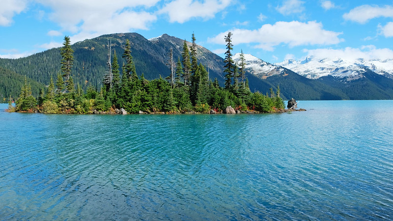
Soon you’ll have views of Battleship Islands, a group of tiny, picturesque rocky islands near the lakeshore. They are photographers’ favorites, and it’s not hard to understand why. They are also easily accessible, you can walk to some of them, or you can swim to others if you dare.
You can still walk a bit on the shore until you find the small dock. It will likely be full of people laying in the sun. This is where the lakeshore trail ends. If you continue on the maintained trail, it takes you up to Mount Price. If you have the time and energy to hike up even further though, we’d recommend another trail.
Views of Lake Garibaldi from above: Panorama Ridge
Have you seen any of those pictures of Garibaldi Lake from above? They were not taken from the Garibaldi Lake Trail, but from the Panorama Ridge Trail. It’s a popular extension of the Garibaldi Lake hike, along with Black Tusk. Both make your original hike well above 25 kilometers there and back though, and the elevation gain is also more than 1500 meters on any of these extensions. But both are said to be incredibly scenic high mountain trails!
We haven’t done any of them yet, and it’s not likely we’ll do them with Tomi anytime soon. Carrying a 15+ kg toddler up there is just out of the question. However, I hope to do them without Tomi some time, it just needs some (and even more) organization.
Many people spend a night at either Garibaldi Lake campground or Taylor Meadows campground, so that they can break the hike into two, and comfortably add these extensions. But if that’s your plan, make reservations well in advance. The campgrounds are also insanely popular and usually sell out quickly. Your best bet for last-minute trips is checking for cancellations.
How hard is this trail?
It’s no Lake Louise where you simply park by the lake. A 18 km round-trip trail with 975 meters elevation gain requires you to be fit. But it’s not a technical trail, simply a steady climb. No exposed ridges, no extremely narrow paths, no balancing acts. If you have the stamina, you can do it.
It’s also safe to do with a baby carrier (again, safe doesn’t mean easy :P), and if your toddler is willing to walk, they can. At least the terrain is suitable for a toddler to walk safely – and for you to hold their hand. However, Tomi didn’t walk much, and I assume the steady uphill tires the littles ones out quite quickly. Let them play on the lakeshore instead.
When is the best time to hike Garibaldi Lake?
Snow free months are short up here: roughly from mid-June until mid-October. July and August are the busiest time, June could be a hit or miss (it depends on the snow level in that current year). The very best time? Late September to mid-October in our opinion. We hiked there in the beginning of October. It was still snow free, and still quite busy, but not unbearable.
Snow usually reaches these elevations by the end of October, and the lake freezes. Technically you can snowshoe to Garibaldi Lake in the winter months (given that Rubble Creek Road is plowed). Hiking further to Black Tusk or Panorama Ridge is a mountaineering objective in snowy conditions though, and you need to be aware of avalanche danger in the area.
Checking the trail report on the official site of the provincial park here is essential before you go, especially in the shoulder season (early summer, late fall). You’ll likely find recent reviews about trail conditions on AllTrails, too. Then you can prepare your gear (and your car) accordingly.
Practical things to know before you go
In the summer season you need a day permit to visit Garibaldi Provincial Park. You won’t even be allowed to enter the park if you don’t have it. Rangers stop you on the road, and check it. This could make visiting harder and more frustrating, especially if you only have a few days to choose from. Because day passes are free, but taken quickly. So quickly.
2024 dates: a day pass is required to visit Garibaldi Provincial Park daily from June 13 to September 2 and on weekends and holidays only from September 3 to October 14. It applies at Diamond Head trailhead, Rubble Creek trailhead and Cheakamus trailhead.
You find more info on where to get them here. We advise you to register an account before your trip to British Columbia, then be online and ready 48 hours prior to your visit to Garibaldi Provincial Park to apply for your pass. Avoid weekends in the summer, your chances to get a pass (and a parking spot at the trailhead) are better on workdays.
Once you have your pass, download it to your phone! It’s important, because cell coverage is weak in the area, you might not be able to access the confirmation email.
Lake Garibaldi from yet another angle
The only case when you don’t need a day permit is when you have a camping reservation within the park. But that’s even harder to get, given the popularity of all the campgrounds. Of course, you can choose to visit before or after the period when the permit is required, however, it mostly covers the snow free time of the year.
Garibaldi Provincial Park – just like almost any park in BC – is bear country. Don’t hike alone, make noise (talk loud), be alert to sounds (don’t use headphones or earbuds), carry bear spray and know how to use it as a last resort. Don’t let your food waste linger around, take all your garbage with you (regardless of bears, by the way, but food attracts bears, too).
Bear encounters are quite common in the summer, attacks are rare. In case you do encounter bears, don’t turn your back on them, don’t run, just slowly back away to give them space. Normally they don’t attack if they don’t feel threatened. Be extremely cautious if you see cubs, because mummy bears are very protective.
What else to do in Garibaldi Provincial Park?
Lake Garibaldi is not the only beauty of this park. It offers many other one day trails and backpacking routes, but one thing is common in all of them: you won’t find anything that’s shorter and easier than hiking Garibaldi Lake.
The trail to Elfin Lakes is a bit longer, but with somewhat less elevation gain, and it’s a popular year-round destination (snowshoeing in winter). Wedgemount Lake can be accessed on a 12 km round-trip trail, but with 1300+ meters elevation gain, and it’s a summer objective.
What to wear hiking in the summer?
Hiking pants, preferably zip-off pants: mornings and evenings are chilly, so you’ll be happy to wear long sleeve pants, but it’s very practical if you can simply zip the sleeves off in the hottest part of the day, or when hiking uphill. Columbia offers affordable, practical and durable models both for women and men.
Waterproof hiking boots: appropriate footwear is very important to have an enjoyable and safe hike. We recommend wearing hiking boots that provide good traction. Waterproofness is also important, because weather in BC is quite rainy for most of the year, and melting snow makes lots of trails muddy well into the summer. Dry feet are key for a happy hike. This Columbia Newton Ridge Plus is a great option for women, and the Newton Ridge Plus II for men.
Long sleeve hiking top: you can wear a lightweight, long sleeve top with sun protection as a standalone wear on high mountain trails (it never gets too hot up there, but the sun will be harsh on your skin on clear days), or you can use it as an additional layer when it gets chilly in the morning or evening at lower elevations. This BALEAF top for women offers UPF 50+ protection, and NAVISKIN has a long sleeve T-shirt with UPF 50+ protection for men.
T-shirt: moisture-wicking and quick-drying technical T-shirts are the best for hiking on a hot day. Here’s a great model for women, and here’s one for men.
Hiking socks: merino wool blends are moisture-wicking and breathable, they keep your feet cozy either when temperatures are warm or cold.
Waterproof rain jacket: a lightweight, easily packable rain jacket should always be in your backpack, just in case. You don’t want to get caught unprepared in a sudden storm. Columbia jackets are affordable and effective for the average hiker, here you find them for women and for men.

