The Hole in the Wall hike in Port Alberni was once one of the best hidden gems on Vancouver Island, and it’s still one of the best stops on your way from Vancouver to Tofino. It’s a unique water feature that’s beautiful to visit all year, and it’s accessible by a short, easy hike. Though it has been getting popular in the past years, thousands of people drive past it each day without realizing what they miss – so let us show you what NOT to miss!
Best accomodations in Port Alberni:
- Mid-range: Hummingbird Guesthouse (riverside location)
- Budget: Char’s Landing Hostel
What is the Hole in the Wall?
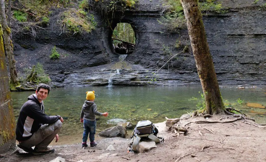
It’s a man-made water feature. Not really a waterfall. Once it was once an opening for a water pipeline, so a hole was drilled through the rock wall. The pipeline has been removed, but the water flows through the hole and into the clear pool below. It’s a pretty oasis, hidden in the forest.
If you like quirky attractions, quiet places or photography (or all of the above), you’ll love the Hole in the Wall, just outside of the small town of Port Alberni.
Overview of the Hole in the Wall hike, Port Alberni:
- Trailhead: off Highway 4 in Port Alberni, opposite of Coombs Country Candy store (I marked the trailhead on Google Maps here)
- Length: ~700 m one-way
- Difficulty: easy
- See it on a trail map here.
How to get to the Hole in the Wall, Port Alberni?
It’s a 1.5 km round-trip hike to reach the Hole in the Wall. It’s a downhill path from Highway 4, with a small, unmarked parking bay on the eastbound side of the highway, opposite of Coombs Country Candy store, just before you enter Port Alberni.
It is small and unmarked, I really mean it. It can fit about 2-3 cars. Alternatively, you can leave your car in the small parking area adjacent to Coombs Country Candy (don’t use the store parking lot, it’s for customers). But be extra vigilant when crossing the highway, because it’s busy, there’s no crosswalk, and the trail starts on the other side of it.
BC Trip Planning is Overwhelming. So We Did It For You.
Our compact guide delivers step-by-step itineraries to BC’s best sights and hidden gems.
The Hole in the Wall trail
Once you park your car, it’s time to find the trailhead. A trail map is highly recommended, because it’s an unmarked gravel path that leads into the forest. After a while you’ll find a handmade, wooden sign with “Hole in the Wall” painted onto it. You can reach this attraction in about 10-15 minutes, and it’s an easy walk, just make sure not to lose the correct path.
After a few minutes among the trees, you’ll get to a clearing, and the trail splits in two here. Choose the right hand path. It’s a wide path, obvious to follow, just don’t let the small side trails distract you.
After a few hundred meters on this wide path, the trail splits again. Keep left, hike down a steep hill. You’ll see another small wooden sign that directs you towards the Hole in the Wall. The last section of the path goes through a beautiful moss covered forest, then you find yourself by Rogers Creek.
Hole in the Wall in late spring
A spectacular, crystal clear swimming hole is fed by a tiny creek flowing through the hole that has been carved into the limestone rocks. It’s a great place for a refreshing dip in the summer (it will be refreshing, because it remains quite cold even in the summer). But don’t expect too much water during dry periods, mainly in the summer. You might be able to walk across the creek to the hole when water levels are low.
If you have time to explore the surrounding side trails, you can find another way to access the Hole in the Wall. This is for the times when crossing the creek is not an option. It’s a challenging track though, including a fallen tree that created a natural bridge across the creek, then some wet, slippery, loose rocks. But your reward will be walking right through the hole, getting another perspective of this idyllic spot.
Useful tips for your visit to the Hole in the Wall
Rent a car to explore the lesser-known places on Vancouver Island.
There are no facilities, no toilets or trash cans. Take out what you bring in.
Would you hike more? Continue the trail to Rogers Creek Falls downstream, and you’ll find a lovely waterfall in exchange for ten more minutes of walking.
The best time to visit is late fall, winter and early spring (which stands true for every waterfall on Vancouver Island). These months have the most rain, you’ll see a heavy and dramatic flow of water. But the trail can get extremely muddy in winter.
Port Alberni is the last town before Tofino, and it’s a great place to spend the night to break up the drive. Look around in the cute fishing town, nicknamed the “salmon capital of the world” (yes, it’s actually a harbour, located at the end of a very narrow, long bay). Eat in one of the waterfront restaurants of Harbor Quay – and maybe choose a dish that includes salmon.
More hiking near Port Alberni
Little Qualicum Falls
Little Qualicum Falls is one of our favorite waterfalls on Vancouver Island. Despite its name, the waterfall is quite big and powerful (especially in the rainy season), and it’s an impressive sight as it tumbles down into a dramatic canyon.
Little Qualicum Falls Provincial Park is only about a 30 minute drive from Port Alberni, and you can reach the waterfall on a straightforward, 1.5 km loop trail from the Little Qualicum Falls day use area. If you have time, continue further down the river to the second waterfall. Then cross the bridge and return to the day use area on the other side.
Wesley Ridge Trail
Cameron Lake is just past Little Qualicum Falls, and it’s right by the road. It’s one of the postcard perfect, deep blue Canadian lakes, surrounded by pine forests.
The 5.8 km return hike to Wesley Ridge offers stunning views of Cameron Lake from above. It’s a great choice if you’re looking for lesser-known trails. But keep your eyes open for the viewpoints, they’re not obvious to find. Trees often block the views along the way, and you need to find those openings where you can really enjoy the scenery. But oh, they are gorgeous!
Wesley Ridge hike:
- Trailhead: Wesley Ridge Trailhead (marked on Google Maps here)
- Length: 5.8 km return
- Difficulty: medium
- See it on a trail map here. Unfortunately, we couldn’t find a more accurate one. The very first section of the trail through the old train tracks is not marked here – but it’s there, believe us, and it’s easy to find.
Cathedral Grove
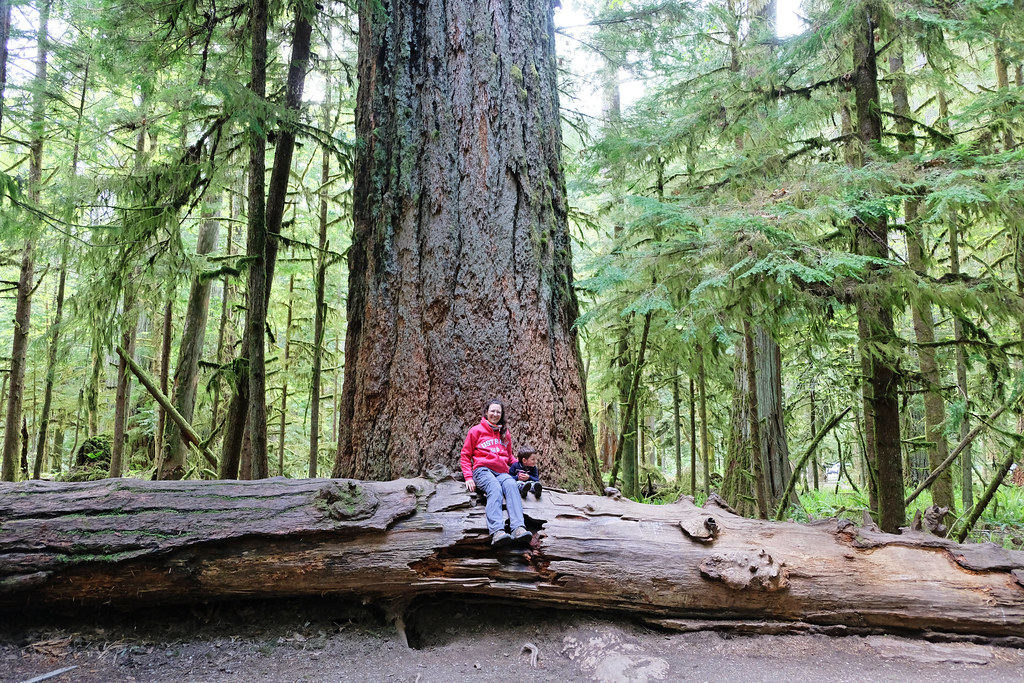
The stop for Cathedral Grove, located in MacMillan Provincial Park, is immediately after you leave Cameron Lake. This mighty grove of old-growth Douglas-firs are among the oldest trees on Vancouver Island. Some of them are 800 years old!
There are two easy loop trails on the two sides of Highway 4 that let you explore Cathedral Grove. Both are wide, obvious to follow and well-maintained. The path on the south side of the road leads to the Big Tree, the largest tree in the grove, with a 30-foot (9-meter) circumference.



Leave a Reply