Shannon Falls is the third highest waterfall in British Columbia (and also in Canada, since the highest waterfalls are all in BC). With 335 meters, it ranks after 481 meters high Della Falls (in Strathcona Provincial Park on Vancouver Island) and 396 meters Hunlen Falls (in Tweedsmuir Provincial Park near Bella Coola). Visiting Shannon Falls is a highlight when driving the Sea to Sky Highway from Vancouver to Whistler.
However, “Shannon Falls hike” can cause some confusion, because there are three trails connected to Shannon Falls, one of them – the Shannon Falls lookout – is rather a walk, and the two others – the Shannon Falls pools hike and the Upper Shannon Falls Trail – are challenging hikes.
Shannon Falls, Squamish
So let’s see all the Shannon Falls trails – what they offer, where they start, how long and how difficult each one is.
BC Trip Planning is Overwhelming. So We Did It For You.
Our compact guide delivers step-by-step itineraries to BC’s best sights and hidden gems.
First, where exactly is Shannon Falls?
It’s quite easy to find, because it’s located in Shannon Falls Provincial Park, right along the Sea to Sky Highway, just south of the city of Squamish. It’s about a 45 minute drive from Vancouver. You can already catch a glimpse of the waterfall from the highway.
Shannon Falls Provincial Park is a neighbor of Stawamus Chief Provincial Park.
Shannon Falls directions from Vancouver: it’s as easy as taking highway British Columbia 99 (the Sea to Sky Highway), then exiting at Shannon Falls.
DO YOU NEED A CAR FOR YOUR ROAD TRIP? SEARCH, COMPARE AND SAVE:
Discover Cars is one of the world’s largest online car rental platforms with vehicles in 10,000+ locations. Compare the best rates here.
More hiking trails and sights in the area:
Shannon Falls viewpoints
The most popular of the Shannon Falls trails is not even a real hiking trail, rather a short, pleasant walk to the Shannon Falls lookouts. It starts from the parking lot in Shannon Falls Provincial Park. In case that it’s full (which is not at all rare on a nice summer weekend), you can park on the other side of the highway, just off Darrell Bay Road. It adds a few hundred meters, but you can safely get to the picnic area in Shannon Falls Provincial Park.
When you reach the picnic tables, you’ll notice a wide, paved walkway leading into the forest. It turns into a gravel trail along Shannon Creek, and you need to walk uphill to the first Shannon Falls lookout. This one is accessible by wheelchair, as well.
view of Shannon Falls from the lookout in summer and in winter
The first lookout offers a relatively distant view of the waterfall, but even so you can’t see the full height of it. Continue up the wooden stairs and the forest trail to the second Shannon Falls viewpoint which has even better views. Expect this trail to be busy, especially in the summer season.
Hiking essentials:
- Trailhead: Shannon Falls Provincial Park parking lot
- Length: 1 km loop
- Difficulty: easy
- Season to visit: year-round
Shannon Falls Pools Trail
Shannon Falls swimming hole? if you dare…
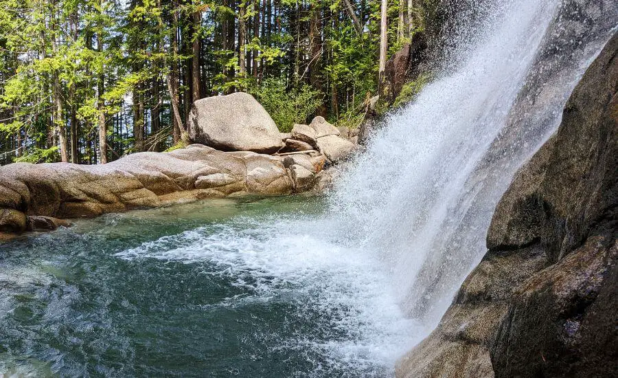
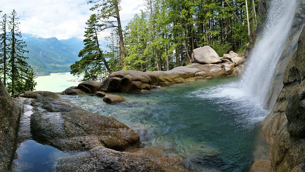
Shannon Falls Pools Trail (actually, the Upper Shannon Falls Pools Trail would be a better name) is not a well-known, official trail, but it’s one used and loved by locals – for a good reason. Most pictures of Shannon Falls in this post were taken on this trail, because it takes you to a fairy garden, with picturesque cliffs, emerald pools and close views of rushing Shannon Falls.
The trailhead is easy to miss, because it’s a narrow path leading into the dense forest from the road, as you drive towards the Shannon Falls Provincial Park parking lot. You can park either there or along Darrell Bay Road, then cross the highway. If you walk from Darrell Bay Road and reach the bridge over Shannon Creek, you already missed the trailhead, so turn back. 🙂
view from the clifftop detour
Once you start on one of the tree narrow paths, they almost immediately join, and you find yourself on a decent forest trail. Though there’s no signage about Shannon Falls or the pools, this is the Shannon pools hike. It’s the only trail, so carry on. First you hike in the forest, steadily uphill.
The trail gets steeper as you reach the giant rock wall – the same rock wall from where Shannon Creek is plunging (but you can’t see it from this part of the trail). What you can often see is rock climbers conquering the sheer rock wall. Just stay on the hiking trail, it goes around it, and you’ll also climb a bit from time to time. But it’s a hiking route, and there’s no need for climbing equipment. There are several sections (about 6-7) which provide rope support, and you need a sense of adventure, arm strength and balancing skills to conquer them. This is not a trail to do with small kids (or while carrying a baby).
looking down to one of the rope-supported sections
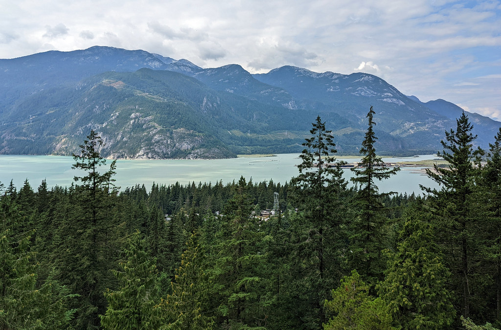
When you don’t climb the rocks, then you hike steeply uphill on a zigzagging forest trail, with large roots. You’ll notice a detour to a clifftop viewpoint, rest a bit there, and enjoy the view of Howe Sound, Squamish and the Sea to Sky Highway meandering below. Then complete the last section to the bottom of the Shannon Falls upper pools.
That’s the highlight of this hike. Even though you can’t see the full waterfall from there, you have a very close view as the upper section of the falls plunge into a crystal clear, emerald green pool, then flows further into lower pools. It’s a popular thing to have a dip in these pools, but be very careful if you choose to do that (we didn’t). The water is cold, the rocks are slippery and can be sharp, and if you’re carried over the rock barrier… Yes, you’ll die. Sadly, people have died here.
dipping in the pool here can be very dangerous!
The granite rocks at the pools have been carved by the water over hundreds of years, and they are very beautiful – and very slick. With the spray coming from the falls and some of the lichen that builds up on it, they can get extremely slippery. So while it’s a fabulous place, be very careful while wandering around or venturing into any of the pools.
The Shannon Falls pool hike is short, but it’s a steep and challenging route. Proper hiking boots are a must.
Hiking essentials:
- Trailhead: Shannon Falls Provincial Park parking lot or Darrell Bay Road
- Length: 2.4 km return
- Difficulty: difficult
- Season to visit: almost year-round, because snow and ice is not typical at this elevation, however, if it occurs, the trail can be dangerous
- See the trail map here!
Upper Shannon Falls Trail
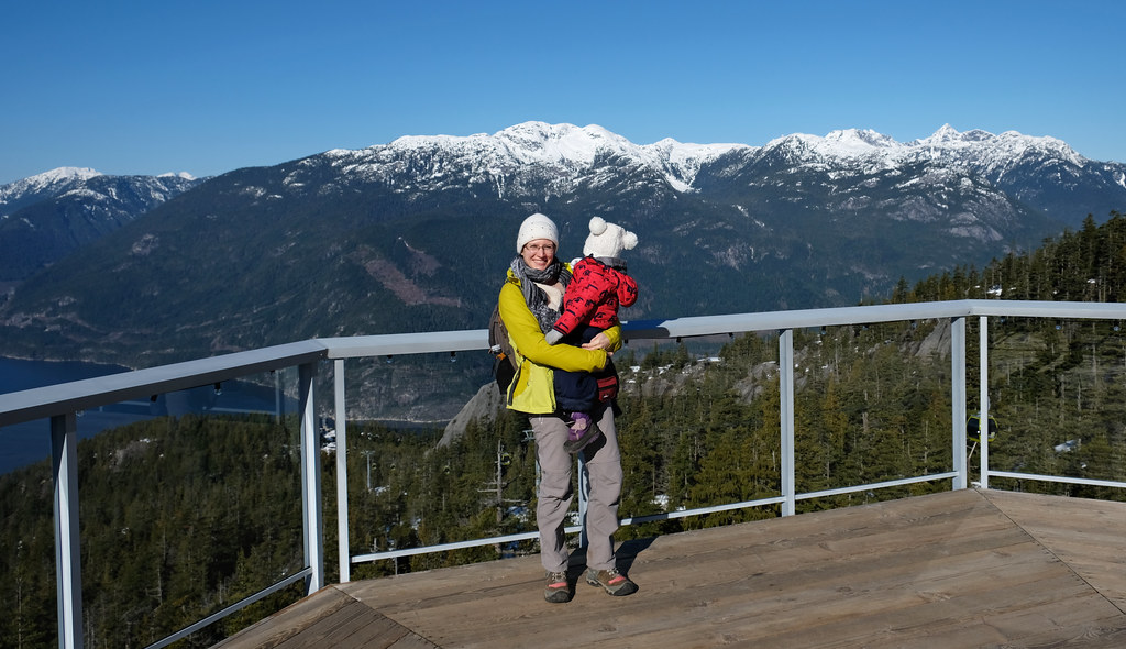
Upper Shannon Falls Trail, also called Sea to Sky Summit Trail, is a full day hike, and it literally takes you from the sea level to the summit (the summit station of the Sea to Sky Gondola). This is the only hike in this list that we haven’t personally done, because we opted for the gondola while carrying a toddler.
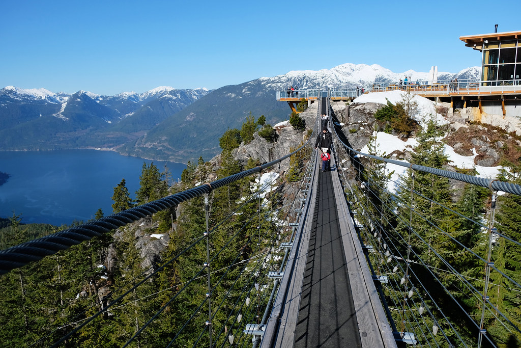
The Sea to Summit Trail is a match for the famous Grouse Grind in North Vancouver, but it offers more views on the way, a spectacular panorama and a suspension bridge at the top. Upper Shannon Falls hike is not exactly the same, it’s a shorter version of this route, only up to the waterfall viewpoint. However, most people continue the trail all the way to the summit lodge, then take the gondola down.
You can start the trail at the Shannon Falls Provincial Park, Stawamus Chief Provincial Park or Sea to Sky Gondola parking lots. The shortest route is from Shannon Falls Provincial Park, but it has the smallest parking lot, as well. Don’t worry, the three routes from the three different parking lots join, and there’s signage for the Sea to Summit Trail. Just keep your eyes open, check your map and make sure not to follow routes to the base station of the gondola or the Chief Peaks. 🙂
Sea to Summit trail markers guide you all the way up, and it’s also a busy route, especially on summer weekends. It’s a technical trail, there are quite a few sections that have plenty of roots, rocks, ropes and chains are there to help you pull yourself up from time to time. But it’s an enjoyable trail, with occasional views of Howe Sound and Upper Shannon Falls, a majestic waterfall viewpoint and a breathtaking panorama from the summit lodge at the end.
Hiking essentials:
- Trailhead: Shannon Falls parking, Stawamus Chief parking or Sea to Sky Gondola parking lots
- Length: 16.4 km return
- Difficulty: difficult
- Season to visit: roughly between April and November
- See the trail map here!
Amenities in Shannon Falls Provincial Park
It has a parking lot, and it’s too small for summer crowds. Don’t get tempted to park just anywhere though, because you’ll be towed. Find more spots along Darrell Bay Road, in the Sea to Sky Gondola parking and in the Stawamus Chief parking lots.
The park itself is small, too. Shannon Falls Provincial Park trails mostly mean the short trail to the two waterfall lookouts, a concession and information center, flush and pit toilets, a picnic area with many benches (equipped with BBQ holders) and a creekside area that’s perfect for kids to play (don’t leave them alone near the water though).
What to wear hiking in the summer?
Hiking pants, preferably zip-off pants: mornings and evenings are chilly, so you’ll be happy to wear long sleeve pants, but it’s very practical if you can simply zip the sleeves off in the hottest part of the day, or when hiking uphill. Columbia offers affordable, practical and durable models both for women and men.
Waterproof hiking boots: appropriate footwear is very important to have an enjoyable and safe hike. We recommend wearing hiking boots that provide good traction. Waterproofness is also important, because weather in BC is quite rainy for most of the year, and melting snow makes lots of trails muddy well into the summer. Dry feet are key for a happy hike. This Columbia Newton Ridge Plus is a great option for women, and the Newton Ridge Plus II for men.
Long sleeve hiking top: you can wear a lightweight, long sleeve top with sun protection as a standalone wear on high mountain trails (it never gets too hot up there, but the sun will be harsh on your skin on clear days), or you can use it as an additional layer when it gets chilly in the morning or evening at lower elevations. This BALEAF top for women offers UPF 50+ protection, and NAVISKIN has a long sleeve T-shirt with UPF 50+ protection for men.
T-shirt: moisture-wicking and quick-drying technical T-shirts are the best for hiking on a hot day. Here’s a great model for women, and here’s one for men.
Hiking socks: merino wool blends are moisture-wicking and breathable, they keep your feet cozy either when temperatures are warm or cold.
Waterproof rain jacket: a lightweight, easily packable rain jacket should always be in your backpack, just in case. You don’t want to get caught unprepared in a sudden storm. Columbia jackets are affordable and effective for the average hiker, here you find them for women and for men.
Where to stay for Shannon Falls?
If you drive the Sea to Sky Highway from Vancouver to Whistler, you can base yourself in Whistler to have a few days to explore the area. Here are the best hotels in Whistler:
- Luxury: The Westin Resort & Spa (top location)
- Mid-range: The Listel Hotel
- Budget: Pangea Pod Hotel (capsule hotel at excellent location)
If you visit Shannon Falls on a day trip from Vancouver, here are your best accommodation options in Vancouver:
- Luxury: OPUS Vancouver (central location)
- Mid-range: O Canada House Bed & Breakfast
- Budget: HI Vancouver Central (central location)
Visiting Shannon Falls: FAQ
How long is the hike to Shannon Falls?
It depends on which hike you want to do. The lookout walk is a ~1 km loop, the Shannon Falls pools hike is 2.4 km there and back, and the Sea to Summit Trail is a full day hike (16.4 km return).
Can you swim at Shannon Falls?
If you hike up to the Upper Shannon Falls pools, you might take a dip. But the water is very cold and the surrounding rocks extremely slippery, so be careful.
Are there any more waterfalls nearby?
Brandywine Falls in the Brandywine Falls Provincial Park near Whistler is another spectacular and easily accessible waterfall. It’s a 300-400 meters walk from the parking lot. Along with Shannon Falls, they’re the most popular waterfalls of the Sea to Sky Highway.
Alexander Falls viewpoint in winter
But there are lesser-known ones. Like the 43 meters high Alexander Falls, which is right by the parking lot in the Alexander Falls Recreation Site, along Callaghan Road near Whistler.
Crooked Falls is in the Upper Squamish Valley, and you can reach it on a 5.5 return hike from Sigurd Valley Trail Trailhead. Prepare to drive the last section on a bumpy, unpaved road (should be fine with a normal car in normal weather conditions).

