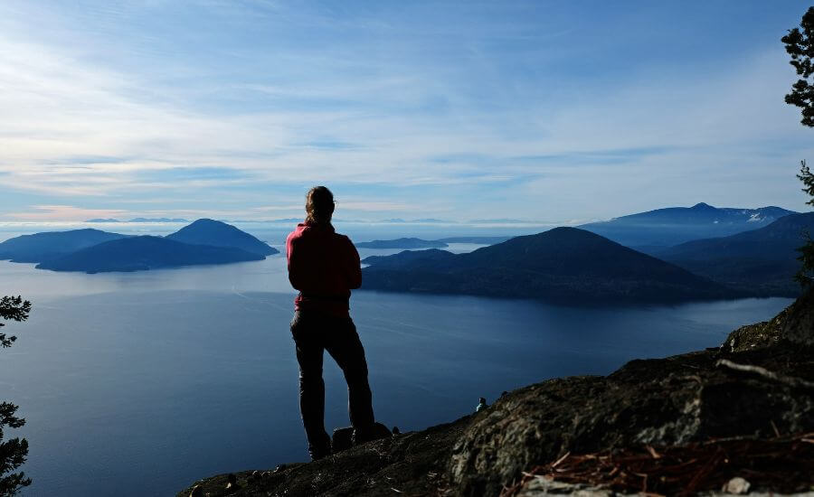
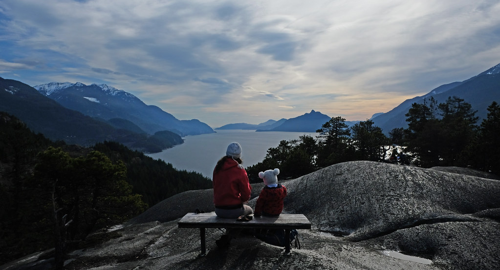
Are you looking for a relatively easy half day hike that leads up to fabulous views of Howe Sound, Bowen Island and the Sunshine Coast? The Tunnel Bluffs hike is exactly that, and it’s a popular day trip from Vancouver, located only about 30 minutes drive from the city.
Beating the crowds is the most challenging thing on this trail, but here we are to help you with that. This post includes everything you need to know to hike to Tunnel Bluffs viewpoint and how to make it the most enjoyable experience.
More hiking trails and sights in the area:
The route to Tunnel Bluffs from Lions Bay

As of March 2020, you can’t get to Tunnel Bluffs from the Sea to Sky Highway, the only possible route is from the tiny coastal town of Lions Bay. The trail starts from the end of the town, from the Sunset Trailhead.
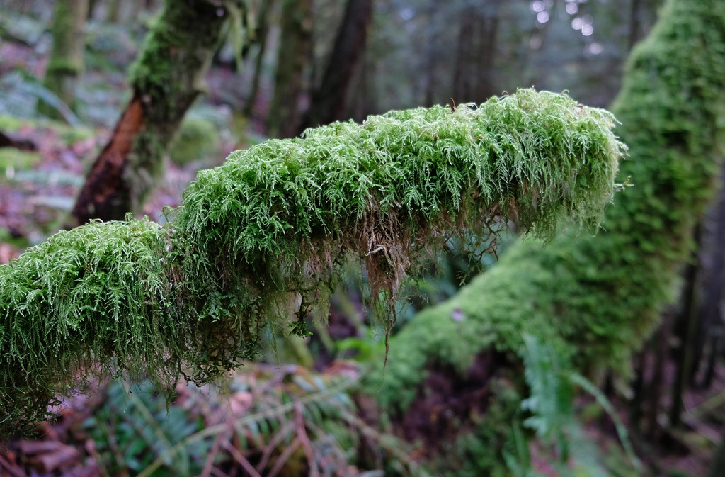
The first section is the steepest, and you need to complete about seven switchbacks. But it’s a wide forest path, so the terrain itself is technically easy, and once you’re over it, you’ve completed most of the elevation gain on the hike.
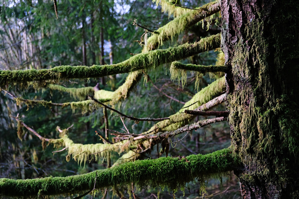
Then comes the first creek crossing, as you cross the log bridge over Magnesia Creek. The creek is rushing and powerful after heavy rains. After you leave it behind, you’ll soon reach the junction where Mount Brunswick Trail branches from the trail towards Tunnel Bluffs. Keep left.
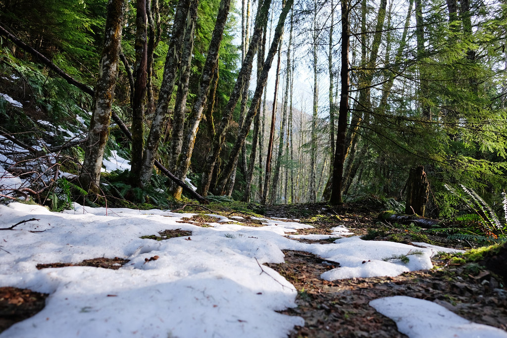
Continue on the easy forest trail, and watch out for the signs, as directions are clearly posted. You’ll cross another mountain creek, and you can catch a glimpse of your first Howe Sound view, but the real treat is the end of the trail.
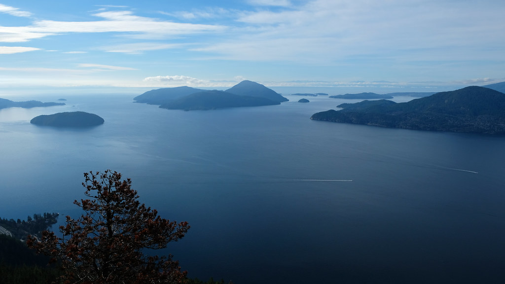
As you get close to the viewpoint, the trail takes you through some rocky sections where a minimal rock scrambling is needed (but no exposure, just watch your footing). After that you descend to a fantastic view of Howe Sound, Bowen Island, the Sunshine Coast, Horseshoe Bay and the Sea To Sky Highway. Sunset views are also spectacular (but you need a headlamp to hike down after darkness falls).
How hard is the Tunnel Bluffs trail?
It’s a moderately difficult hike and a great half day trip from Vancouver. The effort-reward ratio is pretty good, and this hike is suitable for all abilities.
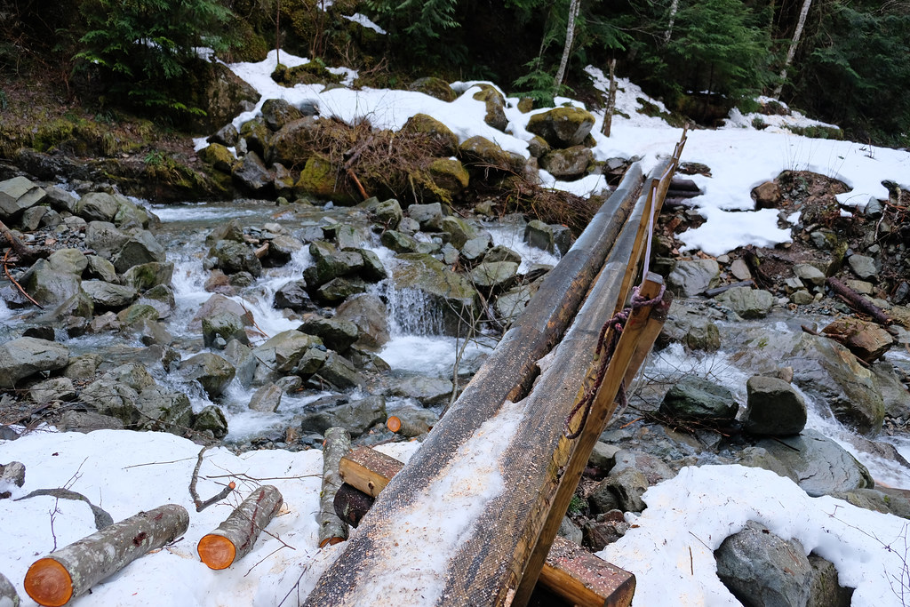
one of the log bridges to cross
While the first two kilometers are steep and leave you breathless (because you’ll be out of breath, not because of the views – not yet), it’s a wide trail which is easy to follow and has no exposure. There’s a few log bridges and a bit of rock scrambling at the end, but otherwise it’s a forest stroll. A 10+ km forest stroll.
How long does it take to get to Tunnel Bluffs from Lions Bay?
It’s about 5.5 kilometers and 500 meters elevation gain one-way. Some can do it in a few hours there and back, and some need about 3-4 hours hiking up to Tunnel Bluffs.
Which is the best time to hike to Tunnel Bluffs?
I’d say it’s a perfect winter hike. Actually, it’s accessible and beautiful all year, but it’s the least crowded in the winter months. Also, what’s the point of using a summer day to complete a hike that can be completed any time of the year, when there are so many high elevation trails which are accessible only in the summer months? This is the logic behind saying it’s the best to do in winter.
It’s a relatively low elevation hike, so it’s snow-free almost all year. Even if there’s snow, it’s manageable, and most likely you won’t even need microspikes. I did it in January, and the route was easily manageable all the way to Tunnel Bluffs. Mostly muddy, with some snow patches here and there. It doesn’t pass any avalanche terrain which makes it a great option for days when avalanche risk is high in the area. But you need a clear day to enjoy the views.
With that said, any clear day in any season is suitable for this hike. But expect it to be very busy on sunny summer weekends (and arrive early to find a parking spot). Luckily, the viewpoint is spacious enough for people to spread out.
Where to park for the Tunnel Bluffs hike?
As for so many popular local hikes, parking is the most challenging part of the Tunnel Bluffs hike, as well.
Since March 2020, you’re not able to do this hike from the Tunnel Point parking along the Sea to Sky Highway. It was a shorter route, but lots of people crossed the highway to start the trail, so parking was limited to 30 minutes to deter hikers. Don’t park here to hike, because you’ll be towed, the 30 minute parking restriction is strict. Don’t park on the road shoulder of the highway either.
You should start the trail from Lions Bay, and follow the route I described from the Sunset Trailhead. It has a small and very busy parking lot which offers pay parking for most of the year (to my pleasant surprise it was free in January). The residential area surrounding the trailhead is also subject to pay parking, and you have to use the Flowbird app. See the details here (and download the app in advance as there might be no cell phone coverage at the trailhead).
So parking on the streets is an alternative solution, but it adds distance. Also, don’t forget to pay, and respect the streets that are for residents only. It’s a very small town, yeah, parking is limited, especially compared to the summer crowds.
The Lion’s Bay Elementary School offers free overflow parking. It’s located opposite to 257 Bayview Road, and it adds an extra kilometer to your hike both ways.
Hiking essentials:
- Trailhead: parking lot at the end of Sunset Drive, Lions Bay
- Length: 5.5 km one-way
- Difficulty: medium
- Season: year-round
- See the trail map here!
Other hiking trails with fabulous views of Howe Sound

view from Saint Marks Summit
St. Marks Summit in Cypress Provincial Park is a more difficult trail to similarly spectacular views of Howe Sound. It’s a 10.5 km return, but the elevation gain is almost 600 meters, and you’ll also hike at higher elevation. It’s even more popular than Tunnel Bluffs, and they say that everyone who lives in Vancouver should do this hike at least once. I agree, and I think that everyone truly does it, because it’s insanely busy in any season when it’s accessible (roughly between June and November).

view from Stawamus Chief First Peak
Stawamus Chief First Peak and Second Peak are awesome adventures for those who are looking for challenging trails and willing to climb up supported by ropes and chains on steep, rocky terrain. It’s a 5 km return trail, with 600+ m elevation gain – and with fabulous views of Howe Sound!
The Jurassic Ridge Trail in Murrin Provincial Park is another short, but challenging trail for those who don’t mind rock scrambling, ropes and ladders. It’s a loop trail, not even 3 km, with 162 m elevation gain. It’s a series of steep ups and downs, and it offers several great viewpoints from the rocky outcrops above Browning Lake.
view from one of the viewpoints along Jurassic Ridge Trail
We did all of these trails, and we enjoyed them and the views they offered very much.
The Eagle Bluffs hike via the Black Mountain Trail in Cypress Provincial Park is slightly easier than the Tunnel Bluffs, but the views are less amazing, as well. Not that it’s a bad hike, but I’d choose Tunnel Bluffs with confidence.