Hiking. Most likely that’s the answer if you ask anyone in Vancouver about their hobbies. It might be accompanied by skiing or camping. No wonder, because Vancouver and its surroundings offer tons of amazing opportunities to all of these! The amazing parks and hiking trails near Vancouver were one of the reasons we moved here. This post is for those who are just about to start (or re-start) hiking. So here they are: the best easy hikes in Vancouver in one long blog post.
They’re for beginners, for families with small kids (we are in this category, and our energetic toddler walked many of these trails on his own) or anyone who doesn’t feel prepared to tackle challenging trails but wants to experience the natural beauties in the area. You totally can! Actually, one of the best things to do in Vancouver is hiking.
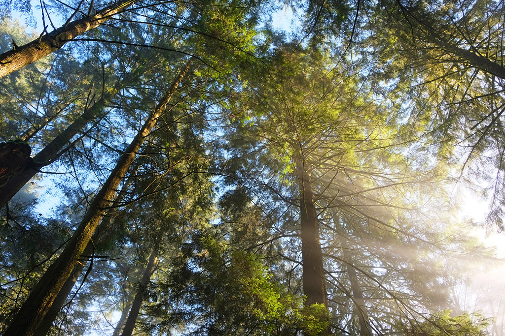
With the Pacific Ocean on one side and the mountains on the other, Vancouver is an ideal starting point for your West Coast adventures. Rainforest trails, roaring waterfalls, picturesque canyons, crystal clear creeks, rivers and lakes impress you, and you don’t even need to leave the city. Countless of these trails are snow-free and suitable to do any time of the year, and rainforests and waterfalls are quite spectacular in the rain, too.
So let’s see those hikes – in Vancouver and in the Greater Vancouver metropolitan area.
TOP 5 easy Vancouver hikes for visitors:
- Best trail that combines a picturesque rainforest with a rushing mountain creek and a waterfall, with many options to lengthen: Twin Falls & Thirty Foot Pool Loop, North Vancouver
- Hike up to a mountain lake for a swim, it’s a truly Canadian experience: Mystery Lake Loop, North Vancouver
- Best short rainforest trail with two waterfalls, located right along the Sea to Sky Highway: Lower & Upper Cypress Falls, West Vancouver
- Best coastal trail, located right along the Sea to Sky Highway: Lighthouse Park, West Vancouver
- A very picturesque rainforest trail: Whyte Lake via Nelson Creek, West Vancouver
Are you looking for even more hiking trails near Vancouver?
Best hikes in Stanley Park
Stanley Park is in Downtown Vancouver, but it has its own peninsula and is almost entirely surrounded by water. We might be biased, but it’s one of the best urban parks in the world. Seriously. Also, it’s the best place to start your hiking adventures in Vancouver, because the Stanley Park Seawall is among the top attractions to see in the city.
Stanley Park has about 27 km of trails, including the coastal path and the interior forest trails. Hikers, runners and bikers all find the suitable trails year-round.
Stanley Park Seawall
If there’s only one trail you have time for, let it be the Stanley Park Seawall. It hugs the perimeter shoreline of Stanley Park, and you can walk or bike it, or even take the stroller for your little one.
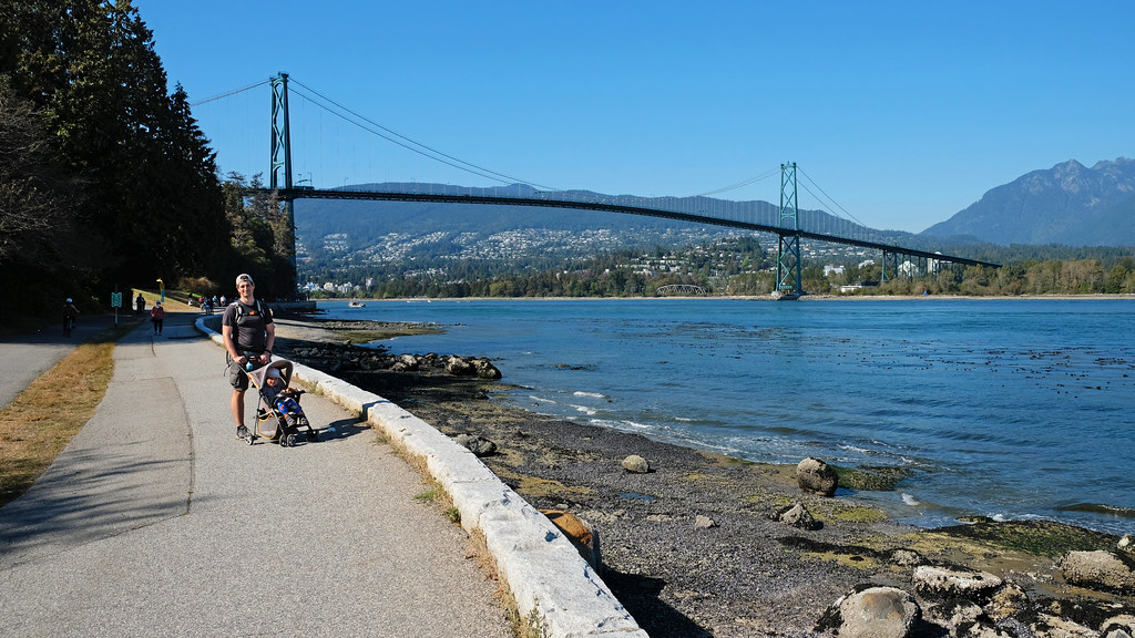
It’s not a short trail, but it’s a paved, flat walk. The full loop is 9.6 km, and it’s very scenic all the way, with views of Coal Harbour and the downtown, Burrard Inlet, Lions Gate Bridge, North Vancouver and the North Shore Mountains. You find plenty of benches and several toilets and beaches on the way.
- Trailhead: you can start the loop anywhere; Lost Lagoon or Second Beach are straightforward places to start the loop if you’re coming from downtown
- Length: 9.6 km loop
- Elevation gain: <70 m
- See the trail map here!
Lost Lagoon Loop

Lost Lagoon is the loveliest lake in Stanley Park, but what makes it truly spectacular is the city views from the north shore of the lake. It’s one of the best very short hikes in Vancouver. Though it’s not paved, it’s smooth for the most part and suitable for sports strollers. But it’s so short that even toddlers can complete it.
Don’t miss the cherry tree grove south of the lake in mid-April. In the summer months take a short stroll to nearby Stanley Park Rose Garden.
You can join the lakeshore loop trail anywhere. A pleasant walking path connects the Lost Lagoon loop with Second Beach, and if you come from Coal Harbour along the Seawall, there’s an underpass that takes you directly to the lakeshore.
- Trailhead: you can start the loop anywhere
- Length: 1.8 km loop
- Elevation gain: <20 m
- See the trail map here!
Beaver Lake Loop

Beaver Lake is a wetland habitat, currently changing from lake to marsh, then soon (within a few decades) to meadow. The highlights of the loop trail are views of wildlife and vegetation. Beavers do live here, but you need some luck to catch a glimpse of them. However, seeing raccoons is quite common not only here, but anywhere else in Stanley Park.
You can join the Beaver Lake Loop from several directions, but most people do it as a detour from the Stanley Park Seawall.
- Trailhead: you can start the loop anywhere
- Length: 985 m loop
- Elevation gain: <20 m
- See the trail brochure here!
Best easy hikes in North Vancouver

North Vancouver has such a wilderness feel! It has city parks with canyons, rainforests, small creeks and waterfalls. The most unique easy hiking trails in Vancouver can be found here, then you can continue with more challenging ones.
The Grouse Grind is a North Vancouver hike that’s included in every blog post about hiking in North Vancouver. I’m not including it here for two reasons: it’s not easy, but exactly the reverse, a great trail for those who’re looking for a physically challenging trail, with quick elevation gain, lots of stairs and steep sections. It’s not really scenic either, it doesn’t offer a view until the very end, and the forest is quite average – there’s much more beautiful rainforest trails and walks in North Vancouver.
Spirit Trail
The Spirit Trail is an ongoing project which aims to connect Deep Cove and Horseshoe Bay by a continuous walking and biking path. The entire greenway of the North Shore will be about 35 km long. It’s not a hiking trail, but a paved path with minimal elevation change, and the section in North Vancouver is ready to use.
The path starts at the lovely Tilford Gardens and takes you to Moodyville Park, The Shipyards, Waterfront Park, Kings Mill Walk Park and all the way to Lions Gate Bridge. We haven’t walked it in one stretch ever, but I often choose short sections of it to take my son for a walk or practice biking with him. The path is close to the waterfront, and it crosses train tracks via scenic overpasses. It has quite a bit of urban feel, unlike most other trails in the list – it might be an advantage or a disadvantage, you choose.
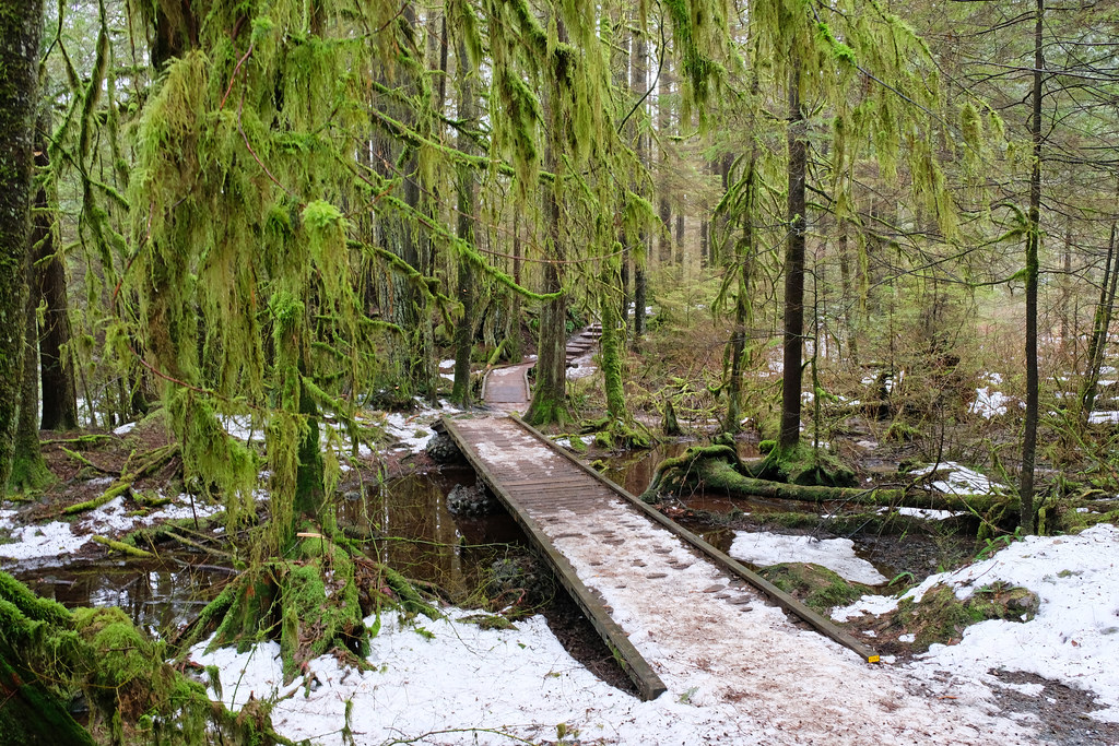
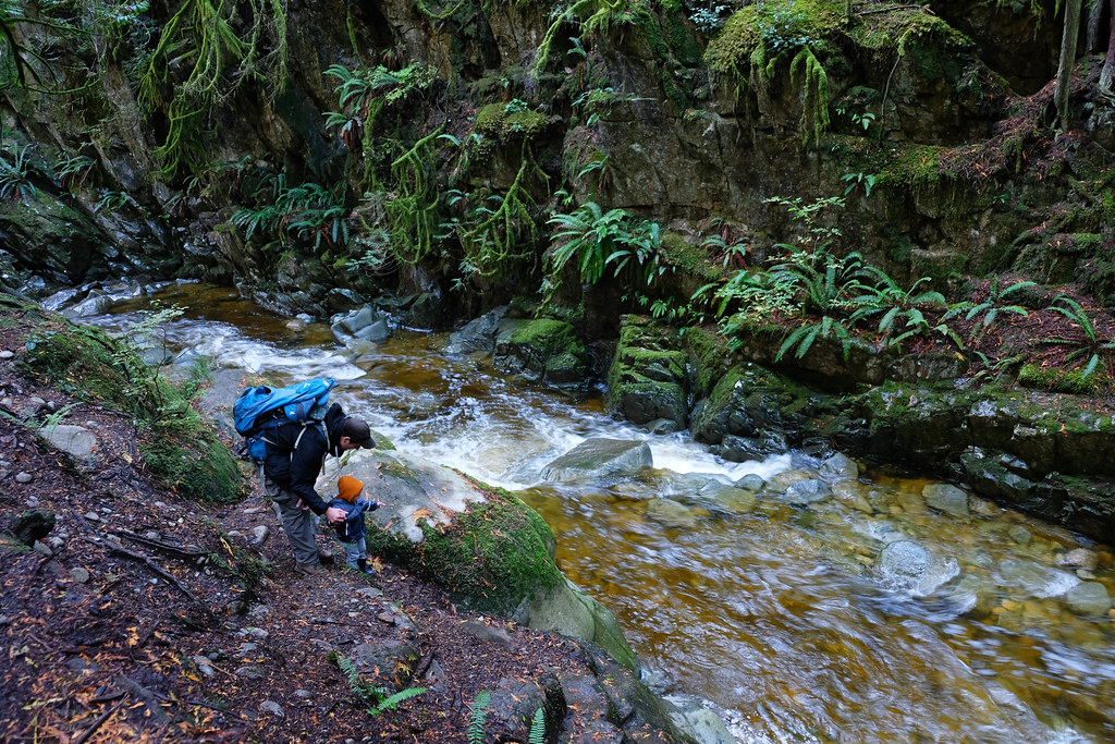
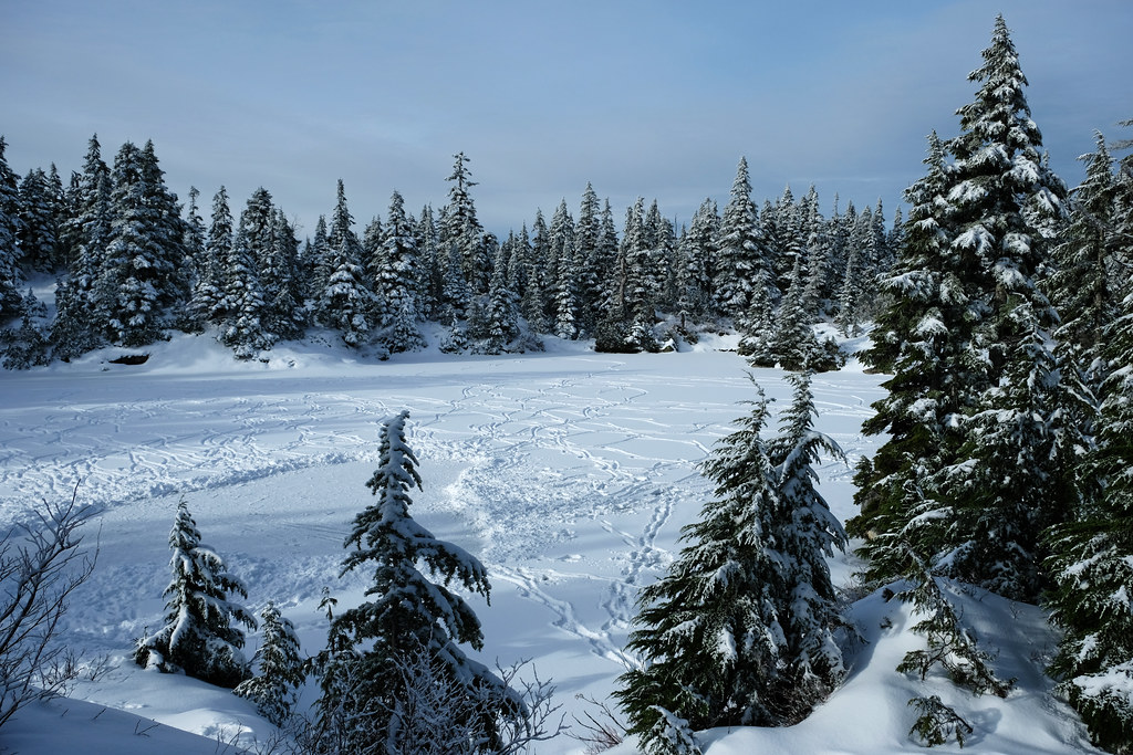
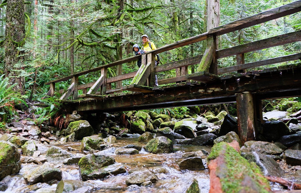
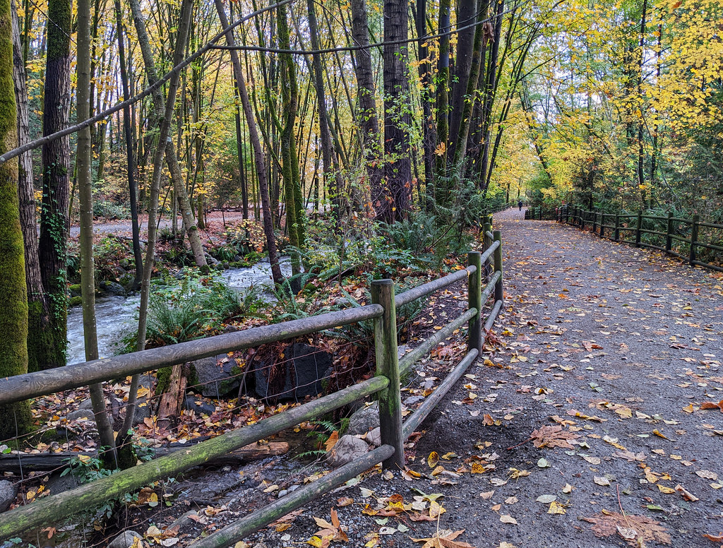
Twin Falls & Thirty Foot Pool Loop, Lynn Canyon Park

One of the most wonderful short hikes near Vancouver is the picturesque loop in Lynn Canyon Park. It takes you through the Lynn Canyon Suspension Bridge, to Twin Falls and Thirty Foot Pool. The rainforest itself is an attraction, too.
Though it’s short, it’s not one of the flat and stroller-friendly ones. It involves dozens of stairs, a few sections that have a boardwalk, and the rest is a rugged forest trail. But Lynn Canyon Suspension Bridge is right there, a few steps away from Lynn Canyon Café. Then you can decide to hike to the Twin Falls Bridge or the Thirty Foot Pool, or combine both in a 2.3 km loop – that’s what we recommend, because it’s really pretty all the way!

Twin Falls is not huge, but surrounded by dramatic rocks and lush greenery, it’s an impressive waterfall. You can get a view from above from the Twin Falls Bridge, but for the best views walk a bit further down on Baden Powell Trail. Keep your eyes open for a steep, short detour down to Lynn Creek. Don’t climb over the fence, you can see Twin Falls very well from behind it.

The emerald Thirty Foot Pool is a swimming hole in the summer, but don’t expect pleasant water temperatures, Lynn Creek is a cold mountain creek! We prefer simply sitting down for snacks by the pool and marveling at the incredible hues of the water.
- Trailhead: Lynn Canyon Café
- Parking: Lynn Canyon Park (paid parking, maximum 3 hours), or you can find free street parking in the area and walk more to the trailhead
- Length: 2.3 km loop
- Elevation gain: ~100 m
- Season: year-round
- See the trail map here!
Mystery Creek & Hyannis Loop, Lower Seymour Conservation Reserve

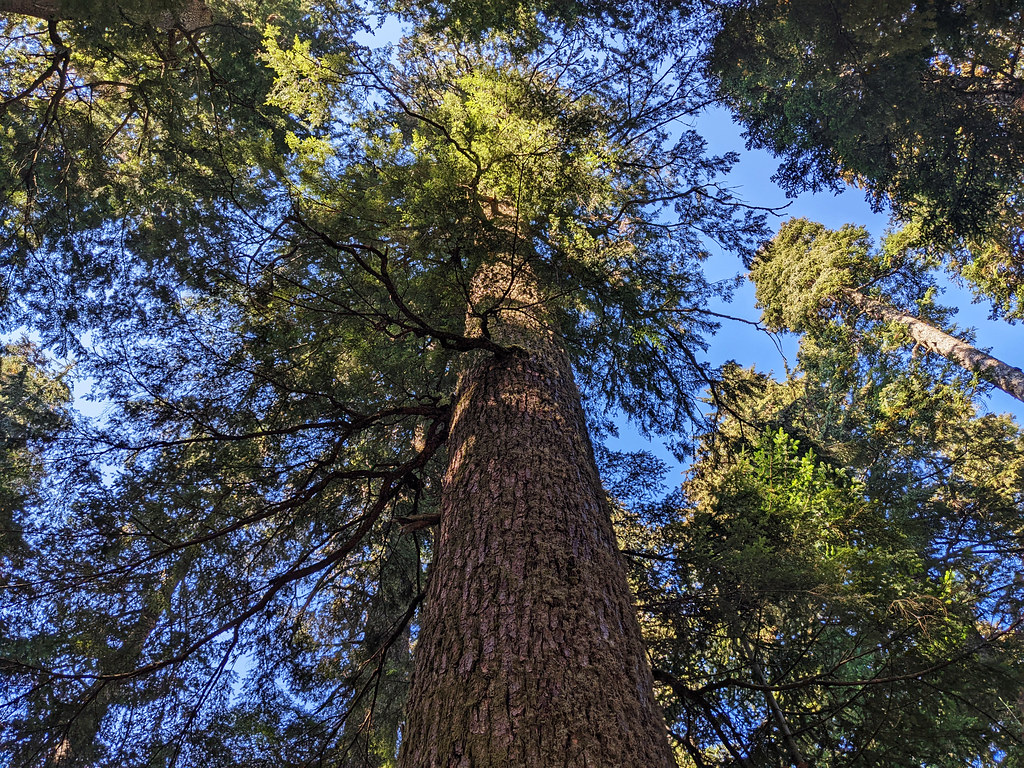
Some of our favorite rainforest trails are in the Lower Seymour Conservation Reserve, like the Mystery Creek & Hyannis Loop. This trail takes you through old-growth forest, and the giant, moss-covered trees lean over you like a green cathedral. This trail is just as fabulous in foggy or rainy weather as in the sunshine, and the dense forest gives you shelter from the rain (at least for the time being).
It’s a short, easy, wide and well-marked hiking trail, with minimal elevation change. There’s no highlight, because the forest itself is the highlight, and pristine, rushing Mystery Creek. Parking is on the street in the residential neighborhood, and you simply start walking in the forest at the end of Hyannis Drive.

If you’d hike more, you can easily lengthen the trail, like hiking further on Baden Powell Trail towards Lynn Canyon, or completing a longer loop that includes seasonal Mystery Falls.
- Trailhead: Hyannis Drive (free street parking)
- Length: 3.6 km loop
- Elevation gain: ~130 m
- Season: year-round
- See the trail map here!
Rice Lake Loop, Lower Seymour Conservation Reserve
It’s one of the most popular easy trails in Vancouver, and it can be combined with the Lynn Canyon Park loop.
Rice Lake is not an alpine lake, but it’s lovely, surrounded by evergreen forests, and the lakeshore trail is an almost flat, wide, dirt path. You find several lake access points and benches on the shore, and there’s a small pier – that’s where you get the best view of the lake.
- Trailhead: Rice Lake parking lot (off of Lillooet Road)
- Length: 3.2 km loop
- Elevation gain: <30 m
- Season: year-round
- See the trail map here!
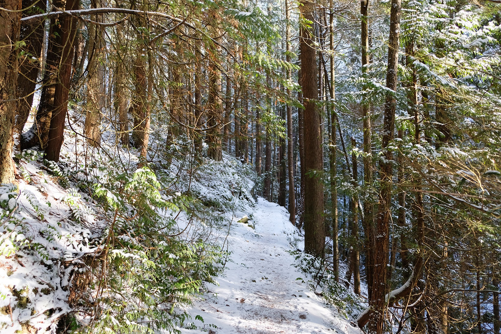
Varley Trail, Lynn Headwaters Regional Park
on one of the few snowy days
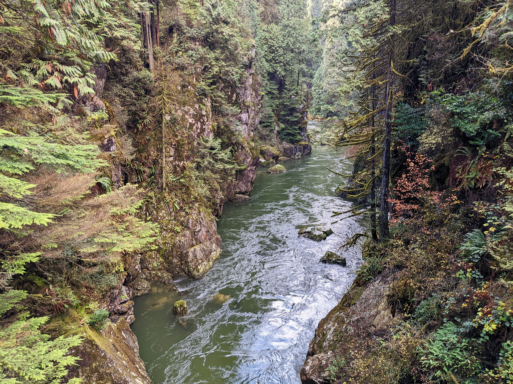
The Varley Trail loop hike can also be a nice addition to the Lynn Canyon Park loop. Varley Trail takes you through a jaw-dropping part of the rainforest right along rushing, crystal clear Lynn Creek. You cross Lynn Creek twice, and both of the bridges treat you with amazing views. Pipeline Bridge, the southern one, has the most perfect view of Lynn Canyon from above.
- Trailhead: northernmost parking lot of Lynn Headwaters Regional Park (paid parking, no time limit), but you can access the loop from the tourist shelter and parking on Lillooet Road, as well
- Length: 3.5 km loop
- Elevation gain: <100 m
- Season: year-round
- See the trail map here!
Coho Loop, Capilano River Regional Park
Unlike the famous Capilano Suspension Bridge Park, Capilano River Regional Park doesn’t have suspension bridges, but is free to visit and has a network of forest trails.
The Coho Loop is the shortest and easiest trail in the park, popular among families. It has pretty views of rushing Capilano River, the best ones are from a wooden viewing platform and from the two bridges. You can lengthen the hike to include Second Canyon Viewpoint and the Cleveland Dam. Even though it doesn’t add much length, it adds elevation gain, because these additions are steady uphill trails.
- Trailhead: Hatchery parking in Capilano River Regional Park
- Length: 1.3 km loop
- Elevation gain: <70 m
- Season: year-round
- See the trail map here!
Mystery Lake & Mystery Peak Loop, Mount Seymour Provincial Park
If you’re looking for an easy lake hike in the North Shore mountains, the Mystery Lake Loop is your best option. Though not an alpine lake, it offers advantages exactly because of that: it’s not that challenging to get to and it warms up in the summer.

The clear waters of Mystery Lake, surrounded by rock bluffs, is a popular swimming spot in the summer, and you can swim between the tiny rock islands in the lake. Then you can continue to Mystery Peak. While not the best peak for panorama, it still offers nice city views from high above for relatively little effort.
The trail starts from the ski area parking at the end of the road. It’s very well marked from beginning to end, with signage at each trail junction. Part of the loop is on the ski slope, and part of it is in the forest where large routes make it a bit more challenging.

Since the area is used for skiing and Mystery Lake is under snow and ice in winter, you can do this hike roughly between July and November. My recommendation would be August and September, because it can be extremely buggy in early summer, right after snow has melted. Late summer and early fall are much more pleasant.
- Trailhead: Mount Seymour Provincial Park parking lot
- Length: 4.8 km loop
- Elevation gain: ~250 m
- Season: July – November
- See the trail map here! (it’s a “rough estimate” as there are actually more trails in the area, and you can visit Mystery Lake both before and after Mystery Peak while doing the loop)
Dog Mountain, Mount Seymour Provincial Park

Being one of the most popular short Vancouver hikes, Dog Mountain trail is busy all year. I have to admit it’s not among my favorite trails for this reason. Also, it doesn’t offer as breathtaking a panorama as other peaks in the area – however, those peaks are more challenging to reach, so not suitable if you’re looking for easy trails.
But Dog Mountain is only about 5 km (that’s insanely short to reach a mountain peak!), suitable for any hiker any time of the year. It gets plenty of snow in winter, but due to the heavy traffic the trail is packed, snowshoes are not needed, but we recommend microspikes.

Dog Mountain Trail in heavy snow; view is not guaranteed
The trailhead is the same as for Mystery Lake: the ski area parking lot in Mount Seymour Provincial Park. During the winter months when the ski resort is in operation, there’s dedicated parking for hikers, and you might need a free day pass to visit.
So Mystery Lake or Dog Mountain? The first one if you prefer a nice lake, the latter if you’re more interested in a panorama of Metro Vancouver.
- Trailhead: Mount Seymour Provincial Park parking lot
- Length: 5.4 km loop
- Elevation gain: ~210 m
- Season: year-round
- See the trail map here!
Mosquito Creek Trail

This is located in one of the city parks in North Vancouver, and it’s rather a walk than a real hike. Mosquito Creek Trail still gives a feeling of being out in the wild. The main walking path runs along Mosquito Creek, and it’s a wide, mostly flat, gravel path, suitable for strollers (mainly sports strollers).
You can explore some side trails with cute little bridges and boardwalks over ponds and small streams (these are not stroller-friendly). They rejoin the main walking trail later, and this main trail is very obvious and surrounded by streets so that it’s actually not possible to get lost in the wild. It’s a typical kid-friendly park, and there’s a small playground (Mosquito Creek playground) at the West 17th Street entrance.
- Trailhead: either end of the trail – in William Griffin Park or on the West 17th Street
- Length: 1.9 km one-way
- Elevation gain: ~75 m
- Season: year-round
- See the trail map here!
Best easy hikes in West Vancouver

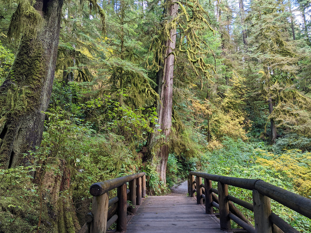
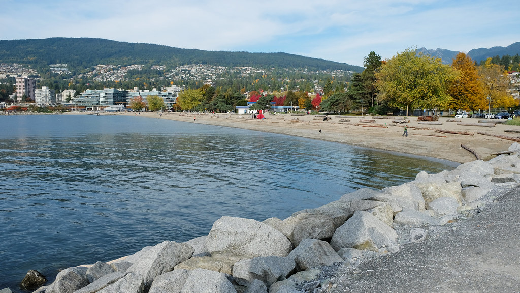
West Vancouver has some of the most amazing beaches in Metro Vancouver, but as you get further from the coast, the streets get steeper and connect to the North Shore Mountains. Short rainforest trails and countless mountain trails of Cypress Provincial Park tempt you, but West Vancouver is also home to the prettiest coastal trails.
Centennial Seawalk
Let’s start with another seaside greenway: the Centennial Seawalk between Ambleside Beach (officially the bottom of 18th Street) and Dundarave Beach. It’s a paved oceanfront walkway with several benches, parks, beaches and playgrounds on the way. It offers views of the Burrard Inlet, Coast Mountains, Stanley Park and the giant ships traveling under the Lions Gate Bridge.
While I think the Stanley Park Seawall is a more scenic walking trail, the Centennial Seawalk definitely has a more local vibe, and I also like its beaches and playgrounds more. The playground in John Lawson Park is among the coolest ones in Metro Vancouver, and both Ambleside and Dundarave Beaches are long and pretty (mostly) sandy beaches.
- Trailhead: either end of the walkway – Ambleside Beach or Dundarave Beach
- Length: 3 km one-way
- Elevation gain: <50 m
- Season: year-round
- See the trail map here!
Lower & Upper Cypress Falls, Cypress Falls Park

If you have time to choose only a few of the easy hikes around Vancouver, Lower & Upper Cypress Falls Trail is an ideal candidate. Especially if you drive along the Sea to Sky Highway from Vancouver to Whistler, because it’s an easy stop close to the highway.
What’s worth seeing here? Two waterfalls – not very tall, but powerful and quite photogenic – , Cypress Creek with its mossy rocks and canyon walls, and a fairy tale rainforest. What’s the effort required? Hiking 1.4 km (one-way). The trail runs along Cypress Creek, it ascends a bit, and the terrain is rugged at places. It’s definitely a hike that requires proper shoes, but still an easy hike.
Lower Cypress Fall is only a few hundred meters from the parking lot and has two fenced viewing platforms. The two viewpoints for Upper Cypress Fall are towards the end of the trail, and the second one might be too much for those afraid of heights – but it offers the best waterfall view. There’s no fence at either of these viewpoints, so be careful not to get too close to the edge of the canyon.
Cypress Falls Park is accessible all year. It rarely snows there, but usually you can hike this trail even in the snow. Microspikes are recommended, especially for the steeper section between the two waterfalls.
one of the few snowy days
- Trailhead: Cypress Falls Park parking area
- Length: 2.8 km return
- Elevation gain: <150 m
- Season: year-round
- See the trail map here!
Yew Lake, Cypress Provincial Park

Yew Lake is the easiest trail in Cypress Provincial Park. Driving here from West Vancouver is already quite nice, then there’s a pleasant, almost completely flat 2.1 km loop via Yew Lake.
It’s not snow-free during the winter months, but it’s a well-worn track that’s fun to do in the snow, too. Microspikes are usually recommended, but honestly, you can likely complete this short walk without any problems even if you don’t have them.
The loop starts from the Cypress Creek Day Lodge (it’s the center of the ski facilities in winter) and takes you through sub-alpine meadows and an old-growth forest. Though Yew Lake is not an alpine lake, the surroundings and the small lakes and marshes in the area make this trail very nice.
- Trailhead: Cypress Creek Day Lodge (paid parking in the skiing season, unless having a resort pass/ticket)
- Length: 2.1 km loop
- Elevation gain: <20 m
- Season: year-round
- See the trail map here!
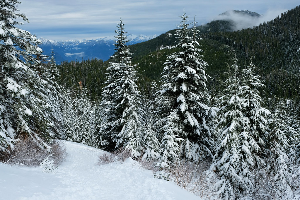
Eagleridge Bluffs via Black Mountain Trail, Cypress Provincial Park

Compared to the Yew Lake loop, this is not an easy trail. But if you want to hike to one of the truly impressive viewpoints in the North Shore Mountains, this is your easiest option (not counting Bowen Lookout, but that’s not nearly as impressive as the views from the Eagleridge Bluffs).
Just like the Yew Lake loop, Eagleridge Bluffs (via Black Mountain) is a year-round trail, but microspikes are recommended in snowy conditions. We did this trail with and without snow, and I think it’s more magical with a snowy landscape. However, you pass five small lakes on the way, and those are all hidden under snow and ice in winter.

Cabin Lake in October
Cabin Lake at the end of November
The trail starts at Cypress Creek Day Lodge. It’s not the only route, as you can hike up to Eagleridge Bluffs from the coast on the Baden Powell Trail, but that’s significantly longer and much more challenging. The route via Black Mountain still requires you to conquer about 440 meters of elevation, but it’s well worth the effort. Eagleridge Bluffs offer amazing views of Metro Vancouver, Horseshoe Bay and partly of Howe Sound.
The steepest section is at the very beginning as you hike along the ski slopes of Cypress Mountain Resort. After this, the hike consists of gentle ups and downs as you pass subalpine lakes, get to the peak of Black Mountain (the first view, though partly obstructed), then to the Eagleridge Bluffs.
- Trailhead: Cypress Creek Day Lodge (paid parking in the skiing season, unless having a resort pass/ticket)
- Length: 8.6 km loop
- Elevation gain: ~440 m
- Season: year-round
- See the trail map here!
Lighthouse Park Loop
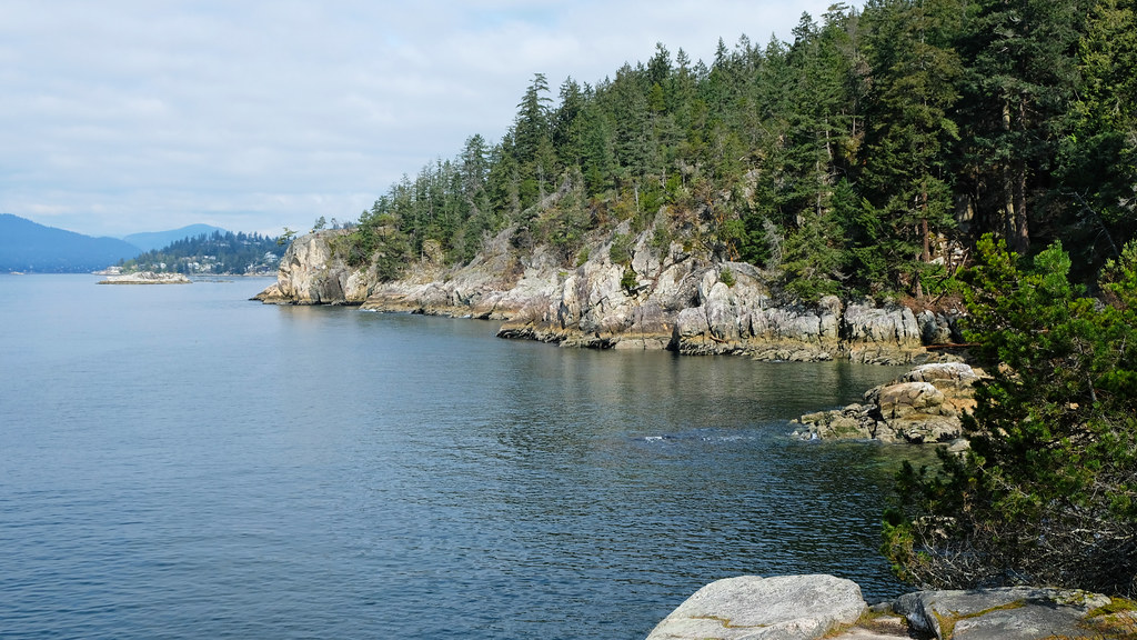
The trail network in Lighthouse Park is about 6 km. Some of the trails run in the forest, but some are along the coastline, and these are among the most scenic coastal trails in Metro Vancouver.
Parking is at the end of Beacon Lane, and compared to the park’s popularity on sunny weekends, the parking lot is not large, and there’s no overflow parking. Beacon Lane Trail is a nice rainforest trail that starts in the parking lot. It’s wide and stroller-friendly.

Juniper Loop & Juniper Point Trails can be combined into an 1.2 km loop, mostly in the forest, but there’s a natural vista point: Juniper Point. The clifftop is perfect for a picnic, but watch small kids closely, there’s no fence and the rocks can be slippery.
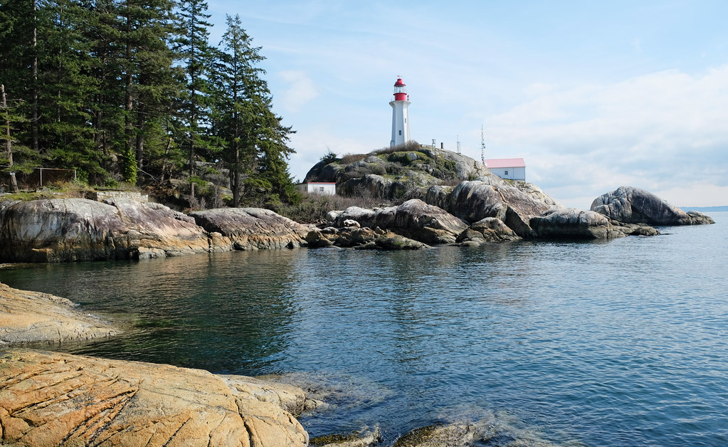
The Shore Pine Trail-Seven Sisters Trail loop is 2.1 km. It runs in the pine forest along the coast, but offers several viewpoints on the way. It’s slightly downhill, and there’s a steep, albeit short detour down on West Beach Trail to the best viewpoint of the lighthouse. This is actually the only lighthouse view in the park, from the rocky bluffs right across it.
Whyte Lake via Nelson Creek
Unlike what you’d expect, the highlight on this hike is not Whyte Lake, but the trail that leads there through spectacular old-growth temperate rainforest and along rushing Nelson Creek. It’s a 5.2 km return, easy and accessible year-round. Occasionally, it might get snow in the winter, but even then you can manage it with microspikes.
It’s definitely a must-do for every local at some point, but even visitors won’t regret dedicating a few hours to it. Read our detailed trail description here!
Best easy hikes in the Tri-Cities
Coquitlam, Port Coquitlam and Port Moody – three adjoining suburban cities of Metro Vancouver, along with the villages of Anmore and Belcarra. It’s another area that has a variety of lakes and creeks, shoreline and forest trails, and eventually you can connect to the mountains.
Sasamat Lake Loop, Belcarra Regional Park, Port Moody

The 3 km loop trail around Sasamat Lake is among the easiest Vancouver lake hikes. It runs directly on the shore for the most part, and several boardwalks allow you to walk over the water. There’s even a floating bridge that takes you across Sasamat Lake.
The path is almost flat, but often uneven due to large roots or a set of wooden stairs. It’s under forest cover which makes it an enjoyable trail even in the rain. (If you visit Vancouver outside of July and August, you’ll likely hike in the rain eventually.)
The trailhead and most convenient parking is at White Pine Beach. It’s a popular swimming spot in the summer and a nice picnic area in the rest of the year (given that you’re in waterproof clothes and own a waterproof picnic blanket – just kidding… uhm, maybe not).
- Trailhead: White Pine Beach (paid parking in the warmer part of the year)
- Length: 3 km loop
- Elevation gain: <50 m
- Season: year-round
- See the trail map here!
Admiralty Point Trail, Belcarra Regional Park, Port Moody

I can’t help but list another trail from Belcarra Regional Park (it has many short, pretty trails!). Admiralty Point Trail is a coastal hike, and the views can compete with those in Lighthouse Park. The trail runs directly on the shore of Belcarra Bay, and several rocky bluffs offer unobstructed ocean views. You can even find small bays that you can mistake for a bay in the Mediterranean (at least on a sunny day).
The trail starts from the main parking lot in Belcarra Regional Park. You find a large picnic area and a small jetty, and Admiralty Point Trail starts left of the jetty. It’s snow-free almost all year, and the rainy, foggy days of the colder months have their own special vibe, just like the shimmering turquoise bays on a sunny summer day.
- Trailhead: Belcarra Regional Park Picnic Area parking lot (paid parking in the warmer part of the year)
- Length: 3.2 km one-way
- Elevation gain: <130 m
- Season: year-round
- See the trail map here!
Shoreline Trail, Rocky Point Park, Port Moody
The Shoreline Trail is an almost flat, very easy gravel walking trail that wraps around the easternmost section of Burrard Inlet. It starts from the pier at Rocky Point Park and ends at Old Orchard Park, or the reverse. It takes you through several waterfront parks, and there’s a playground at each end of the trail. The pier itself is a nice scenic walk.
However, tide conditions make a huge difference in the scenery here. At low tide you mostly see the mudflats, at high tide it’s a tranquil bay. Though the trail runs directly on the bayshore, views are often obstructed by the trees. But there are quite a few nice viewpoints on the way.
- Trailhead: either end of the trail – Rocky Point Park (time limited parking) or Old Orchard Park
- Length: 3 km one-way
- Elevation gain: <50 m
- Season: year-round
- See the trail map here!
Low Knoll & Marsh Trails Loop, Minnekhada Regional Park, Coquitlam

Minnekhada Regional Park has hills, dense forest, elevated rocky viewpoints, mountain views, marshlands and rich bird life. Most trails here are easy, and the park is relatively small, so it’s popular among local families.
The easiest and most scenic trail is around the two marshes – that look like small lakes when they have enough water – and a short, but steep detour to the Low Knoll viewpoint. (You can hike to High Knoll, too, but the views are quite similar.) It can be combined into one loop via Lodge Trail, Mid-Marsh Trail, Fern Trail and Lodge Trail. The dyke offers great opportunities for bird watching, and it’s the completely flat part of the loop. The section up to Low Knoll viewpoint is the steepest, with roots, rocks and rougher terrain. But it was doable even for my toddler, he actually found the rough terrain exciting.
- Trailhead: Minnekhada Regional Park parking area, off of Quarry Road
- Length: 3.8 km loop
- Elevation gain: ~160 m
- Season: year-round
- See the trail map here!
Mundy Lake & Perimeter Trail Loop, Mundy Park, Coquitlam

Mundy Park is one of the largest parks in Coquitlam and one of my favorites in all of Metro Vancouver. It’s a city park, but offers the experience of walking in a temperate rainforest. It has two lakes, a trail network of 16(!) km, large sport fields, picnic shelters and an exciting playground for kids of any age.
The 1 km loop around tranquil Mundy Lake is so pretty, and the surrounding rainforest trails (Nature Interpretive Trail, Perimeter Trail) won’t disappoint either. This 2.7 km loop is our usual route with Tomi – not too long for a toddler, and scenic enough for me. It starts at the parking lot by the sport fields, but you can start it elsewhere, too, like from the parking lot by the swimming pool or the playground. You can also make it longer by including Lost Lake, the full length of Nature Interpretive Trail or Perimeter Trail.

The good thing about Mundy Park is that most of it is evergreen, so it’s equally beautiful in every season. I’ve never seen it in the snow (and it rarely gets snow), but it could only make it more magical.
- Trailhead: parking near the sport fields in Mundy Park
- Length: 2.7 km loop
- Elevation gain: ~50 m
- Season: year-round
- See the trail map here!
Lafarge Lake Loop, Coquitlam

The loop around Lafarge Lake is really rather a stroll than a hike. But it has lovely lake views and some distant mountain views. Lafarge Lake Park feels much more like a city park than Mundy Park, but if you visit in the Christmas season, don’t miss it. Lights at Lafarge is an impressive light show along the lakeshore loop trail.
Like most of the lowland, Lafarge Lake Park is snow-free (almost) all year, but most of the trees here are not evergreen – which means nice fall colors in October, and bare trees during winter and early spring.
- Trailhead: C or D parking lots in Town Center Park
- Length: 1.5 km loop
- Elevation gain: <10 m
- Season: year-round
- See the trail map here!
Coquitlam River Walk, Coquitlam River Park

The Coquitlam River walk is wide, flat, never crowded, and it runs along rushing Coquitlam River. It’s a perfect easy hike for those longing for solitude. The area offers about 10 km of walking trails, but I marked my favorite section on the trail map below.
It starts from a small dirt parking lot just off of Shaughnessy Street, and I prefer heading north as that’s the direction out of the city. I marked a 2 km long section (up until David Avenue) which is full of river access points, there are some small rocky beaches and countless little cascades. But you can continue along the river for a very long time and eventually end up in the wilderness.
You can also choose to walk southward from the parking lot, it takes you to Lions Park and Gates Park. It’s a more urban landscape though.
Coquitlam River Park is quite colorful in the fall, as the majority of the forest is seasonal. Fall is also the time when salmon travels up the river from the Pacific Ocean. Winter and spring bring plenty of water, so the river becomes very powerful. Summer is time for a dip in the (cold) water.
- Trailhead: dirt parking area off of Shaughnessy Street
- Length: 4 km return
- Elevation gain: <50 m
- Season: year-round
- See the trail map here!
Best easy hikes in Burnaby
Burnaby doesn’t have mountains, but it has a few lakes, marshlands and even a nice coastline along the Burrard Inlet. Living in Burnaby, we liked its parks and visited them quite often, but visitors with a limited time in Greater Vancouver find more spectacular trails in North and West Vancouver or in the Tri-Cities.
Deer Lake Loop

The trail around Deer Lake is the typical afternoon family stroll. It’s flat and scenic, with lake views, Burnaby skyline views and even distant mountain views, and ducks, geese and turtles in the lake. There’s a small sandy beach in front of the parking lot, but it’s more like a huge sandbox for kids, because the lake is not suitable for swimming. Boating is popular though. There’s also a set of swings on the beach and many benches along the loop trail.
- Trailhead: Deer Lake Park parking (off Sperling Avenue)
- Length: 3.5 km loop
- Elevation gain: ~60 m
- Season: year-round
- See the trail map here!
Drummonds Walk, Barnet Marine Park

Barnet Marine Park is the only shoreline park in Burnaby. It offers a sandy beach (with a swimming area) and a scenic coastal walk: the Drummonds Walk. This is a shoreline walkway, wide and flat, about 2 km one-way, so it’s an easy, pleasant afternoon stroll with ocean and mountain views. You can wave to the hikers in Belcarra Regional Park on the opposite side of the bay. 🙂
- Trailhead: Barnet Marine Park parking (off Barnet Highway)
- Length: 2 km one-way
- Elevation gain: <50 m
- Season: year-round
- See the trail map here!
Trail of Hope, Central Park

The Trail of Hope is a lovely loop trail in Burnaby’s Central Park, with old trees, two ponds, many ducks, geese and squirrels. It’s rather a pleasant walk than a hike, the trail is gravel or paved and quite wide, suitable for strollers, as well.
- Trailhead: parking lot at the Lower Pond in Central Park (but you can join the loop from any of the parking lots)
- Length: 3.1 km loop
- Elevation gain: <90 m
- Season: year-round
- See the trail map here!
Best easy hikes in Richmond
Richmond is quite flat, the nicest walks are near the Fraser River and the ocean. Tide conditions mean significant differences in the views though.
Iona Beach Trail

Iona Beach Regional Park is Richmond’s beach park. It’s located where the Fraser River meets the ocean, and it has a long beach, sand dunes, small ponds and a long, flat walkway on the jetty. You can walk on the jetty for several kilometers, or choose the 5 km return Iona Beach Trail loop. The latter is an easy walk that follows the beach, passes sand dunes and driftwood, a grassy area, and it provides a great opportunity for bird-watching.
For the best views though, you better check the tide and plan to visit at high tide. You’ll only find a mudflat stretching to several kilometers if you go there at low tide – it’s much less scenic. Also, prepare for strong winds in the winter months.
- Trailhead: Iona Beach Regional Park parking lot
- Length: 5 km return
- Elevation gain: <50 m
- Season: year-round
West Dyke Trail
West Dyke Trail starts from the Terra Nova Rural Park
The West Dyke Trail is another waterfront walkway, it’s completely flat, but much longer than the Iona Beach Trail. Actually, you walk all along Richmond on the waterfront. Again, views are significantly different at low or high tide, because the tidal zone becomes a muddy marshland at low tide. These flat coastal trails are not as impressive as the trails of Lighthouse Park or Belcarra Regional Park, but they have rich foreshore ecosystems and are great for bird-watching.
West Dyke Trail starts at the Terra Nova Adventure Park, and you can walk all the way to Garry Point Park in the south. But it’s a there-and-back route, so you can make it as long or as short as you like. It’s popular for biking and jogging, too, and the gravel path is suitable for strollers.
- Trailhead: Terra Nova Rural Park parking lot (at the end of River Road)
- Length: 10.5 km return
- Elevation gain: <50 m
- Season: year-round
- See the trail map here!
Best easy hikes in Surrey
Surrey doesn’t have mountains either, but it has some lovely forest parks and beachfront walkways.
Redwood Park Fairy Forest

This 1.3 km loop takes you through majestic redwoods and is named for the hundreds of cute fairy houses you find on the way. The redwoods in the park are planted, and the fairy village was created by the community. Colorful, grand or tiny fairy homes hang from branches, perch on logs, hide in tree hollows, and you can add your own to the collection. Or just take a walk under the redwoods, it’s a soothing therapy.
- Trailhead: Redwood Park Parking Lot
- Length: 1.3 km loop
- Elevation gain: <50 m
- Season: year-round
- See the trail map here!
Crescent Beach Path & Blackie Spit

The walkway along Crescent Beach is quite similar to the West Dyke Trail, only much shorter. It’s flat and runs along the water – though whether you actually see water depends on the tide. Great blue herons can often be seen in the shallows, hunting for fish at low tide. At the Blackie Spit area, you can hardly see the water at low tide, there are mudflats and marshlands. Don’t forget your binoculars, many birds live here.
The sandy beaches are suitable for small kids to splash in the water or play in the sand in warmer weather, and you find plenty of picnic benches and a small jetty, as well.
- Trailhead: Crescent Beach parking lot (off Target Street) or Blackie Spit parking lot (at the end of McBride Avenue)
- Length: 3.9 km return
- Elevation gain: <20 m
- Season: year-round
- See the trail map here!
What to wear hiking in the summer?
Hiking pants, preferably zip-off pants: mornings and evenings are chilly, so you’ll be happy to wear long sleeve pants, but it’s very practical if you can simply zip the sleeves off in the hottest part of the day, or when hiking uphill. Columbia offers affordable, practical and durable models both for women and men.
Waterproof hiking boots: appropriate footwear is very important to have an enjoyable and safe hike. We recommend wearing hiking boots that provide good traction. Waterproofness is also important, because weather in BC is quite rainy for most of the year, and melting snow makes lots of trails muddy well into the summer. Dry feet are key for a happy hike. This Columbia Newton Ridge Plus is a great option for women, and the Newton Ridge Plus II for men.
Long sleeve hiking top: you can wear a lightweight, long sleeve top with sun protection as a standalone wear on high mountain trails (it never gets too hot up there, but the sun will be harsh on your skin on clear days), or you can use it as an additional layer when it gets chilly in the morning or evening at lower elevations. This BALEAF top for women offers UPF 50+ protection, and NAVISKIN has a long sleeve T-shirt with UPF 50+ protection for men.
T-shirt: moisture-wicking and quick-drying technical T-shirts are the best for hiking on a hot day. Here’s a great model for women, and here’s one for men.
Hiking socks: merino wool blends are moisture-wicking and breathable, they keep your feet cozy either when temperatures are warm or cold.
Waterproof rain jacket: a lightweight, easily packable rain jacket should always be in your backpack, just in case. You don’t want to get caught unprepared in a sudden storm. Columbia jackets are affordable and effective for the average hiker, here you find them for women and for men.
Vancouver hiking FAQ
Is it safe to hike in Vancouver in the winter?
Vancouver has mild winters, which means that freezing temperatures and snow in the city is rare, and it applies to the Lower Mainland in general. However, temperature drops with elevation, and the coastal mountains get plenty of snow each year. Most of the trails in this list are at low elevation, so they are snow-free for almost all year.
Some of the mountain trails are accessible all year, but microspikes are recommended to avoid slips and falls during the winter months. There are countless summer-only hiking trails, too, but they’re generally not in the easy category, anyway, so we didn’t include them in this list.
Do I need a car to go hiking in Vancouver?
Not necessarily. Cars are the more flexible and faster option to get to the trailheads that are out of the Vancouver Downtown area, but most trailheads can be reached by a combination of public transport and walking. Though please check schedules and routes on Translink, some of the services only run in the summer season.
To pay for public transit, the easiest and most common way is a reloadable fare card called the Compass Card. Buy one at any SkyTrain station or online. Tap your card when you get on a bus, tapping out is only required when using the SkyTrain or the SeaBus. If you don’t have a Compass Card, you need an exact change on the bus, or you can buy single-use tickets from the machines at the SkyTrain stations. The SkyTrain and SeaBus are charged based on a zone system (fare increases as you travel through more zones), buses are counted as one zone.