Vancouver and the Lower Mainland are privileged places in Canada because of their mild (but very rainy) winters. Not only can you hike here year-round, but you can also choose Vancouver winter hikes with or without snow. Since hiking is one of the best things to do here even in the winter, we brought you the best winter hikes in Vancouver.
BC Trip Planning is Overwhelming. So We Did It For You.
Our compact guide delivers step-by-step itineraries to BC’s best sights and hidden gems.
The list is mainly split in two so that you can choose lush green trails or snowy hikes depending on your mood. In addition to the incredible amount of rain and mud during the colder half of the year, Vancouver treats you with a rare privilege: stay close to the ocean coast and in the low elevation forests for year-round greenery, or find magical snowy landscapes at higher elevations in the coastal mountains.
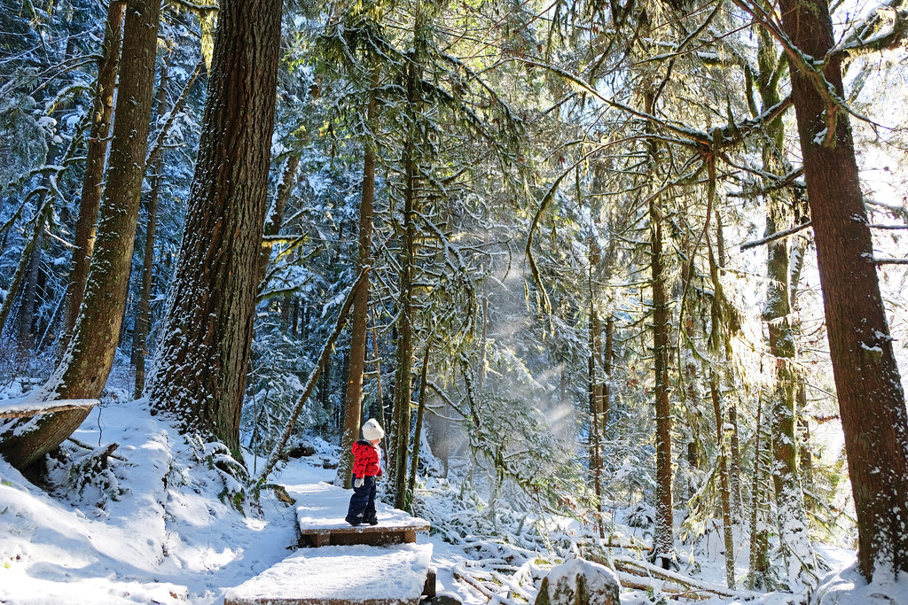
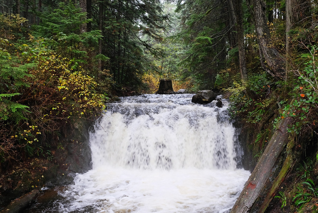
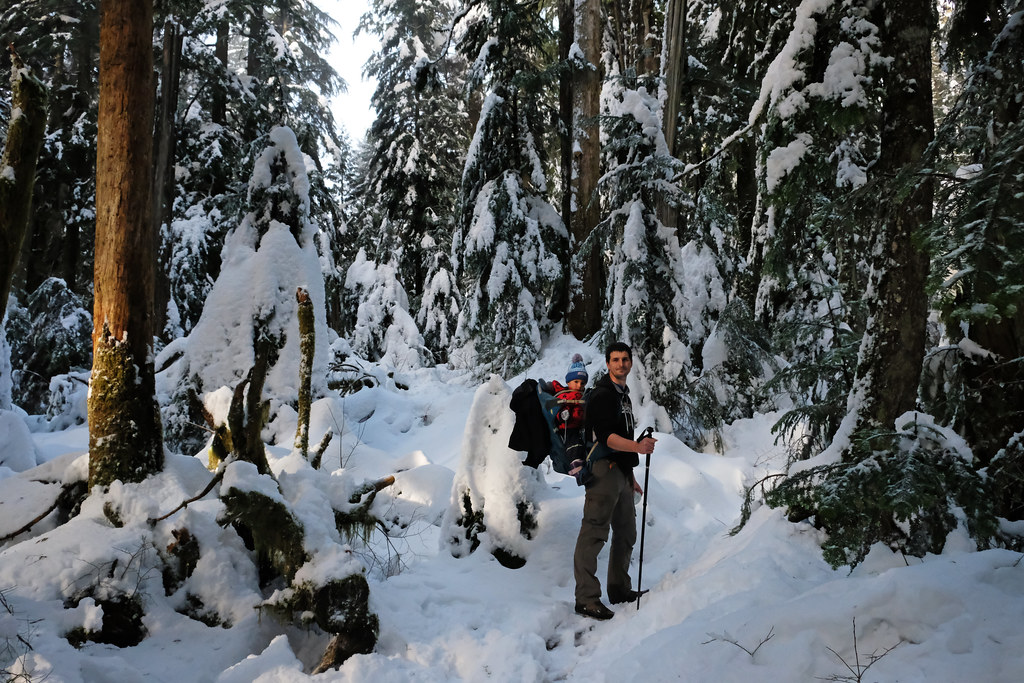
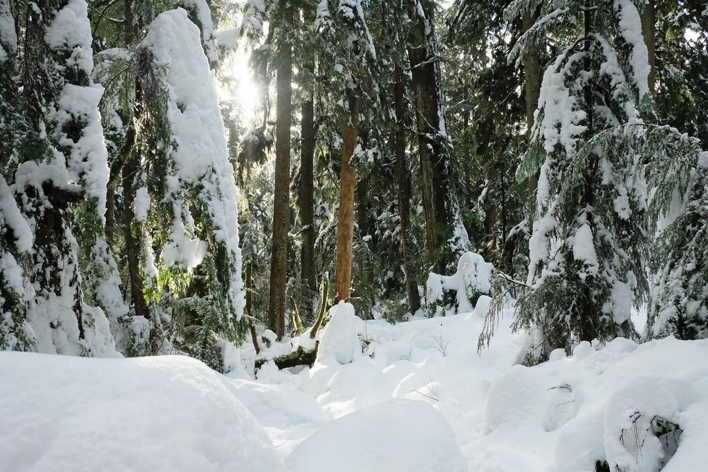
one of the rare snowy days in the rainforest (Lynn Canyon)
Few of the hikes are actually located in the city of Vancouver, but most of them are in the Greater Vancouver area, including some from Pitt Meadows, Maple Ridge or Mission.
Still thinking? My top picks for staying in Vancouver:
- Luxury: OPUS Vancouver (stylish & central)
- Mid-range: O Canada House Bed & Breakfast (cozy “home feel” & good location)
- Budget: Samesun Vancouver (central, social, great value)
Best snow-free hikes in Vancouver
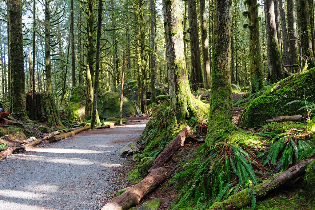
There’s no shortage of snow-free hiking trails in Greater Vancouver. If you stay low enough and close enough to the coast, it’s very rare that winter temperatures go below freezing. The trails in this section rarely get snow, and even if they do, it melts quite soon, and they’re manageable with microspikes until then. Otherwise, no special winter gear is needed, just your good old rain jacket, warm sweater and waterproof boots.
The forests these trails lead you through are evergreen, so you enjoy lush greenery even in the winter, and waterfalls are quite spectacular at this time of the year. Yeah, it rains a lot, too.
TOP 3 snow-free Vancouver hikes:
- Two Canyon Loop, North Vancouver
- Tunnel Bluffs, Lions Bay
- East & West Canyon Loop, Golden Ears Provincial Park
Stanley Park
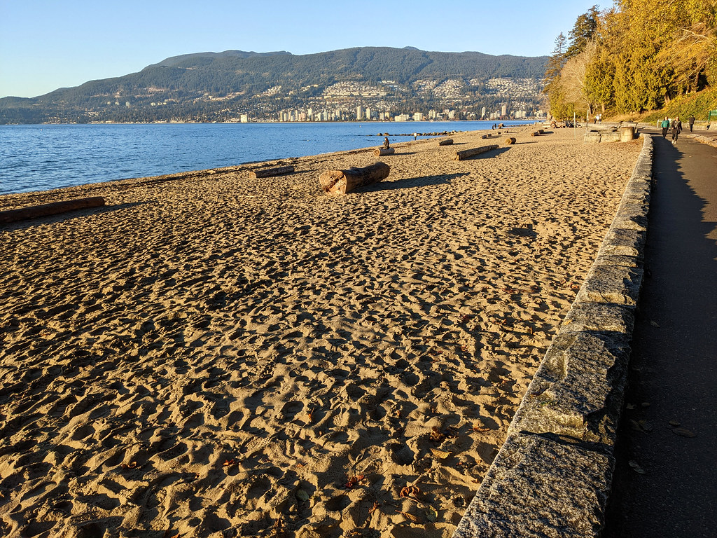
There’s one real hiking opportunity without leaving Downtown Vancouver: the 27 km trail network of Stanley Park. This park has its own peninsula, and the ~10 km long Stanley Park Seawall circles it, combining city views with nature and beaches. But you can also explore the interior forest trails, or the two lakes in Stanley Park: Lost Lagoon and Beaver Lake. Both have easy loop trails running on the lakeshore.
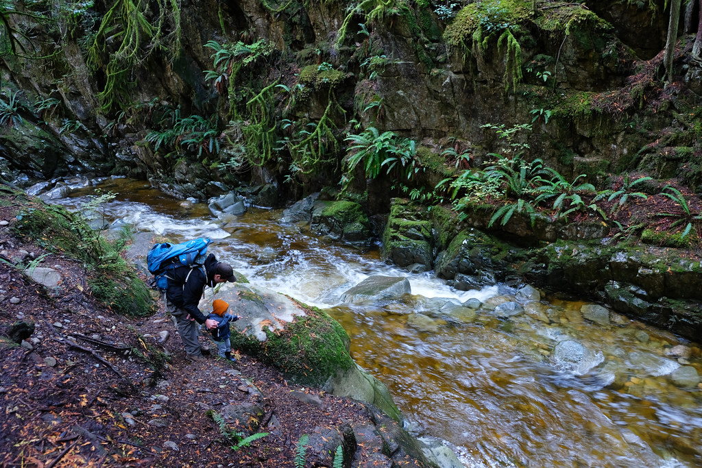
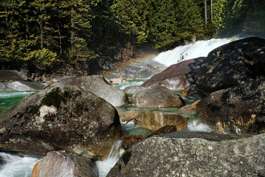
Lynn Canyon Loop, North Vancouver
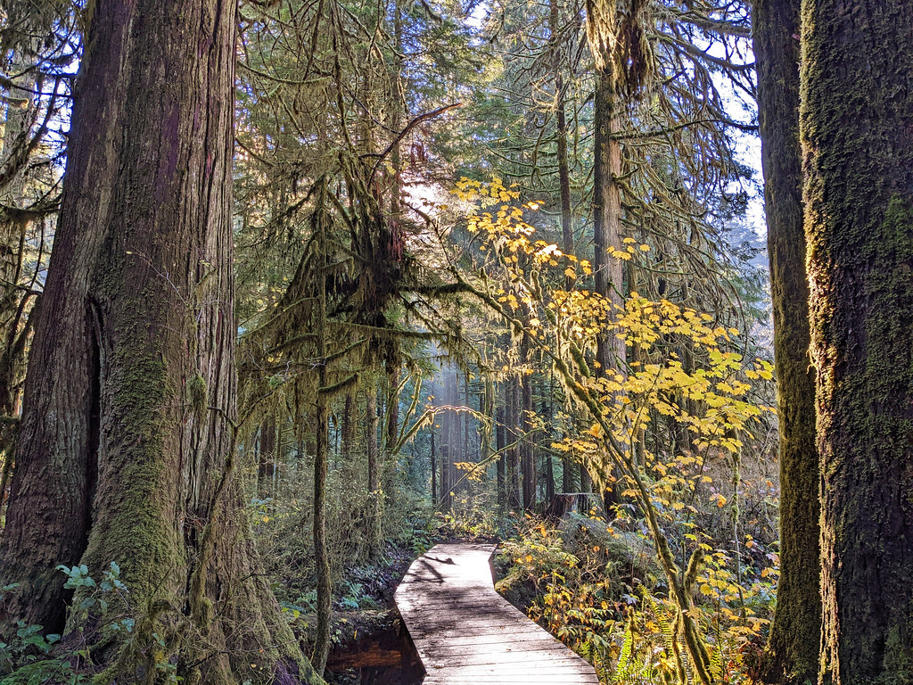
One of the most wonderful easy winter hikes in Vancouver is some combination of the trails in Lynn Canyon. They’re similarly stunning any time of the year, but winter rains make Lynn Creek even more rushing, and the rainforest looks even more vibrant. Not to mention that the dense forest gives some protection from the rain – well, some.
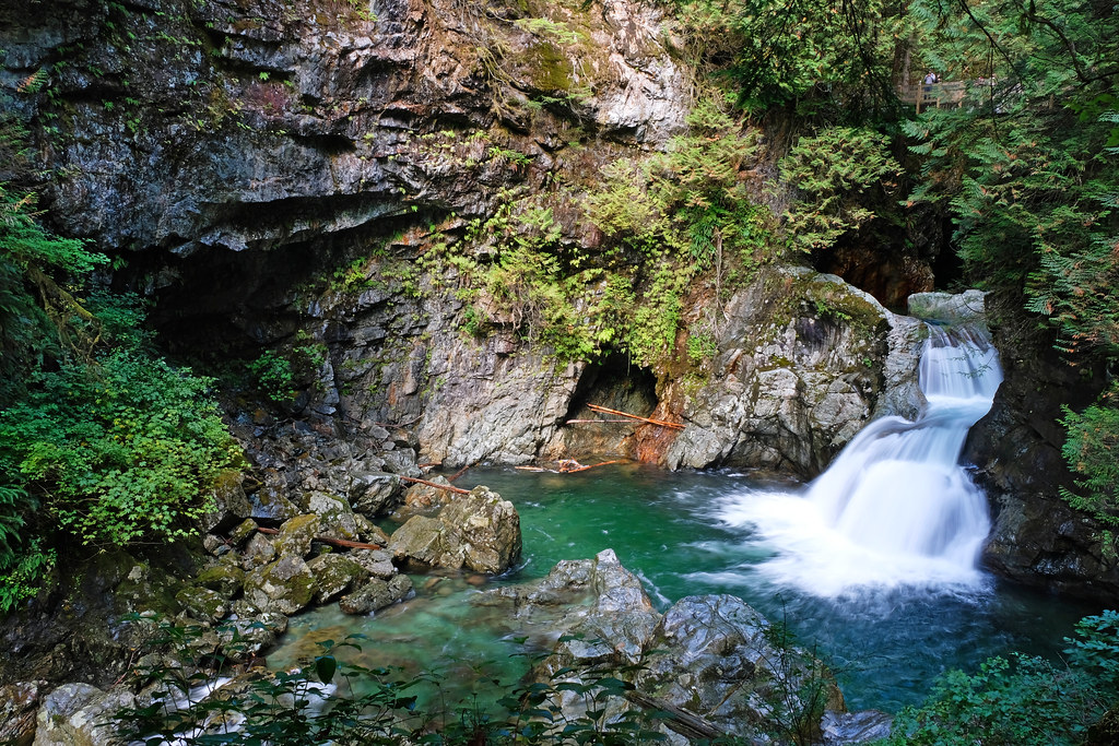
This loop is about 8 km, and it includes the prettiest attractions in the area: Lynn Canyon Suspension Bridge, Twin Falls, Thirty Foot Pool, Rice Lake and the picturesque stretch of rainforest surrounding Varley Trail. You can make it shorter if you have less time (or hike with young kids), but also longer all the way to Norvan Falls. Oh, yes, waterfall trails are huge hits in the winter!
- Trailhead: Lynn Canyon Café
- Parking: Lynn Canyon Park (pay parking, max. 3 hours), but you can also find free street parking in the area (if you’re willing to walk a bit more)
- Length: ~8 km loop
- See the trail map here!
Read about more hikes in the Lynn Valley in this post!
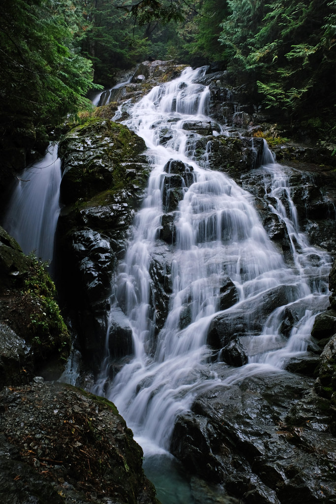
Norvan Falls, Lynn Headwaters Regional Park, North Vancouver

The Norvan Falls hike is not that short, but relatively easy, with only a few hundred meters elevation gain – and with a pretty 30 meters high waterfall at the end of the lovely rainforest trail. It’s challenging enough to be exciting (with the occasional steeper sections, creek crossings and large roots), but still suitable even for beginner hikers and families. (This distance is certainly not for toddlers and very young kids though. They need to be carried, at least partially.)
The trail to Norvan Falls includes part of the Lynn Valley Loop and Cedar Mills Trails where you hike along Lynn Creek, then it continues on Headwaters Trail, and you finally end up at the bottom of Norvan Falls. If water levels are low enough, you can get very close to the bottom of the falls, by crossing the creek and walking closer on the other side.
- Trailhead & parking: Lynn Headwaters Entrance parking
- Length: ~14 km return
- See the trail map here!
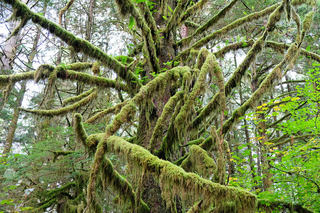
Kennedy Falls and the Big Cedar Tree, North Vancouver
Kennedy Falls is a very picturesque series of cascades, still it’s not too well-known. The rugged trail takes you through lush forest, with lots of large roots and creek crossings (wear waterproof hiking boots!), passing another impressive attraction on the way: the 600-year-old Big Cedar Tree.

this is not the Big Cedar Tree, but remnant of another giant
You’ll have dense forest to cover you (because most days in this season are rainy), and the trail is usually extremely muddy in the winter months. Embrace it, you have no other choice (other than staying at home). Once you reach the creek at the end, walk a bit upstream for the best waterfall views – and prepare to get wet from the spray.
- Trailhead & parking: Mountain Highway parking (dirt parking lot at the very end of Mountain Highway)
- Length: 9.6 km return
- See the trail map here!
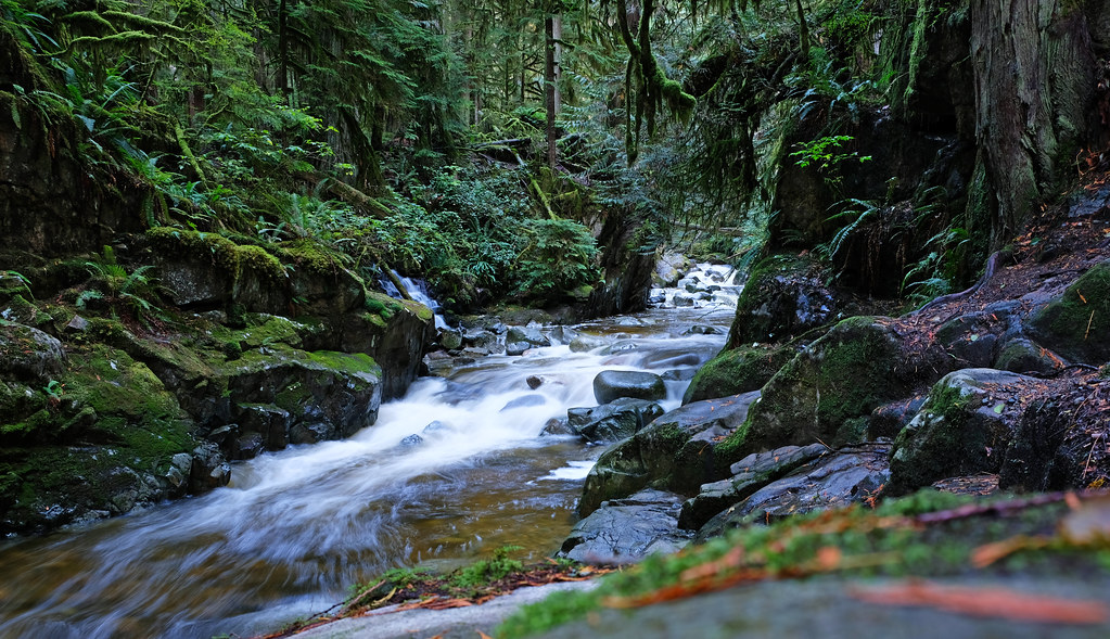
Two Canyon Loop, Lower Seymour Conservation Reserve, North Vancouver

Two rushing, beautiful mountain rivers, four bridges (two of which are suspension bridges), several waterfalls, fairy tale rainforest – this is what the Two Canyon Loop offers for very little effort. The loop is a bit more than 8 km, and even though it has uphills and downhills, some sections are almost flat or slightly ascending (descending). It’s also very well-marked and well-frequented, with several information boards and proper signage on the way.
You can start it from different points of the loop, but Rice Lake parking lot is where you probably have the best chance to actually find parking. Then you can choose which canyon to start with. Homestead Trail takes you to the Seymour Canyon, this is a particularly photogenic piece of the rainforest, then Fisherman’s Trail North is an almost flat gravel path that runs along the Seymour River, with several short detours to viewpoints. You cross Seymour River Suspension Bridge to continue on Fisherman’s Trail South, which later connects to Baden Powell Trail through another bridge, and the Baden Powell Trail takes you to Lynn Canyon, its suspension bridge, crystal clear, emerald pools and waterfalls.

This section of the trail is almost the same that’s covered in the Lynn Canyon Loop. Not that Lynn Canyon can’t be enjoyed several times in any season, but if you have to choose, the Two Canyon Loop obviously offers more sights than the Lynn Canyon Loop. You can easily lengthen it a bit to include Rice Lake, as well.
- Trailhead & parking: Rice Lake parking lot
- Length: 8.7 km loop
- See the trail map here!
Circuit 8 Trail, Lower Seymour Conservation Reserve, North Vancouver

This trail doesn’t include the typical famous attractions of this area, and that’s exactly what we like about it: it’s a lovely rainforest trail, without too many people and with a nice view of Rice Lake. Another iconic spot is this tree in the picture which is also a tunnel. You can combine this peaceful trail with a hike to either Seymour or Lynn Canyon.
- Trailhead & parking: Rice Lake parking lot
- Length: 5.5 km loop
- See the trail map here!
Whyte Lake via Nelson Creek, West Vancouver

Unlike what you’d expect, the highlight on this trail is not Whyte Lake, but the rest of the trail that leads you along a crystal clear creek and through spectacular old-growth temperate rainforest. Of course, Whyte Lake is nice, too. Several trails give access to it, but this is the most spectacular, following the Trans Canada Trail along Nelson Creek and Whyte Creek. Read the detailed trail description here!
Cypress Falls Trail, West Vancouver
Cypress Falls Park is a short detour from the Sea to Sky Highway, so it’s a nice stop for anyone driving towards Squamish or Whistler, but also for those looking for a small and pretty park in West Vancouver.
Despite its small size, Cypress Falls Park has two waterfalls, three waterfall viewpoints and a dramatic canyon, all surrounded by lush green rainforest. The Lower Cypress Falls viewpoint is a short walk from the parking lot, but it’s worth continuing up along Cypress Creek to the first and the second viewpoints of Upper Cypress Falls which is even more impressive.
This elevation rarely gets snow, but the trails can be icy, so microspikes are highly recommended in the winter months, especially between Lower and Upper Cypress Falls.
- Trailhead & parking: Cypress Falls Park parking area at Woodgreen Place
- Length: 2.8 km return
- See the trail map here!
Lighthouse Park trails, West Vancouver
Lighthouse Park is one of the best coastal parks in Vancouver, with short and easy trails. They run mostly through evergreen forest, occasionally ending up at rocky bluffs which are perfect viewpoints over the water and great for spotting seals or even migrating whales.
There’s little elevation gain on these trails and overall, the trail network is about 6 kilometers. Our favorite scenic loop for short hikes are the Juniper Loop & Juniper Point (1.2 km loop) and the Shore Pine Trail-Seven Sisters Trail (2.1 km loop). It’s worth taking the steep, but short detour on West Beach Trail, not because of the beach, but because of the views of the (otherwise inaccessible) lighthouse from the rocks.
- Trailhead & parking: Lighthouse Park parking in Beacon Lane
- Length: it’s about 6 km to hike all around the park
Jug Island Trail, Belcarra Regional Park, Belcarra

Belcarra Regional Park is another coastal park with lovely, short trails which are snow-free all year. One of them is Jug Island Trail that runs through temperate rainforest and ends at a secluded rocky beach that overlooks Jug Island and the surrounding mountains.
There’s a few hundred meters elevation gain, some steep uphills and downhills, some stairs and big roots, but it’s still a very easy and enjoyable trail. It might not get snow, but it gets extremely muddy in the rainy winter months, so definitely wear waterproof hiking boots.
Jug Island is not accessible to most people. Even though it’s not far by any means, and you could easily swim there, I wouldn’t rush swimming in that ice cold water about 360 days of the year. 🙂 Your other option is kayaking, but in that case you’re unlikely to hike the Jug Island Trail. So most probably you’ll find a comfortable driftwood to sit on and enjoy the view of Jug Island at the end of the trail.
- Trailhead & parking: Belcarra Picnic Area (paid parking in the summer season)
- Length: 4.8 km return
- See the trail map here!
Woodhaven Swamp & Sasamat Lake, Belcarra Regional Park
This loop is a combination of two short trails that you can even do separately: Woodhaven Swamp and Sasamat Lake loop. Both have fairy tale rainforests with dense moss covering the rocks and trees so that you feel like walking in a large, quiet, green cathedral. Misty-foggy days of the colder months add a special vibe to it.

On the Woodhaven Swamp loop, you get some views of the swamp, but you’re mostly in the forest (and you won’t be able to resist photographing moss, lichen and mushrooms, tons of them). The Woodhaven Swamp-Sasamat Lake Connector Trail is a spectacular stretch of rainforest, then you can walk around on the shore of Sasamat Lake. This loop runs directly on the lakeshore for the most part, offering lake views and water access points quite often. There are boardwalks that let you walk over the water, and a floating bridge that takes you across the lake, offering pretty mountain views in the distance.

Majority of the loop is in dense forest which gives shade in summer and some protection from the rain on wet days. It rarely gets any snow, but those days are magical. Any trails likely remain accessible, but microspikes are recommended.
- Trailhead & parking: Woodhaven Swamp parking lot or White Pine Beach parking lot (paid parking in the summer season)
- Length: 8.6 km loop
- See the trail map here!
Buntzen Lake Loop, Buntzen Lake Recreational Area

Buntzen Lake is a 4.8 km long lake, named after Johannes Buntzen, the first general manager of the B.C. Electric Co., and today it’s managed by BC Hydro as a recreation site. The easiest – though not short – trail here is the loop around Buntzen Lake. It runs directly on the lakeshore, but goes deeper into the forest from time to time. There are several water access points and platforms with wonderful, unobstructed views.
- Trailhead & parking: Buntzen Lake Recreation Area parking lot
- Length: 10.5 km loop
- See the trail map here!
Diez Vistas & Buntzen Lake, Buntzen Lake Recreational Area

If you’re looking for more challenges and more scenic views, the Diez Vistas – Buntzen Lake Trail could be an ideal day hike option even for the shorter daylight hours (but check when the gate closure is, it’s quite early in winter time). Ocean, lake and mountain views – you get all on this 15 km loop.
Diez Vistas is named after the stunning views of Indian Arm and Deep Cove – which I have to admit I’ve never seen. Cloudy, foggy days can block the views, and they’re especially common in the colder months. Old-growth forest still looks good, maybe even more on a misty day. You might even find some snow at higher elevation on the Diez Vistas, so have your microspikes ready in winter.
After hiking along the ridge with several viewpoints on the Diez Vistas Trail, you get down to the lakeshore. You can choose either the east or west shore – we chose the west, because currently the eastern shore can’t be accessed due to the closure of the suspension bridge in the north.
The lakeshore hike is just as scenic and much easier, with less elevation gain than Diez Vistas – which often gets quite steep. Well, you have to get high enough for the views. All in all, any hiker with enough stamina will enjoy this adventurous trail with the beautiful views.
- Trailhead & parking: Buntzen Lake Recreation Area parking lot
- Length: 15 km loop
- See the trail map here!
Low Knoll & High Knoll, Minnekhada Regional Park, Coquitlam

Minnekhada Regional Park on the outskirts of Coquitlam offers hills, dense forest, marshes, rich bird life and elevated rocky viewpoints with mountain views.
Most trails are short and easy, and the best viewpoints are Low Knoll and High Knoll. Both offer similar views of the marshland below from the rocky bluffs, and both require conquering short, but steep uphills on rougher terrain with roots and rocks in the last stretch before the viewpoint.
A scenic and almost flat trail runs around the two marshes that look like small lakes when they have enough water. It’s great for bird watching, too. You can combine this walk with the climb to Low Knoll and High Knoll to get a varied, interesting half day hike.
Note: Minnekhada Regional Park is partially closed due to wildfire damage in Sept 2022. Access to Mid-Marsh Trail, High Knoll and Low Knoll is not possible until further notice. More info here.
- Trailhead & parking: Minnekhada Regional Park parking area, off of Quarry Road
- Length: 5.7 km loop
- See the trail map here!
Sawblade Falls & Coquitlam Lake Viewpoint, Pinecone Burke Provincial Park, Coquitlam
Pinecone Burke Provincial Park is a gem, and this hike takes you through beautiful pine forest, passing several waterfalls on the way and ending at Coquitlam Lake Viewpoint which treats you with pretty views of the mentioned lake far below you.
The terrain is varied, part of it is easy, occasionally on gravel roads, but other sections are steep scrambles in the woods. There are three rivers to cross, and the very last section before the Coquitlam Lake Viewpoint is the toughest and requires a steep scramble, occasionally using your hands, too. This last stretch of the trail might be closed in the winter months, and you better have microspikes when tackling it in spring, but the trail to Sawblade Falls is enjoyable year-round.

Sawblade Falls is not too tall, but a rushing, scenic waterfall, surrounded by lush greenery. The best time to see it is the rainy part of the year, and especially early spring when it’s very impressive due to all the melting snow. The flow is barely more than a trickle by the end of summer. Since several trails take you to Sawblade Falls, you don’t have to get there and back on the same way, you can complete one direction on the Upper Loop, the other on the Lower Loop.
Note: this trail runs close to a hunting club, so the sounds of gunshots can be heard during the first few kilometers.
- Trailhead & parking: Coquitlam Lake View Trailhead
- Length: 11.7 km loop
- See the trail map here!
Byrne Creek Ravine Loop Trail, Burnaby

Burnaby doesn’t have mountains, but it still has quite some lovely parks and trails. Deer Lake and Burnaby Lake are often mentioned (and we’ve written about both, several times), so now I brought one which is lesser-known and unique.
Hiking in the Byrne Creek Ravine feels like a getaway into the wilderness: dense forest, a steep ravine and a rushing creek. But it’s surrounded by residential neighborhoods, and is easy to access and explore.
You can join the loop trail from several of the surrounding streets, but Ron McLean Park is the most straightforward starting point. It has a playground with slides, climbing and spinning structures and a truck, and also a wading pool in the summer. The Byrne Creek is a nice shaded hike in the summer, but it’s just as lovely in the winter months, too, when the creek is the most powerful.
- Trailhead & parking: Ron McLean Park parking lot (or street parking)
- Length: 3.4 km loop
- See the trail map here!
West Dyke Trail, Richmond
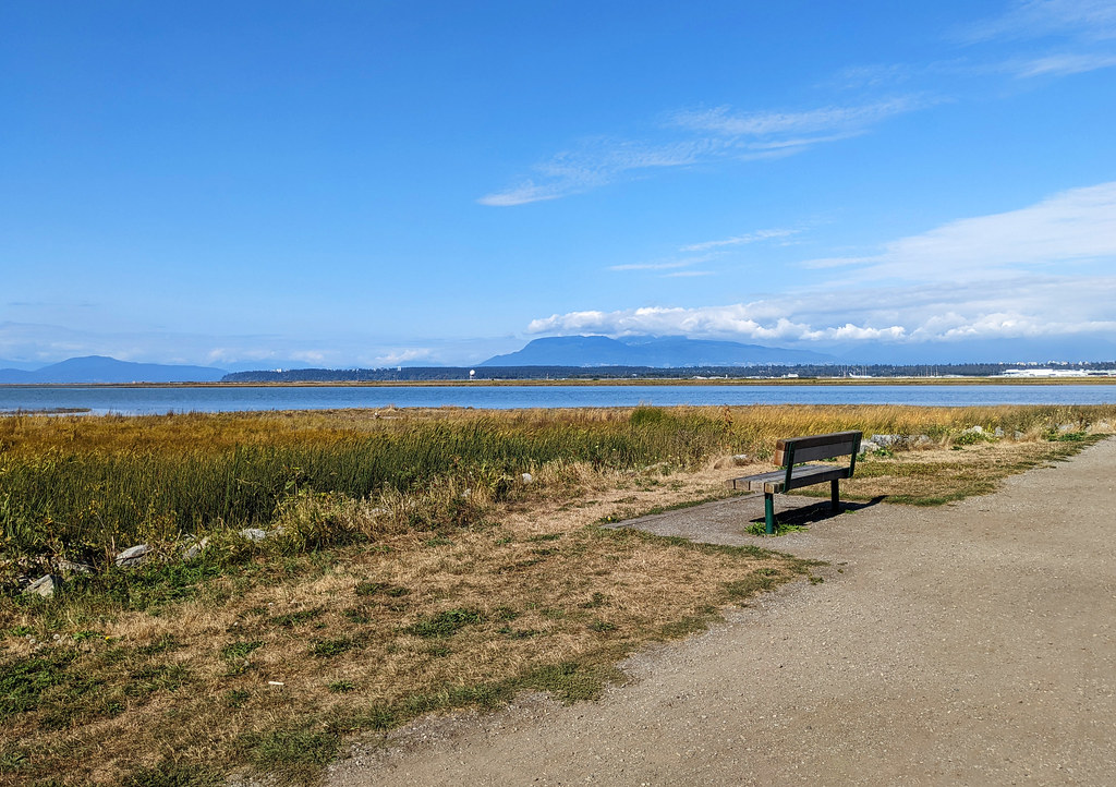
this picture was taken at the end of summer, the landscape is much more green once the fall and winter rains arrive
West Dyke Trail is a long, flat, gravel waterfront path in Richmond, with views of the Salish Sea and the salty marshlands along the coast. These views are significantly different at low or high tide, because the tidal zone becomes a muddy marshland at low tide.
West Dyke Trail doesn’t offer such impressive ocean views from high ground as the trails of Lighthouse Park or Belcarra Regional Park, but it’s very easy terrain year-round, suitable for bikes and strollers, as well. Also, it has rich foreshore ecosystems and offers good opportunities for bird-watching.
West Dyke Trail starts at the Terra Nova Adventure Park and ends in Garry Point Park in the south. It’s a there-and-back route, so you can make it as long or as short as you like.
No special winter gear is needed on this trail any time of the year, but winds can be strong in the winter, so warm clothes, layers and a good (waterproof) jacket comes handy.
- Trailhead & parking: Terra Nova Rural Park parking lot (at the end of River Road)
- Length: 10.5 km return
- See the trail map here!
Tunnel Bluffs, Lions Bay

If you’re looking for a relatively easy half day hike that leads up to fabulous views of Howe Sound, Bowen Island and the Sunshine Coast and can be completed any time of the year, Tunnel Bluffs is for you! We particularly love the winter season here, because it’s not as crowded as summer, and it’s possible to find parking even if you don’t arrive at 5 am.
Read our detailed guide about hiking to Tunnel Bluffs from Lions Bay here!
Katzie Marsh Loop, Pitt-Addington Marsh Wildlife Management Area

The Katzie Marsh Loop trail is a flat walk through a marshland, but we’ve never expected any marsh to be that beautiful! It’s surrounded by mountains, and the peaks perfectly reflect in the ponds of the marshland in calm weather.
The Pitt-Addington Marsh has incredibly rich wildlife, with over 200 species of birds, otters, bears, mule deer and coyotes. You can often spot hawks, eagles and ospreys hunting. There are two wooden viewing towers.

We started the loop clockwise, but the counterclockwise route is even better, facing the mountain views for the most part. If you start clockwise, the first third of the loop is a wide, flat pathway, suitable for bikes and strollers, too, then the path gets narrower as it turns south. The last stretch (after the second viewing tower) is very narrow and a bit overgrown, it has less views than the rest of the trail. Overall, it’s an easy loop, and you get excellent mountain views – without climbing any mountain. 🙂
It’s usually snow-free in the winter, but the surrounding mountains are covered by powdery snow which makes for even more fabulous reflections.
- Trailhead & parking: parking lot at the end of Rannie Road (in the Pitt-Addington Marsh Wildlife Management Area)
- Length: 6.9 km loop
- See the trail map here!
Gold Creek Falls, Golden Ears Provincial Park
Golden Ears Provincial Park is a popular one, and the trail to Lower Gold Creek Falls is the most popular hike there. It’s stunning, both the waterfall and the old-growth rainforest, and the trail is also short and easy, rather a casual forest stroll than a real hike.
It’s accessible and usually snow-free all year (which doesn’t apply to many trails in Golden Ears Provincial Park), but it offers nice views of surrounding (snow-capped) mountain peaks. Even if there’s some snow, the trail is manageable with microspikes. The colder part of the year has the advantage of less people on the trail. Also, a free day permit is required for parking in the summer season. (Find more info on day use passes here.)
Lower Gold Creek Falls is not particularly high, but a powerful, roaring waterfall. The two viewpoints are both wonderful, but you better have your waterproof jacket on so that the spray won’t soak you. The trail there is one of the nicest rainforest walks in Greater Vancouver, with occasional access to the creek.
The round-trip is a bit more than 5 kilometers, well-maintained and the elevation gain is minimal, making it a popular trail for families. If you’d prefer a loop hike, you can return on East Canyon Trail.

- Trailhead & parking: Gold Creek Parking (free, but day permit might be required)
- Length: 5.5 km return
- See the trail map here!
East & West Canyon Loop, Golden Ears Provincial Park
The Lower Gold Creek Falls hike is an easy trail that only takes a few hours. If you’re looking for a more challenging full day hike which continues to impress you all the way, follow the East Canyon Trail from the waterfall viewpoint, then cross the bridge over Gold Creek, and return to the parking lot on the West Canyon Trail.
There are two detours to two more waterfall viewpoints on this route. The Upper Gold Creek Falls lookout is a detour from East Canyon Trail, but it’s not nearly as impressive as the Lower Gold Creek Falls. The third waterfall viewpoint for the lower falls (in addition to those two mentioned in the section above) is a short, very steep(!) detour from the West Canyon Trail. It might not be worth the effort, because the views are not better than from the other viewpoints. But it gives a different perspective, and in case the two previous viewpoints are crowded, you can enjoy some solitude here.
But the attractions of this trail are not only the waterfalls. East Canyon and West Canyon are both spectacular, especially the more dramatic West Canyon with viewpoints overlooking the river (and with a more rugged trail). You find tiny stream crossings along the route in both canyons, and the rainforest is very pretty. It feels like these giant trees are talking to you.

It might be accessible all year, but it gets snowy and icy, and we definitely don’t recommend venturing past Lower Gold Creek Falls without microspikes. You need that extra stability on the steep canyon trails, especially on West Canyon Trail. If ice is not an issue, then be prepared for muddy trails. Waterproof boots are a must here all year.
- Trailhead & parking: Gold Creek Parking (free, but day permit might be required)
- Length: 11.7 km loop
- See the trail map here!
Steelhead Falls, Mission
Steelhead Falls is not the tallest, nor the most well-known waterfall near Vancouver. But it’s one of our favorites, and a great, short, not too busy trail for any season. The forest trail is among the scenic ones, with mossy trees, hanging lichen and lovely little bridges over rushing streams.
Steelhead Falls is also very picturesque, surrounded by lush greenery. It’s just off the Hayward Reservoir Trail, and the hiking trail starts from a paved parking area off Dewdney Trunk Road.
The trail is slightly and steadily descending (or ascending on your way back), and the turnoff for Steelhead Falls is well-marked. There are two waterfall viewpoints close to each other, the upper one is without a fence, the lower one is a safe wooden platform with a fence and a bench. Both offer similarly beautiful views.
If you want to hike more, the trail to Rolley Falls is just 10 minutes drive from the Steelhead Falls trailhead.
- Trailhead & parking: small, free parking lot just off Dewdney Trunk Road
- Length: ~2 km return
- See the trail map here!
Rolley Lake & Falls Loop, Mission
Rolley Lake is one of the warmest lakes where you can swim near Vancouver in the summer. For the rest of the year, the loop trail around Rolley Lake and the smaller loop that passes Rolley Falls offer an easy, lovely hiking opportunity.
The lakeshore loop is almost completely flat, sometimes it runs directly by the water, sometimes deeper in the forest. The smaller loop that joins the northern tip of Rolley Lake adds some elevation and has some stepper sections with roots and rocks. Honestly, Rolley Falls is nice, but the views are obstructed by the trees, and you find countless more impressive waterfall views in the area. But the creek is powerful in the rainy season, and Rolley Lake is beautiful, especially in calm weather when it reflects the pine trees on the lakeshore.

Snow is rare, but expect lots of mud on this trail.
- Trailhead & parking: Rolley Lake Provincial Park
- Length: 5 km loop
- See the trail map here!
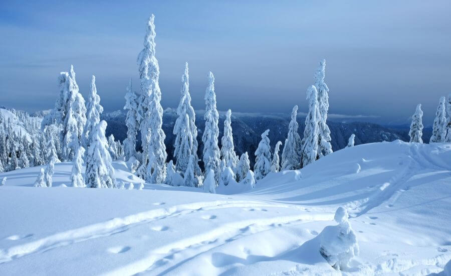
Best snowy winter hikes near Vancouver
When I say winter hikes, do you think of snowy hikes? Well, if you’ve started reading this post to find snowy winter hikes in Vancouver, this is the section for you.

The best and closest place to go is the North Shore mountains: Cypress Mountain, Mount Seymour and Grouse Mountain. They all have their own ski resorts, and also dedicated winter hiking trails. Microspikes are recommended when going for a hike between November and May/June, and unless it’s snowing heavily, they’re usually sufficient. The winter trails in the North Shore mountains are well-trafficked, so you’ll likely hike on packed snow. Snowshoes might be needed when a huge amount of fresh snow falls though.
TOP 3 snow hikes in Vancouver:
- Pump Peak, Mount Seymour Provincial Park
- Eagle Bluffs via Black Mountain, Cypress Provincial Park
- Brothers Creek & Lost Lake Loop
Yew Lake & Bowen Lookout, Cypress Provincial Park
This is not the most spectacular, but probably the easiest winter trail (and summer trail, too). It starts from the Eagle Express chair lift, winds through the forest, along Yew Lake (which is likely frozen and under snow), and after a steady climb it ends at Bowen Lookout. The lookout offers some nice views of Howe Sound. It’s not the most impressive, but the most easily reachable Howe Sound viewpoint in Cypress Provincial Park.
This trail leads to the St. Mark’s Summit if you continue further, but this is not recommended in the winter as the trail is not maintained. Until Bowen Lookout, it’s usually very busy, and you’ll share the viewing area with many people on any clear winter day.

Parking is a bit tricky in Cypress Provincial Park in the winter season, when the ski resort is in operation. The only free parking lot that can be used by hikers and snowshoers is 3B lot, which is before the gate and adds another kilometer to any hike that starts at Cypress Mountain Lodge or Black Mountain Lodge.
You also need to get a (free) disclaimer sticker and put it on your jacket or backpack. It roughly means that no one will be responsible if you die while hiking. Or maybe not exactly this. But we were not raised in North America and don’t know much about these liability issues – and we’re not too curious to dig deeper either. Nevertheless you need that sticker, because employees of the ski resort won’t let you pass otherwise. You can get it at the Black Mountain Lodge.
- Trailhead & parking: Cypress Provincial Park (3B lot is the only one that’s free for hikers when the ski resort is in operation)
- Length: 5 km return
- See the trail map here!
Eagle Bluffs via Black Mountain, Cypress Provincial Park

Compared to the Bowen Lookout hike, this one is not easy. But if you’d like to hike to one of the truly impressive viewpoints in the North Shore Mountains, this is still your easiest option. Eagleridge Bluffs via Black Mountain Trail is a year-round trail, but it’s the most magical when it turns into a winter wonderland.
The route passes five small lakes which you can’t see when everything is covered by snow. But you can enjoy the view of the snowy pine trees. Eagleridge Bluffs has amazing views of Metro Vancouver, Horseshoe Bay and partly of Howe Sound.

lake view in winter: Cabin Lake
The hardest section is at the very beginning as you hike up on steep switchbacks along the ski slopes of Cypress Mountain Resort. After this, the trail is a series of gentle ups and downs as you get to the peak of Black Mountain (the first view, though partly obstructed), then to the Eagleridge Bluffs.
As we’ve already written about it in detail at the Bowen Lookout hike, park in 3B lot and get your disclaimer sticker at Black Mountain Lodge.
- Trailhead & parking: Cypress Provincial Park (3B lot is the only one that’s free for hikers when the ski resort is in operation)
- Length: 8.6 km loop
- See the trail map here!
Hollyburn Peak Winter Route, Cypress Provincial Park

This snowshoe trail to Hollyburn Peak is often suitable to do even without snowshoes, only with microspikes, because the snow is usually packed enough due to frequent traffic. It’s a fairly steep trail that will warm you up, especially the last stretch which is a steep ascent where hiking sticks come handy. But you get nice views on the way and at the top of Hollyburn Mountain – well, in case it’s a clear day which is never straightforward in the winter months.
Some portions of this trail cross with cross-country ski trails in winter, so be careful. Otherwise it’s definitely a winter route, not very enjoyable and quite overgrown in the summer. The summer trail to Hollyburn Peak starts from the Cypress Mountain downhill parking lot.
- Trailhead & parking: Cypress Mountain Hollyburn Nordic Area (hikers have separate parking when the ski resort is in operation)
- Length: 8 km return
- See the trail map here!
Dog Mountain Trail, Mount Seymour Provincial Park
Dog Mountain Trail is one of the most popular short Vancouver hikes all year, and it’s just as busy in winter as in summer. It’ll likely be everyone’s first snowy hike or snowshoe trail, and it’s ideal for that. It has a bit of elevation gain (about 200 m), but just enough to make you feel like being on a mountain trail. It runs through a nice pine forest and ends at a panoramic view over Metro Vancouver.
I have to admit that we like any other trail on Mount Seymour better, because they’re less busy and just as pretty – or even prettier, like the astonishing 360 degrees panorama from Pump Peak. However, Dog Mountain is surely short and easy enough to be suitable for anyone. Due to the heavy traffic, the snow is packed here, so microspikes are sufficient.
During the winter months when the ski resort is in operation, there’s dedicated parking for hikers (P4 parking lot), and you might need a free day pass to visit.
- Trailhead & parking: Mount Seymour Provincial Park parking lot (P4 lot can be used by hikers in winter)
- Length: 5.2 km return
- See the trail map here!
Pump Peak (First Peak), Mount Seymour Provincial Park

Our absolute favorite panoramic mountain hike in Mount Seymour Provincial Park is hiking to the three peaks of Mount Seymour. Or only to the first one, Pump Peak, in the winter (it’s not safe for hikers to venture further than Pump Peak).
Surprisingly, the trail to Pump Peak is easier to do in the snow, because it makes the otherwise rough trail (with lots of roots and rocks) more even. The steepest section of the trail is the final ascent to the summit. At least on your descent you have the advantage of cautiously coming down on your butt in winter.

The view from the top is unforgettable: a 360 degrees panorama of the surrounding mountains and Metro Vancouver. It’s challenging to count the mountain peaks, because you can see so many!
Not as busy as Dog Mountain Trail, it’s still well trafficked, so snowshoes are likely not required, only microspikes. However, you’ll pass through avalanche terrain towards the end of the trail, so please check the avalanche ratings before heading to Pump Peak.

Dog Mountain or Pump Peak? The latter is slightly longer and more challenging, but offers 360 degrees panorama and more unobstructed views.
- Trailhead & parking: Mount Seymour Provincial Park parking lot (P4 lot can be used by hikers in winter)
- Length: 7 km return
- See the trail map here!
Mount Fromme via St Georges Trail, North Vancouver

A lovely winter hike on Grouse Mountain that doesn’t require a cable car is the trail to Mount Fromme from the end of Saint Georges Avenue in North Vancouver. This quiet residential neighborhood never gets too busy, and you easily find street parking (there’s no dedicated parking lot).
The trail to Mount Fromme is about 10 km out and back, with 884 meters elevation gain. It’s not particularly easy, mostly steadily uphill all the way – steep or steeper. The beginning is steeper, with large roots and rough terrain, then comes an easy-moderate section, and it gets steeper again in the last kilometer or so. It runs in the forest, under giant evergreen trees, and you only get a view when you reach the summit.

But there you can enjoy views of several peaks, like the Colosseum, the North and South Needles, Lynn Peak and Seymour Peak. However, hike further than the marker, because that’s not the end of the trail, and the actual viewpoint is a but further. It’s even easier to get confused when there’s deep snow at the top (from late November until late spring), so have an offline map.
Whether microspikes are enough or you need snowshoes depends on the actual snow conditions. I did it with microspikes in early spring, and it was fine for the most part, but I sank knee-deep into the snow sometimes. The trail gets some traffic, but not nearly as much as Dog Mountain Trail or the other snowy hikes on Cypress Mountain, so the snow might be deep.
- Trailhead & parking: end of Saint Georges Avenue (street parking available)
- Length: 10 km return
- See the trail map here!
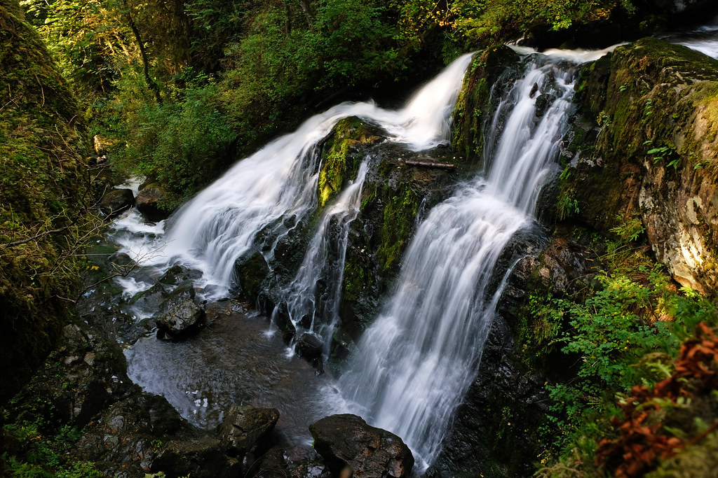
Brothers Creek & Lost Lake Loop, West Vancouver
This hike runs in a forest of giant Western Red Cedar trees and follows a portion of Brother’s Creek coming down from Cypress Mountain, with many small waterfalls and surprisingly impressive Brother’s Creek Waterfall at the first bridge. Surprisingly impressive considering the fact you can never find this waterfall ever mentioned in any article that’s about waterfalls in the Vancouver area. Certainly, it’s not the largest or most powerful, but it’s worthy to remember:

The trail is enjoyable year-round, and can turn into a magical winter wonderland after heavy snow. The lower section of it might be snow-free for most part of the year, but as you hike further, you might need microspikes or even snowshoes.
The trail crosses Brother’s Creek two times along the way, on two bridges. You get the best view of Brother’s Creek Waterfall from the first bridge. There was a third bridge in the middle section of the trail, but it has been removed, so you need to hike to the next bridge and make a larger loop. From there you can also hike to Lost Lake.
The trail climbs at a fairly moderate gradient along the creek. It’s well-trafficked until the destroyed bridge, but rarely traveled and more rugged after that, with some tricky creek crossings. You can extend the loop to 8.5 km and include Blue Gentian Lake, however, it’s a rough and not well-marked trail, so have an offline map.
- Trailhead & parking: Brother’s Creek Trailhead (off Millstream Road)
- Length: 7 km loop
- See the trail map here!
What to wear hiking in the winter?
Dress in layers:
- synthetic or wool base layer (for men, for women)
- insulating midlayer (for men, for women)
- outer layer to protect you from wind, rain and snow (for men, for women): no need for an insulated jacket for day hikes near Vancouver, as you’ll get easily overheated in ski jackets; just make sure it’s waterproof
- hiking pants (for men, for women)
- optionally, rain pants: they should be worn over your hiking pants in wet conditions, or simply to shield you from the wind and add an extra layer
- waterproof hiking boots (for men, for women) or snow boots
Cover as much of your skin as possible:
- gloves
- wool socks
- gaiters: keep the snow out of your boots when hiking in deep snow
- beanie
- face mask or neck gaiter
Stay safe:
- microspikes: they make hiking on icy, snowy terrain easier and safer
- headlamp: days are shorter in the winter, and you don’t want to get lost in the dark
- emergency blanket
Vancouver winter hiking tips

The snow-free hikes on this list are all at low elevation which means they’ll actually be snow-free on all but the coldest days. However, they can be icy, and they can get the occasional snow, so microspikes are recommended to keep you safe on those slippery, icy, snowy days. Trekking poles give extra support and safety, as well.
The snowy Vancouver hikes are at higher elevation, but we chose trails that are safe and enjoyable to do in the snow. However, please check weather conditions and avalanche reports as harsh conditions can make any trail unsafe. Also, snowshoes might be required after heavy snowfall on these trails.

Winter days are short, it gets dark early. Start early and have a flashlight or headlamp on every hike, just in case.
Bring waterproof and warm clothing (and spare clothing). Wear good – sturdy, warm and waterproof – hiking boots.
Make sure a friend or family member knows about your planned route before you venture out.
Looking for more winter things to do in and near Vancouver? Check out these articles:
- 22 Delightful Things To Do In Vancouver In Winter
- 5 Great Things To Do At Green Lake, Whistler
- 32 Best Easy Hikes In Vancouver
- 23 Best Things To Do In Whistler In Winter