Living in Metro Vancouver, taking a hike in Squamish is among our favorite things to do on any weekend that has acceptable weather. We’ve already done tons of hikes, and in this post we put together the very best hikes in Squamish for you. They are grouped by difficulty, we start with the easy ones, and you find more challenging ones as you read further. No doubt that any nature lover can find a suitable trail in the area.
We’ve written this article based on our personal experience. There are a few hikes that we haven’t done yet, we indicated those, but still decided to include them to make the list complete.
DO YOU NEED A CAR FOR YOUR ROAD TRIP? SEARCH, COMPARE AND SAVE:
Discover Cars is one of the world’s largest online car rental platforms with vehicles in 10,000+ locations. Compare the best rates here.
When is the best time to hike in Squamish?

You can find a great trail any time of the year. Squamish is surrounded by mountains, but it sits on the ocean coast. It means that the low elevation trails are usually snow-free all year, while trails at higher elevations are accessible between early spring/early summer and mid-fall/late fall. Some trails can be done even in the winter, preferably with microspikes.
We included the recommended hiking season for each trail in this post. You can also check trail reports and the latest comments on AllTrails to get info about the most recent trail conditions.

Looking for more outdoor adventures in BC? Check out these posts:
Best easy hikes in Squamish
Here are all the best easy Squamish hiking trails, some of them are rather short and easy walks. They are perfect trails for beginners, or to do with small kids, even with toddlers.
What does easy actually mean? Length is a factor, but not the only one. Most trails in this collection are short, but not all. Elevation gain matters just as much. I consider a 10 km trail with only 300 meters elevation gain easy, because it consists of flat and mild uphill/downhill sections. A 2 km trail with 200 meters elevation gain wouldn’t be easy though. But the short trails in this list usually have less than 50 meters elevation gain.
Shannon Falls Lookout

The 335 meters high Shannon Falls is the third highest waterfall in British Columbia (ranking after 481 meters high Della Falls in Strathcona Provincial Park and 396 meters Hunlen Falls in Tweedsmuir Provincial Park). Only a short walk is required from the parking lot to the two viewing platforms to marvel at this beauty, and half of the loop is even wheelchair accessible.
All in all, it’s very rewarding, not really a hike, but one of the best Squamish walks, and a popular stop if you drive the Sea to Sky Highway from Vancouver to Whistler. This area is snow-free most of the year, but we visited it even in January when there was snow on the trail, and it was fine with a pair of microspikes. Shannon Falls is wonderful either way: surrounded by lush greenery or sparkling white snow.
- Trailhead: Shannon Falls Provincial Park parking lot, just off of the Sea to Sky Highway
- Length: 900 m loop
- Elevation gain: 39 m
- Hiking season: all year
- See the trail map here!
Browning Lake Loop, Murrin Provincial Park

Here’s another easy walk: the almost flat Murrin Park loop trail around Browning Lake. This small lake is located south of Squamish, right by the Sea to Sky Highway, and you can casually walk around it in half an hour. Half of the loop is along the highway which makes it less peaceful, but there’s a solid fence, so no worries if you do it with kids, they can’t just jump on the road.
There are several picnic tables on the lakeshore, and Browning Lake gets warm enough for a pleasant swim in the summer. It’s also super popular in the summer months, so either visit it in the off season, or arrive very early in the morning (around 7 am). This hike would be doable all year, but the parking lot is usually closed for the winter months, and parking along the highway is not allowed.
We combined it with the Jurassic Ridge Trail which makes it truly spectacular and doesn’t add too much length, but adds difficulty. Scroll further to find it below the medium difficulty trails.
- Trailhead: Murrin Provincial Park parking lot, on the west side of the Sea to Sky Highway
- Length: 1 km loop
- Elevation gain: 6 m
- Hiking season: March – November
- See the trail map here!
Cat Lake Loop

Cat Lake is one of the best hikes near Squamish to be combined with swimming in the summer. It’s not an alpine lake, so it has quite a pleasant water temperature by late summer, and there are some docks where you can jump in, because otherwise the lakeshore is very steep.
We walked the short and almost flat loop trail around Cat Lake to find the best swimming and picnic spots, and it’s worth chilling out for a full day in nice weather. There’s also a campground around the lake, with outhouses, which can make it a noisy place on summer weekends.

Cat Lake is north of Squamish, about 2 km up on a logging road. It’s bumpy and has quite some potholes, but doable with a 2WD, just take it sloooow. There’s plenty of parking, and if you can’t find a spot at Browning Lake, this can be your backup. We actually prefer Cat Lake. 🙂
- Trailhead: parking lot at the end of Cat Lake Road
- Length: 1.6 km loop
- Elevation gain: 35 m
- Hiking season: March – November
- See the trail map here!
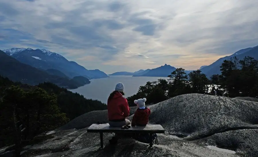
The Panorama Trail
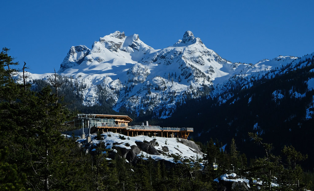
This trail is short and easy given that you start it at the top of the Sea to Sky Gondola. You either pay for the ride, or hike up on the Sea to Summit Trail – the latter is a challenging full day hike.
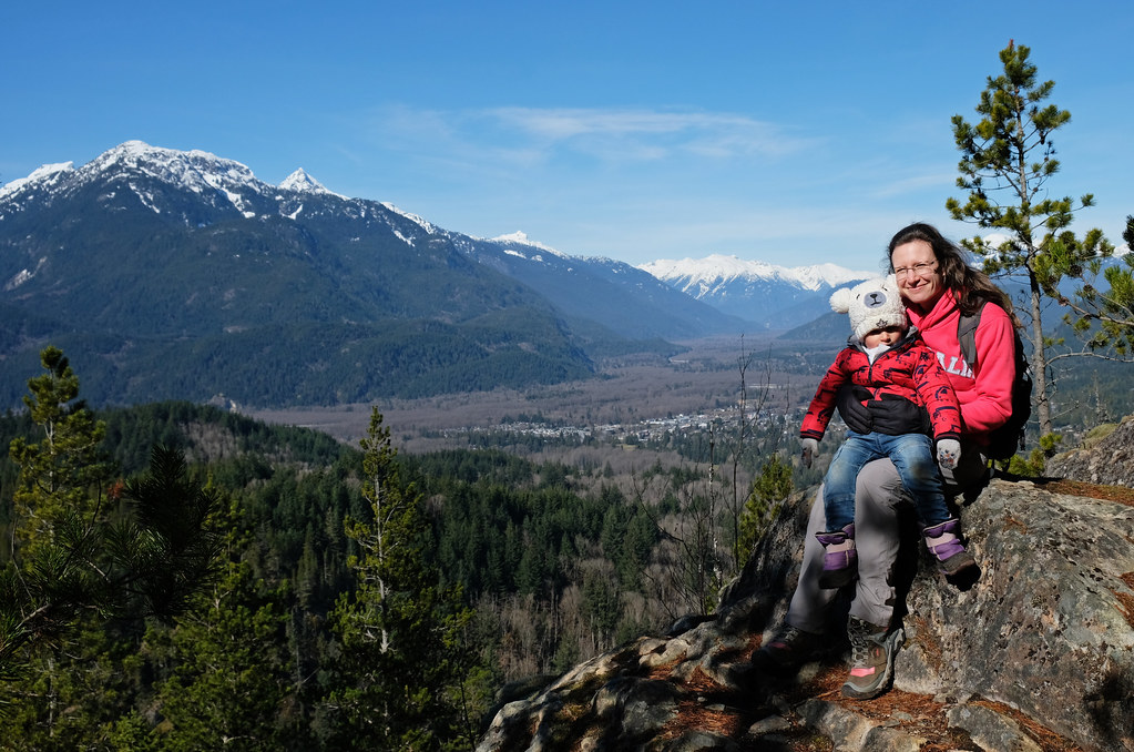
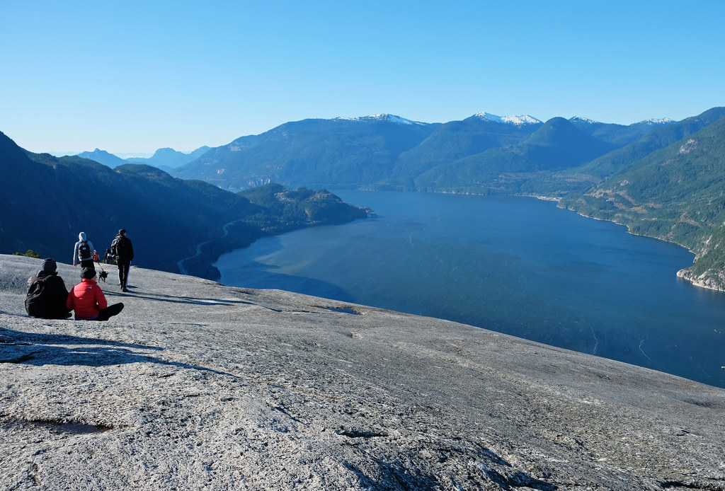
Several shorter trails start at the top of the gondola, but the Panorama Trail is the most scenic. It’s a loop, but short detours lead to four beautiful viewpoints on the way. The elevation gain is minimal, kids and elderly people can also complete it, and the views are outstanding, because you’re at high elevation.
You can do it year-round, but this trail is NOT snow-free in the winter months (roughly from November to April). We did it in March, and it was a snowy wonderland! We actually think the views here are the best when the surrounding mountains are all snow-capped. The snow on the trail is usually packed, because it’s a busy route. No need for snowshoes, but we used microspikes.
- Trailhead: top of the Sea to Sky Gondola
- Length: 2 km loop
- Elevation gain: 44 m
- Hiking season: all year
- See the trail map here!
The Spit

Honestly, the Spit is not even a walking trail, it’s a dirt road for cars, and it wouldn’t be very enjoyable for walking if not for the views. But the views – they can’t be ignored, because they are simply stunning!
It’s a flat walk on the outskirts of Squamish and requires no uphill, yet it spoils you with amazing mountain scenery, with all the giant peaks towering above Squamish from every direction. The estuary itself is nice, too, this is where the turquoise Squamish River flows into Howe Sound.

You can drive to the end of Spit Road, and walk as much as you like, or just sit on a rock and have a picnic. The last few kilometers of this road is dirt and can be bumpy, but it’s fine for any car if you drive carefully.
- Trailhead: Squamish Spit & Estuary on Spit Road
- Length: ~1 km one-way
- Elevation gain: <10 m
- Hiking season: all year
Smoke Bluffs Loop Trail
This is the only one in the list of easy trails that we are yet to complete. But it’s so easily accessible and doable that we just couldn’t miss it. Actually, this is the reason we haven’t done it yet, because we aimed for more challenging trails at higher elevations during the summer season. As winter is approaching, we are getting back to the trails that are accessible all year, like this one.
The loop offers three viewpoints towards Howe Sound, the Chief and the Sea To Sky Highway below.
- Trailhead: Smoke Bluffs parking, just off of Loggers Lane
- Length: 3.1 km loop
- Elevation gain: 123 m
- Hiking season: all year
- See the trail map here!
Four Lakes Trail, Alice Lake Provincial Park
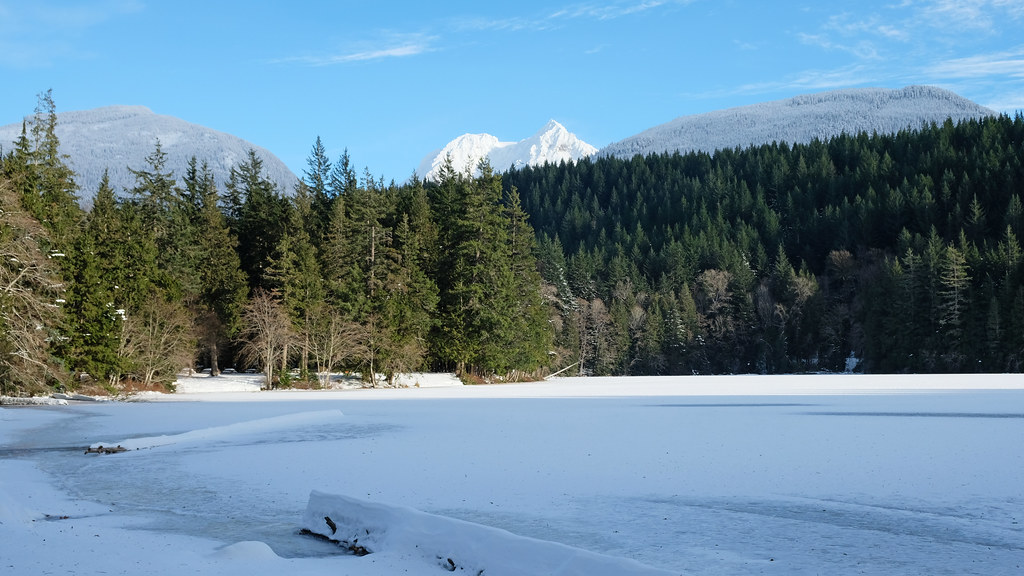
Here’s a real hike, but still an easy one. Not surprisingly, the Four Lakes Trail passes four lakes while taking you for a 6.4 km loop in the mossy forest. Stump Lake, Fawn Lake, Edith Lake and Alice Lake are similar, yet each one has their own character, and they have lovely mountain backdrops. You can start with either Stump Lake or Alice Lake.
You can hike this path all year, but it occasionally gets snow, and the lakes might be frozen and under snow during the winter months. However, it’s a well-trafficked trail, so the snow is unlikely to be too deep. Microspikes were enough for us in December.
- Trailhead: Alice Lake Road parking area
- Length: 6.4 km loop
- Elevation gain: 146 m
- Hiking season: all year
- See the trail map here!
Cheakamus Canyon Trail

The Cheakamus Canyon Trail follows part of the Sea to Sky Trail and the railway. Just to get your expectations right: the trail is not in the canyon. Cheakamus River Canyon is dramatic but inaccessible, so this trail goes parallel with it, and offers occasional views of the canyon. These views are impressive, but you don’t have them all the way, and some of the views are obstructed by the trees.
At about halfway you pass Starvation Lake where you can swim in the summer. The trail ends when you reach the highway (there’s a concrete fence, and there’s no parking at this end of the trail), and you get the best views in the last section.

It’s a nice, easy and well-marked forest trail, but granted, there are countless hiking trails in the area that are more impressive (and more challenging, as well).
To get to the trailhead you need to turn to Squamish Valley Road from the Sea to Sky Highway, then cross the Cheakamus River bridge, and continue on Paradise Valley Road. Drive as far as you can, the last ~3 kilometers are on a bumpy, dirt road. Here I marked the parking lot for 2WD vehicles, however, you might want to walk more and drive less, if the road conditions are more challenging due to mud or snow.
- Trailhead: end of Paradise Valley Road
- Length: 10.9 km return
- Elevation gain: 323 m
- Hiking season: all year
Best medium difficulty hikes in Squamish

So this is my collection of the medium difficulty Squamish trails. Whether a trail is medium or hard depends on your hiking experience and physical abilities, so I indicated both the length and elevation gain that helps you estimate the actual difficulty. Also, please keep in mind that challenging weather conditions (like icy or wet rocks) can turn a medium difficulty trail into a very challenging one.
You find some shorter trails here, as well, but they simply don’t fit in the list of easy hikes due to their steepness.
Al’s Habrich Ridge Trail
Al’s Habrich Ridge Trail is one of the best trails in Squamish, and probably “the very best” for the average hiker. It doesn’t mean it’s easy though. It has quite steady elevation gain, with occasional steeper sections, and hiking shoes with a good grip are recommended for walking on the large rock surfaces.

However, it’s an incredibly scenic trail, following a granite ridge with panoramic views almost all the way. You can enjoy a subalpine terrain with wildflowers and small ponds in the summer months, and it’s magical in the winter and early spring, with all the snowy peaks around you.
We hiked the Al’s Habrich Ridge Trail in early spring in the snow. We only needed microspikes, because the trail was packed. Depending on how much traffic it gets after snowfalls, it might be accessible for hiking all year. Occasionally, you might need snowshoes if the snow is too deep.
The trailhead is at the top of the Sea to Sky Gondola. You can choose to hike up on the Sea to Summit Trail, but that makes it considerably longer and very challenging.
- Trailhead: top of the Sea to Sky Gondola
- Length: 6.3 km return
- Elevation gain: 405 m
- Hiking season: all year
- See the trail map here!
Jurassic Ridge Trail, Murrin Provincial Park

The Jurassic Ridge Trail is a typical example of a short, but very steep hike. It takes you up to the granite outcroppings above Browning Lake, and the viewpoints are stunning! The trail is for adventurous and fit hikers though, because you’re either climbing an endless series of steps or scramble up on the large rocks.
We underestimated it, and did it while having our son in the baby carrier – not ideal. We had to be extra cautious at lots of places, and scrambling up is very tiring with a toddler on the back. It would have been a pleasantly challenging trail otherwise, and the views are truly worth the effort. Choose a dry day though, because wet rocks are extremely slippery. Avoid it on icy days, as well.
The trail starts from Browning Lake, and takes you up to Quercus Lookout, Jurassic Peak (Watt’s Point) and Brian’s Lookout. The viewpoints are somewhat similar, but we were happy we didn’t miss any of them, because all have their own charm and angle. You can do the Browning Lake Loop after it, it’ll be a piece of cake. 🙂
- Trailhead: Murrin Provincial Park parking lot, on the west side of the Sea to Sky Highway
- Length: 2.9 km loop
- Elevation gain: ~200 m
- Hiking season: March – November
- See the trail map here!
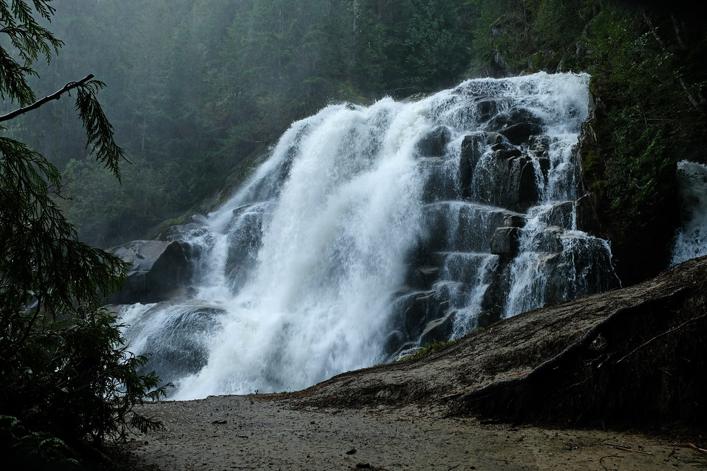
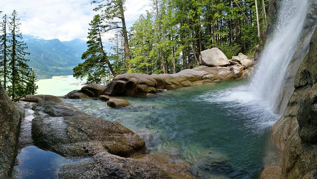
Crooked Falls & Stoltmann Lookout

Crooked Falls is a powerful, roaring waterfall, one of our favorites near Squamish. The trail there is also quite delightful, in a mossy forest and with pretty viewpoints from time to time. It has a few steep sections where you even need to use your hand, but overall, it’s steady uphill (and downhill on the way back).
It starts at the Sigurd Valley Trail Trailhead, just off Ashlu Forest Service Road after crossing Ashlu Creek. The road is fine for 2WD vehicles, but be careful after heavy rains, as it can get muddy, and there’s a risk of flooding. There’s a small shoulder for parking, then you have to find the trailhead – which is not that obvious.

The trailhead is not marked, so have an offline map, and start on the narrow path among the bushes. It runs in the creek for the first few hundred meters. After about 15 minutes, you’ll reach a sign board and the Sigurd Valley Trailhead mark. The path is well-marked and obvious from there.
this is half of the waterfall
As you hike towards Crooked Falls, there are several viewpoints, but the first and best one is easy to miss. Keep your eyes open for a narrow, unmarked trail that leads up to a rocky bluff and has incredible views of Squamish Valley. The two other viewpoints later are easy to notice.
But the highlight is the end: the two natural platforms that offer close views of Crooked Falls, with their sharp 90-degree turn while cascading onto a rock bluff. Prepare to get wet, as the mist from the falls soak the platforms. It’ll still be a wonderful view, but taking a wonderful picture is hard. 🙂

On the way back, take the short, but steep detour to Stoltmann Lookout for great views of the surrounding snow-capped peaks.
- Trailhead: Sigurd Valley Trail Trailhead, just off of Ashlu Forest Service Road
- Length: 6 km return
- Elevation gain: 520 m
- Hiking season: April – November
- See the trail map here!
Mount Crumpit

Being 331 meters high, Mount Crumpit won’t impress as a peak, but it does impress with a surprisingly good view of the Stawamus Chief, Shlanay peak and Howe Sound from the summit, a lovely forest trail that never gets too busy, and several other viewpoints if you take a loop hike in the area.
Though relatively short, it’s not an easy trail. There’s a network of trails in this area which can get confusing, and some routes are steeper than others. So how to navigate this loop to get the best views?
Don’t head to Mount Crumpit directly, hike the loop to find several spectacular viewpoints. The trailhead is at the intersection of Westway Avenue and Cherry Drive. Street parking is plenty, just be respectful, it’s a residential neighborhood. Head into the forest, cross the bridge and turn left, look for the “S+M Connector” trail, you’ll follow it along Little Stawamus Creek.
Ignore unmarked side trails until you reach the junction with Fartherside Trail, turn right on Fartherside Trail. Then turn onto Woodpecker Trail, do the detour to Lacking Head Viewpoint, then onto Viewpoint Trail (sign will tell you: “long route to Mount Crumpit via the Viewpoint”).
Then join Woodpecker Trail again, it takes you to the rocky bluff at the summit of Mount Crumpit. It’s time to enjoy the views and have a picnic. Then make a circuit around the summit to get even more of those fabulous views. Finally, Stairway to Heaven and Deep Ends trails take you down to finish the loop. They are very steep. Alternatively, you can take the same route back (via Woodpecker Trail, Fartherside Trail and S+M Connector) – it’s longer, but not as steep.

Definitely bring an offline GPS and trail map. The reason we gave such a precise trail description is because you have too many options and even more unmarked side trails. But the viewpoints and the summit views are well worth the effort.
The hike to Mount Crumpit can be done at any time of the year. Microspikes make it safer in the winter months, but it’s snow-free for the majority of the year as the elevation is quite low.
- Trailhead: intersection of Westway Avenue and Cherry Drive, Squamish
- Length: 4.9 km loop
- Elevation gain: ~300 m
- Hiking season: all year
- See the trail map here!
Slhanay Peak
Here’s another lesser-known hike which can get a little confusing and steep at places, but offers incredible views of the Stawamus Chief from several viewpoints. If you have the feeling that it’s not a proper trail, well, it’s an informal trail and can be a bit rough at places. But once you’re halfway, you’re done with the hardest uphill.
Don’t forget your offline map and GPS either. The trail is marked, but still there are some intersections where it’s not obvious where to turn, and there’s a large trail network in this area.
Where to start? Drive about 2 km on the Mamquam Forest Service Road. Like most forest service roads, it’s a bumpy gravel road, but this 2 km is doable for 2WD vehicles, as well. The trailhead is not obvious, it’s a narrow path that leads into the bush, so you need your trail map right away. Parking is possible on the road shoulder.
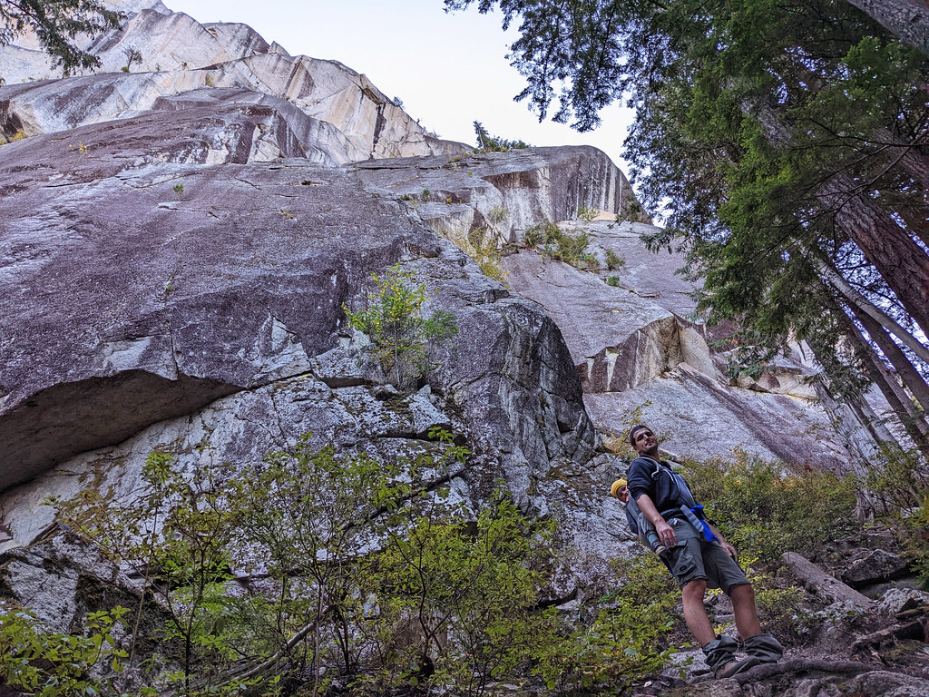
Then you start a steep ascent through the forest, occasionally you need to use your hands, too. You’ll reach a giant rock wall quite soon, and maybe you’ll see rock climbers, but as a hiker you’ll take the route around the rock wall. It’ll be challenging enough as there are some steep, narrow, exposed sections. Just take it slow.

Keep your eyes open for short detours to two viewpoints as you hike towards Slhanay Peak, and then for another one on the return side of the loop. They compete with the summit view. The summit is a rocky bluff with an impressive view of the Chief which is right in front of you, a bit of Howe Sound and many other distant mountain peaks.
Think twice before attempting this hike in rainy weather, it makes the steep sections even more challenging. The same applies to icy conditions, so it’s best to do this hike outside of the winter months. We did it in October and met with only a handful of people.
- Trailhead: Mamquam Forest Service Road
- Length: 5.5 km loop
- Elevation gain: 676 m
- Hiking season: March – November
- See the trail map here!
Brohm Lake Interpretive Forest & Tantalus Lookout

You can see Brohm Lake from the highway, but it’s not very tempting, it looks like a “nothing special” marshy lake. While it’s no match for any of the turquoise, glacier fed lakes, it’s a lovely swimming lake in the summer, if you explore its shoreline a bit. Also, there’s a loop trail that includes Brohm Lake and several pretty viewpoints on the west side of the lake.
Unlike higher elevation trails between Squamish and Whistler, the Interpretive Forest is snow-free almost all year, and it offers great views of the surrounding snowy peaks. It offers a variation of hiking options, like a simple, easy loop around Brohm Lake, or a larger loop with detours to different viewpoints. This is what we recommend, as our favorite part of this hike was not the lake, but the west side viewpoints, especially Tantalus Lookout.

Parking is right by the highway, in the Brohm Lake Day Use Recreation Site parking. What makes it challenging is that the parking lot is small compared to summertime crowds. But you barely meet anyone here in spring or fall. Then you start on the lakeshore, and it’s worth taking the side trails to some of the rocky outcroppings above Brohm Lake, as they offer the best lake views.
Soon you leave the lakeshore though, and climb several long stairs – first up, then down. The trail is far from being flat, but it rarely gets very steep, it’s steady uphill or downhill for the most part. The steepest sections are the short detours to the viewpoints, particularly to the Tantalus Lookout. But that’s the highlight of this loop, and it’s worth the effort.

The extensions to the Cheakamus Loop and the High Trail are less maintained and a bit overgrown, but the west side still offers some great lookout points. Then you get back to Brohm Lake.
- Trailhead: Brohm Lake Day Use Recreation Site parking lot
- Length: 8.1 km loop
- Elevation gain: 407 m
- Hiking season: March – November
- See the trail map here!
Best challenging hikes in Squamish
Finally, here are the best hikes in Squamish that require stamina and hiking experience. Two of them are relatively short, but very steep and require lots of scrambling, the others might not be too steep, but their overall length and elevation gain makes them challenging.
Also, none of these trails are recommended as winter hikes, as they are high enough to get plenty of snow or get icy which makes them dangerous. Snowshoeing might be an option on some of them, depending on weather conditions.
Stawamus Chief First Peak & Second Peak
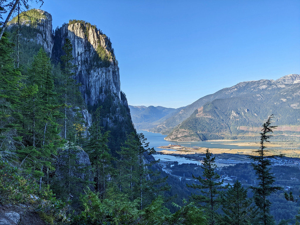
The Chief hike is famous for a good reason. These granite cliffs tower above the highway, and they look impressive even from the road. The adventurous trail up there and the breathtaking panorama in the end makes it the most popular (and the most busy!) hike in Squamish.
Stawamus Chief Provincial Park has three peaks, and the main trail splits into separate ones to give access to the different peaks. You can choose to hike to only one of them, or all. Most people choose the First Peak and Second Peak, and that’s what we recommend, as well.
view from the First Peak
First Peak offers prime views of Howe Sound and Squamish below, but it’s also the busiest one. Second Peak has an impressive mountain panorama and a great view of the granite dome of the First Peak. It’s somewhat quieter, because many people turn back after the First Peak. The trail to the Third Peak is not well-maintained and quite overgrown, so we didn’t do it.
Reaching the First Peak is a 3.7 km return trail, but with more than 500 meters elevation gain! It includes lots of stairs, ladders and chains to help you conquer the steep terrain, and rock scrambling is definitely required.

view from the Second Peak
First and Second Peak is 5 km return, with 655 meters elevation gain. The route to the Second Peak is quite similar to the First Peak trail, so if you enjoyed one you’ll enjoy the other. (If you found it dreadful, you’ll find the other one dreadful, too. People with the fear of heights should be cautious.)
Parking is in Stawamus Chief Provincial Park, just off of the Sea to Sky Highway. There’s overflow parking, as well, but you have to arrive very early in the morning on summer weekends to find an available spot in any of the parking lots.
- Trailhead: Stawamus Chief Provincial Park parking lot
- Length: 5 km return
- Elevation gain: 655 m
- Hiking season: March – November
- See the trail map here!
Shannon Falls Pools Trail
Though the walk to the Shannon Falls lookouts is short and easy, the area offers challenges for those who are looking for it. The Shannon Falls Pools Trail is not a well-known, official trail, but it’s used and loved by locals. It’s one of the best hidden Squamish hikes!
It takes you up to the crystal clear pools below Shannon Falls on a very steep route that requires rock scrambling, supported by ropes. But you find a fairy garden at the top: the turquoise pools, the roaring waterfall, with views of Howe Sound and Squamish below. We’ve written a detailed guide to all the Shannon Falls hikes, find the Shannon Falls Pools Trail description here!
Sea to Sky Summit Trail (Upper Shannon Falls Trail)

The Sea to Sky Summit Trail, also called Upper Shannon Falls Trail, is a full day hike (16.4 km return), and it literally takes you from the sea level to the summit – which means the summit station of the Sea to Sky Gondola. You pass Upper Shannon Falls and spectacular viewpoints on the way. See our detailed trail description here!
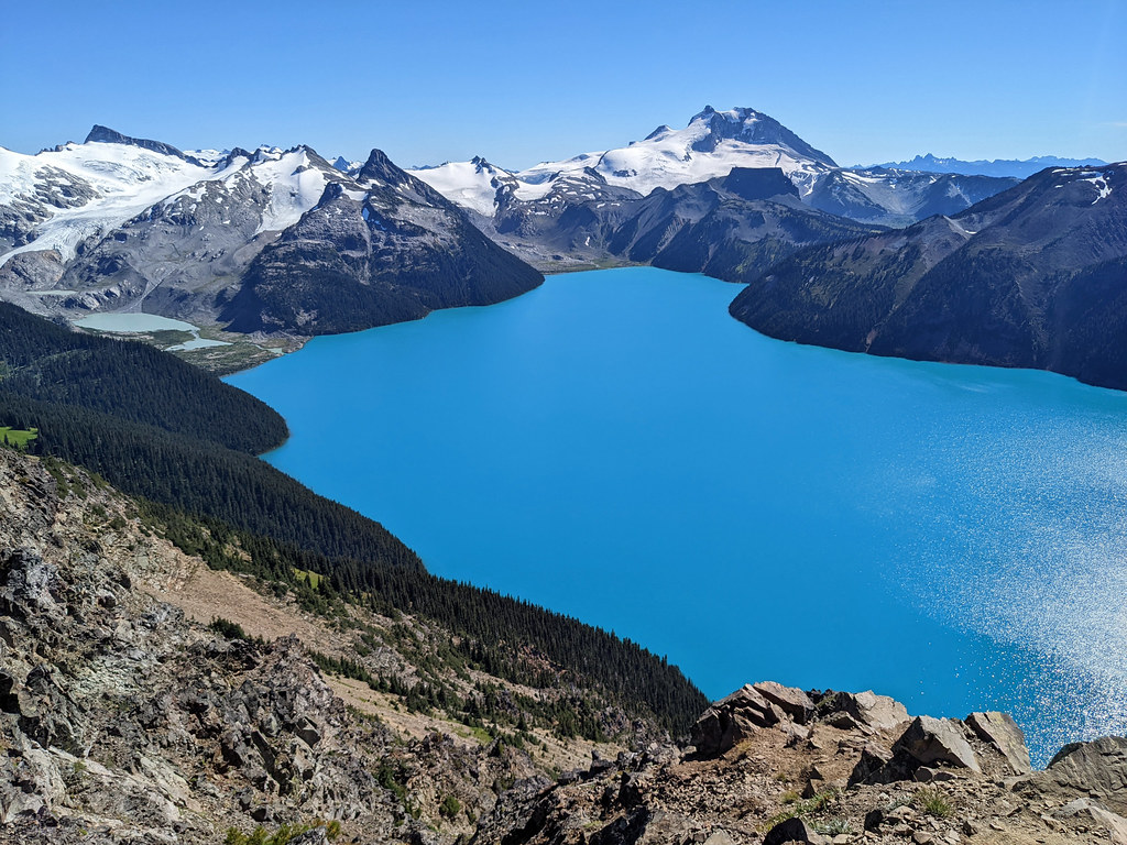
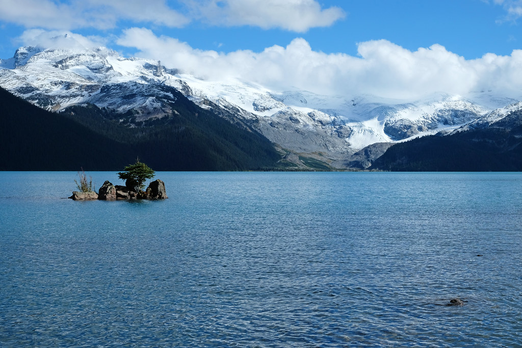
Garibaldi Lake, Garibaldi Provincial Park

The hike to Garibaldi Lake is a classic. Even though most of it is a series of switchbacks in the forest that seem to be endless, and it offers no views until the end. But once you reach Lesser Garibaldi Lake and then Garibaldi Lake, you won’t even consider whether it was worth it. This fabulous glacial lake has few competitors not only in BC, but in all of Canada. (And those competitors are mostly the world-famous turquoise lakes of the Canadian Rockies.)
Read our detailed hiking guide about Garibaldi Lake here!
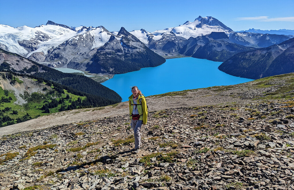
Panorama Ridge Trail, Garibaldi Provincial Park

Panorama Ridge Trail is not only one of the best Squamish hikes, but one of the most beautiful hiking trails in British Columbia. It runs through alpine meadows, while passing several lakes with breathtaking mountain backdrops. Finally, you reach a rocky ridge that takes you above Garibaldi Lake. It’s not only the very best view of the lake and its glaciers, but also a perfect, wonderful 360 degrees alpine panorama with more peaks than you can count.
Oh, and Panorama Ridge Trail starts from Garibaldi Lake – which is a challenging day hike itself. So Panorama Ridge is not for everyone. With almost 30 km and 1600+ meters elevation gain, it’s a very challenging trail, suitable for long summer days, as you need a minimum of 10.5 hours to complete it. Calculate with 11-12 hours though, with all the scenic picnic breaks. Some people complete it in two days, while camping at Garibaldi Lake or Taylor Meadows.

The hike is not technical, a bit of scrambling is required right before the top, however, most of the trail is steady uphill. Don’t let that fool you though, it is challenging and you need to be fit to complete it.
The trailhead is the Rubble Creek parking lot, and the first section is the Garibaldi Lake Trail. Once you have had enough of the views on the lakeshore, you continue further up, and soon you’ll leave the forest behind. The trail is very scenic from there until the end. Views of Black Tusk and several smaller lakes are fantastic, and Garibaldi Lake has an incredible hue when looking at it from above.
On your way back, you can take the trail through Taylor Meadows. It’s more scenic and shorter than Garibaldi Lake Trail, but offers no lake access.
This is a summer trail, accessible roughly from late June until the first snowfalls in October. While the Garibaldi Lake Trail can be suitable for snowshoeing in the winter, Panorama Ridge Trail is more of a mountaineering objective in winter conditions.
- Trailhead: Rubble Creek parking lot
- Length: 29.4 km
- Elevation gain: 1610 m
- Hiking season: late June – mid-October
- See the trail map here!
Elfin Lakes, Garibaldi Provincial Park
We didn’t get to Elfin Lakes the past summer, though it’s on the top of our BC hiking bucket list. It’s also a full day summer hike in Garibaldi Provincial Park, and it’s popular for snowshoeing in the winter.
It’s a steady uphill, and after a bit of a boring start on an old road, you can enjoy nice alpine scenery and the two pretty lakes in the end. To access the trailhead you need to drive on Garibaldi Park Road, which you can access from the Garibaldi Highlands neighborhood in Squamish. It’s a bumpy gravel road, but usually fine for 2WD vehicles in the summer.
- Trailhead: Diamond Head Trail parking
- Length: 19.8 km
- Elevation gain: 821 m
- Hiking season: late June – mid-October
- See the trail map here!
FAQ about hiking in Squamish

Do you need a 4WD on the forest service roads?
To reach some of the hikes around Squamish, you need to drive on forest service roads (unpaved logging roads). And when it gets to forest service roads in BC, 4WD vehicles are often recommended. However, all the trails in our list can be accessed by any kind of car.

We got to all the trailheads with our low clearance sedan (with no damage to the car, I might add). I wouldn’t say I particularly enjoyed those drives, but the bumpy sections are short and can be done slowly and cautiously. So just take it slow – or give the wheel to your husband and close your eyes (just kidding… well, or not :D).
Are there bears near Squamish?
Bears are everywhere in British Columbia. 🙂 Squamish is home to both black bears and grizzly bears. So make noise, hike in groups if you can, carry bear spray and know how to use it. And keep in mind that most bears avoid humans as much as they can, and aggressive behavior is very rare.
Be cautious with mummy bears though, as they are protective of their cubs. Never approach or feed bears.
Can you hike in Squamish as a day trip from Vancouver?

That’s what we do all the time. Squamish is about an hour drive from Vancouver, so you can totally do it as a day trip. It has plenty of accommodation options though, including campgrounds, if you’d stay for several days.