Looking for an easy, pretty waterfall hike in Vancouver? Our favorite is Cypress Falls, and in this article we’re sharing everything you need to know for a delightful hike to this fabulous pair of waterfalls (because there are two of them!), located in a small wilderness park.
Cypress Falls Park is one of the loveliest parks in West Vancouver. It has a rushing creek, two fabulous waterfalls, 300-year-old Douglas Fir and Red Cedar trees and a captivating rainforest scenery. You’ll notice the new growth sprouting from the fallen trees and stumps as the circle of life in the forest never stops. You’ll totally forget you’re in a city once you set foot on the forest path – a typical Vancouver hike.
It’s a great stop along the Sea to Sky Highway from Vancouver to Whistler, and I recommend adding it to your Vancouver itinerary, too, if you have several days in the city. It’s also among our favorite family hikes in Vancouver, because even a toddler is able to complete it, and there’s plenty of excitement on the way, like the large tree roots or the creeks. I visited Cypress Falls Park with Tomi in every season, and we never got bored of it.
Don’t confuse Cypress Falls Park with Cypress Provincial Park, which is also on the North Shore and is a great place to hike, but it’s a different park and much larger.
Read this, too: 12 Best Waterfalls Near Vancouver, British Columbia
How to access Cypress Falls Park?
Cypress Falls Park is just off the Trans-Canada Highway in West Vancouver. This makes it a great roadside stop if you’re driving from Vancouver to Whistler. You need to take exit #4, and the Cypress Falls parking lot is off Woodgreen Drive.
It’s a decent sized parking lot, but no matter the size, parking lots in Vancouver tend to fill up on sunny summer weekends. If it’s full, park along the sides of the nearby streets.
Our guide to the Cypress Falls hike
The main attractions of the park are Lower and Upper Cypress Falls, and a well-marked, often quite busy trail leads you to both of them within about 1-1.5 hours.
Hiking essentials:
- Trailhead and parking: Cypress Falls Park parking area (just off Woodgreen Drive)
- Length: 2.7 km return (about 1-1.5 hour)
- Elevation gain: 124 m
- Difficulty: easy
- Check out the Cypress Falls trail map here!
Reaching the Lower Cypress Falls viewpoints
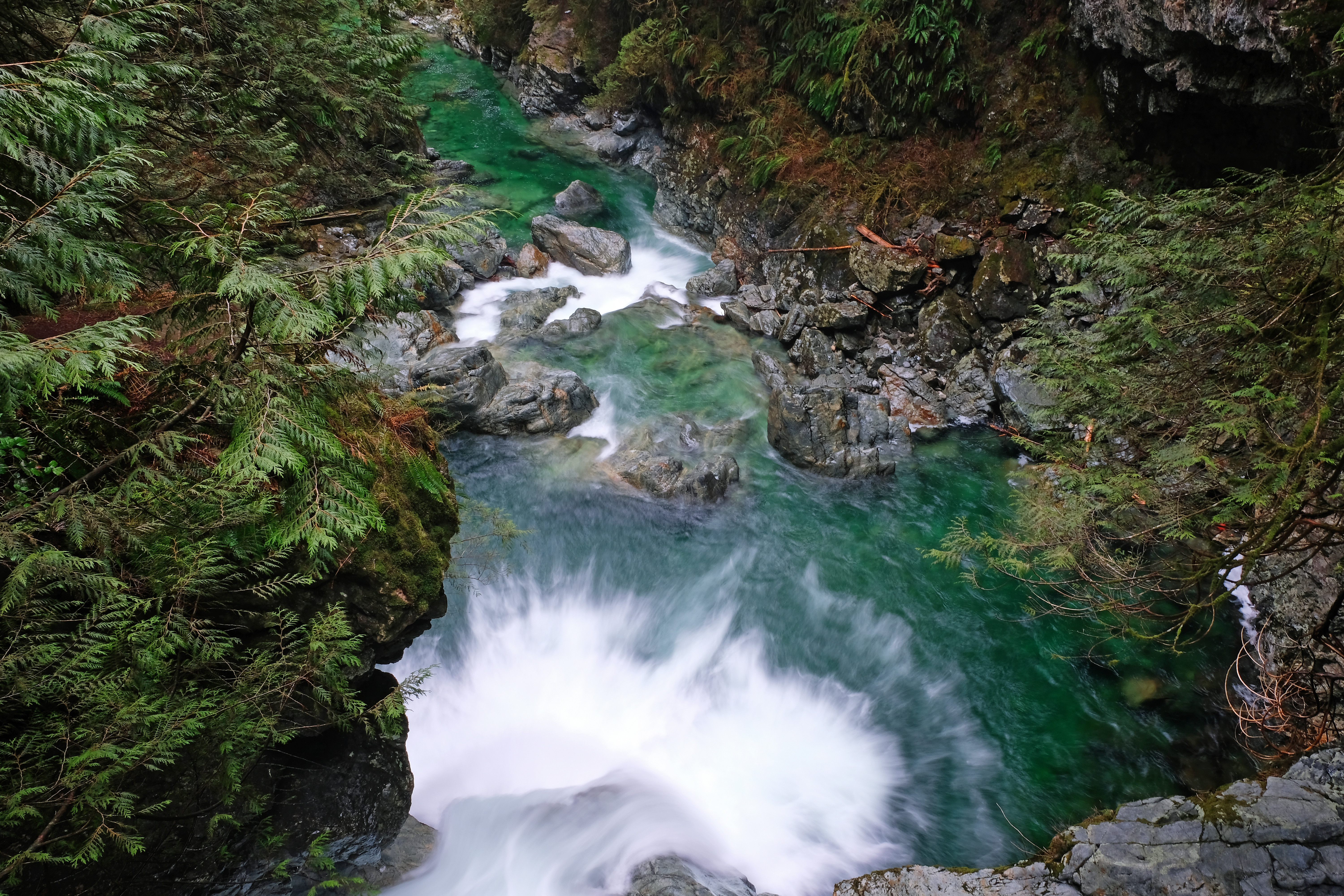
Lower Cypress Fall is the first, and it’s a really short and almost flat walk from the parking area. It has two fenced viewing platforms, the second looks over the waterfall from above. Lower Cypress Falls is roaring, especially after heavy rains and during the spring months when the snow is melting, and it goes through a narrow and rocky part of the ravine. This makes it very impressive, even though it’s not a particularly high waterfall.

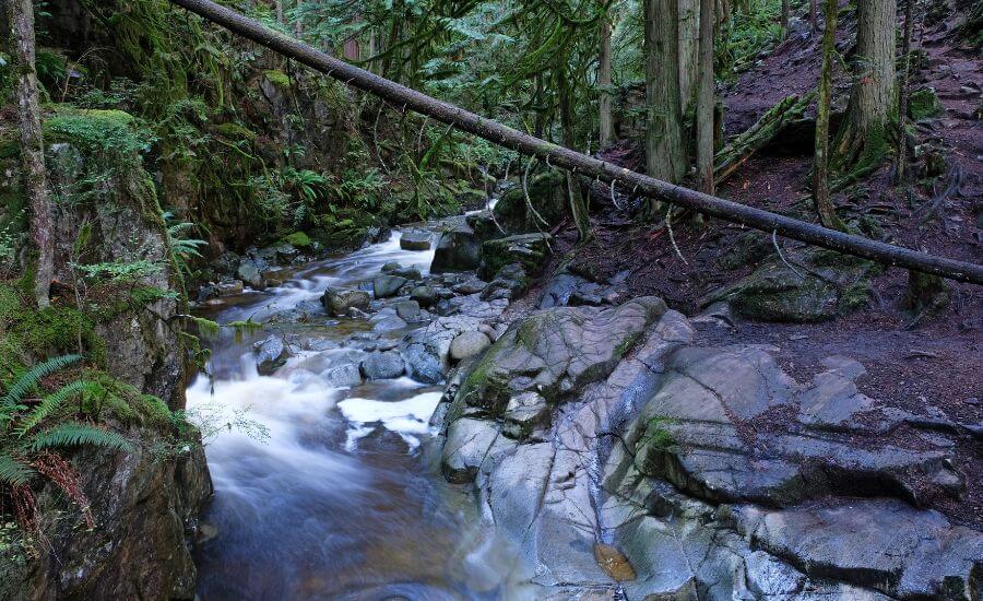
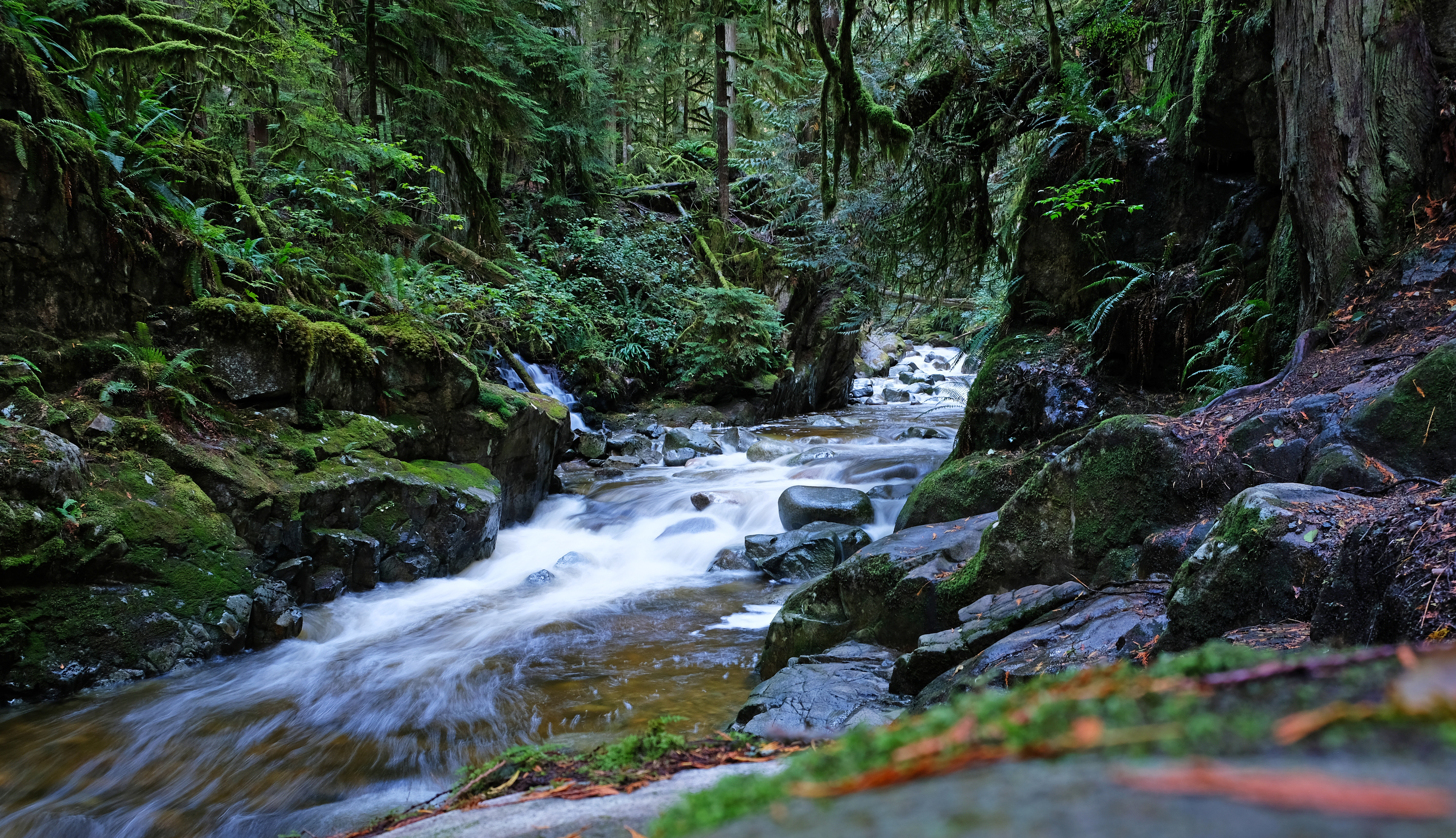
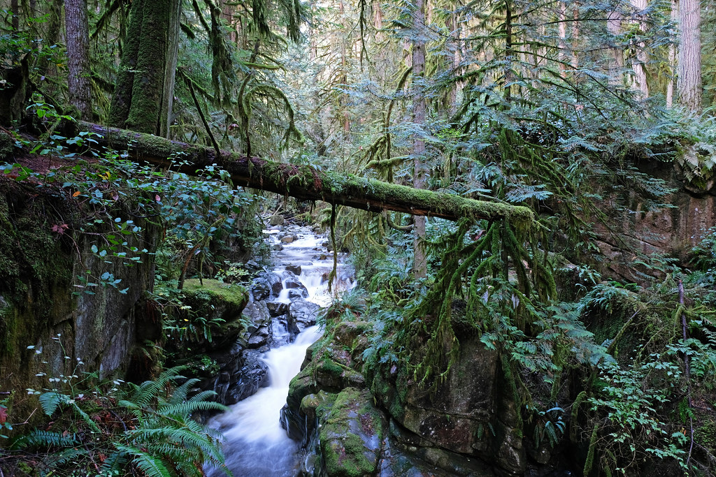
Hiking along Cypress Creek
It’s worth continuing further up on the trail. You’ll get nice views of Cypress Creek and its numerous cascades, and the lush green ravine. You’ll soon arrive at a wooden bridge, and you can cross it to enjoy the views of the ravine which are particularly dramatic there.
Otherwise, stay on the left side of the bridge, that’s where the trail continues towards the Upper Falls. Cypress Creek will be on your right all the way to the first viewpoint of the Upper Falls. Whenever in doubt, check for the orange markers on the trees.

Continuing to the views of the Upper Cypress Falls
The two viewpoints of the Upper Cypress Fall were the highlight of this hike for us. You need to leave the maintained area of the park to reach them. There will be a fence and a warning sign, but don’t worry, just continue further, you’re on the right path.
 u
u
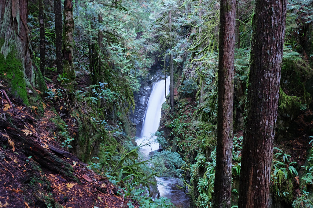
Upper Cypress Falls from the first viewpoint
The first viewpoint is quite straightforward to find, as you’ll notice it as you meander through the forest, along the edge of the ravine. There’s no fence, so be careful as you find the nicest viewing angle. Upper Cypress Falls looks pretty, but the canyon is just as amazing. But the second viewpoint is even better, though it’s easily missed if you don’t follow your trail map.
How to find the second viewpoint of Upper Cypress Falls?
Hike further until you reach a crossing with a quiet gravel road. Turn left and continue for a little while, but keep your eyes open for a right turn that takes you into the forest again. The narrow path descends to a natural viewing platform of the Upper Cypress Falls.
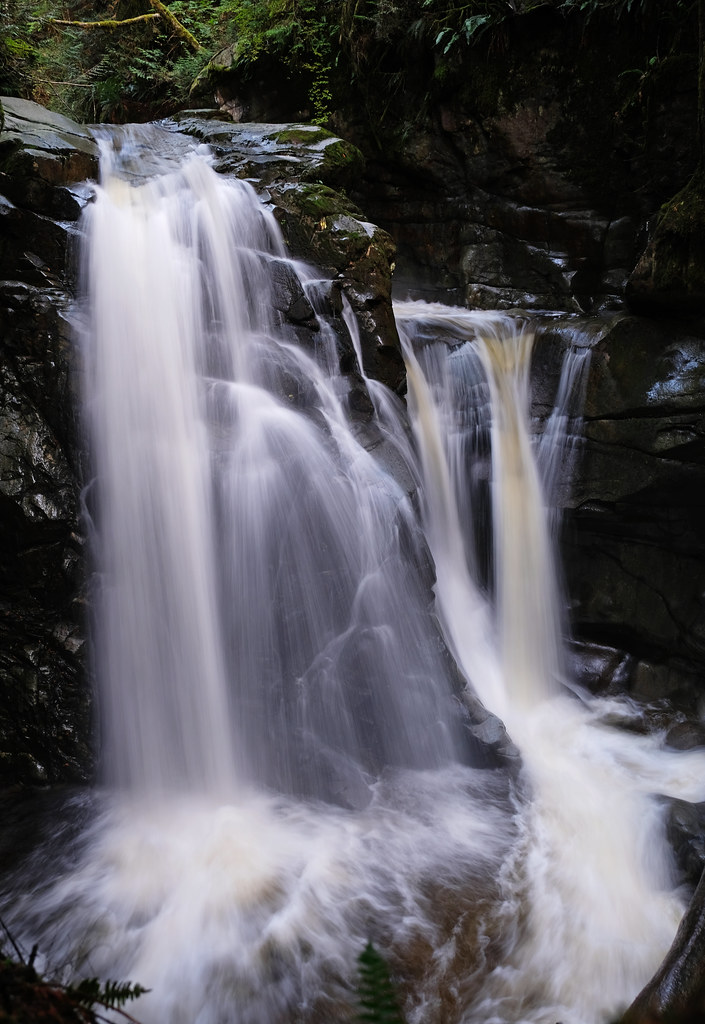
You’ll get the very best, close and undisturbed views of this powerful waterfall here. There are no railings and a steep drop down though, and the terrain can be slippery, especially after rains, so watch your steps (and keep small children close, holding their hands).
Once you have enough of the waterfall views, take the same path back to the parking lot. You can choose to find the trail that runs on the other side of Cypress Creek, eventually arriving at the wooden bridge I mentioned.
Read this, too: 12 Best Hikes In North Vancouver, British Columbia
How difficult is the Cypress Falls trail?
Based on the distance and the elevation gain, this is an easy hike, a great introduction for beginners and families. It takes about 1-1.5 hours to complete. Nevertheless, it’s a hike, not a casual forest stroll.
The terrain gets quite rough at places, with large tree roots and rocks. It runs along the edge of a steep ravine for a considerable distance, so be careful not to venture too close to the edge, and keep a close eye on young children. These sections are among those where I wouldn’t let go of my toddler’s hands.
The path can get very muddy and slippery after rains, and there will be months each year when it can’t dry up. So wear hiking shoes, preferably waterproof hiking boots, for the best experience. Flips-flops are not suitable for this terrain even during dry periods.
What to wear hiking in the winter?
Dress in layers:
- synthetic or wool base layer (for men, for women)
- insulating midlayer (for men, for women)
- outer layer to protect you from wind, rain and snow (for men, for women): no need for an insulated jacket for day hikes near Vancouver, as you’ll get easily overheated in ski jackets; just make sure it’s waterproof
- hiking pants (for men, for women)
- optionally, rain pants: they should be worn over your hiking pants in wet conditions, or simply to shield you from the wind and add an extra layer
- waterproof hiking boots (for men, for women) or snow boots
Cover as much of your skin as possible:
- gloves
- wool socks
- gaiters: keep the snow out of your boots when hiking in deep snow
- beanie
- face mask or neck gaiter
Stay safe:
- microspikes: they make hiking on icy, snowy terrain easier and safer
- headlamp: days are shorter in the winter, and you don’t want to get lost in the dark
- emergency blanket
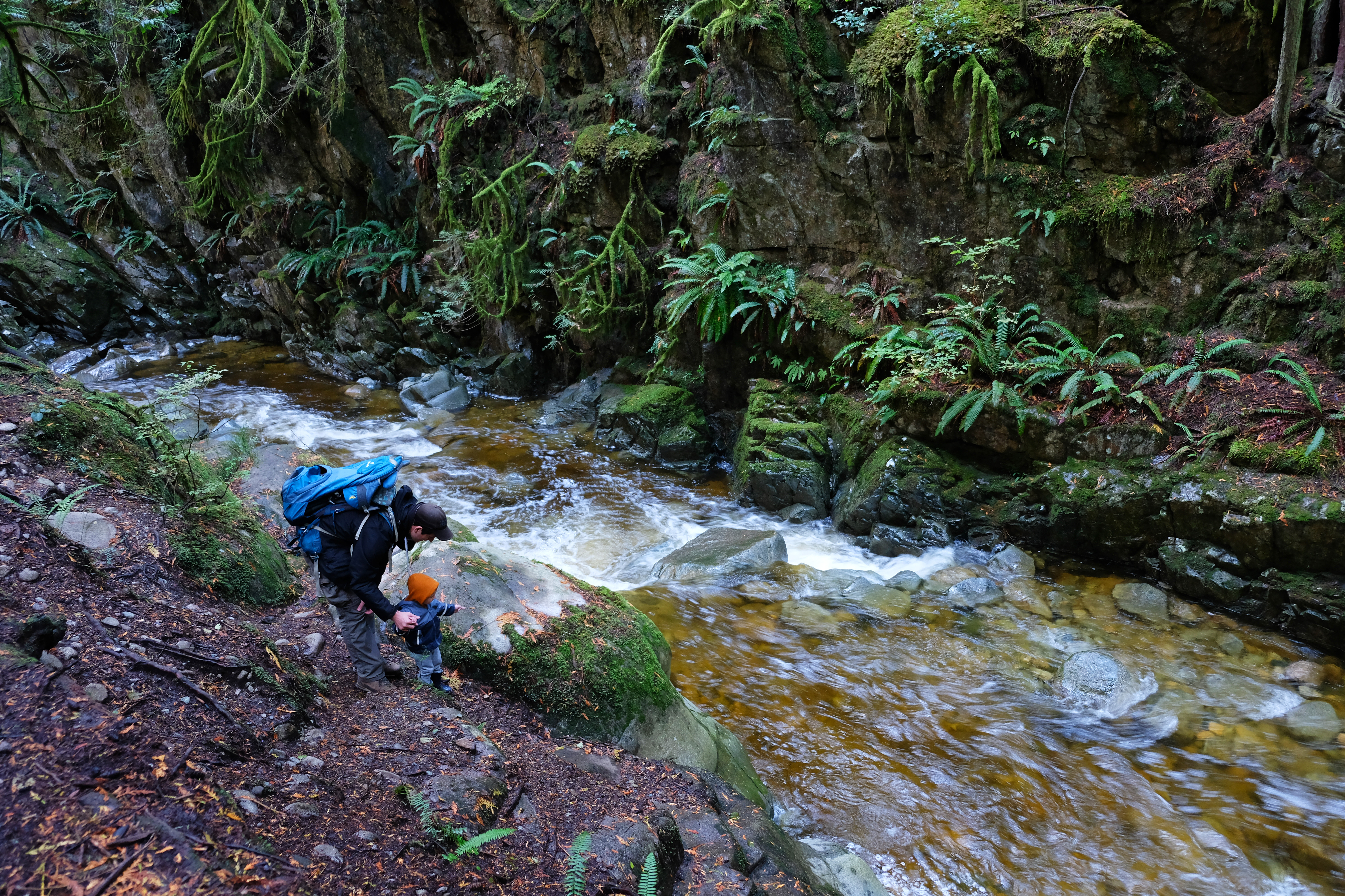
Is it a family-friendly hike?
It takes about 10-15 minutes to reach the Lower Falls, and 1-1.5 hours to hike the full route. The terrain is rough enough to be challenging and to offer the experience of being on a real hike, yet it’s short, and the elevation gain is minimal. This makes it ideal for kids of any age. You can carry your baby, let your toddler climb the large roots or your preschoolers lead the way.
The most risky areas are where the trail runs on the edge of the ravine, and the two unfenced viewpoints of the upper waterfall. Keep your kids close, and hold hands if needed.
What is the best time to visit Cypress Falls Park?

a rare snowy day in Cypress Falls Park, West Vancouver
It’s a low elevation trail, which means that it’s snow-free for the majority of the year, and it’s also beautifully evergreen all year. This makes it a great winter hike. If it gets the occasional white blanket in December or January, it looks like it’s from a fairy tale book. It remains accessible, but microspikes are recommended on hard-packed, slippery snow.
Another great time to see the waterfalls is spring, because the melting snow in the mountain makes the small creek thundering and powerful. It happens after heavy rains, too, though be prepared for muddy trails.

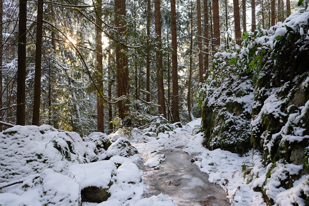
don’t let some snow scare you away, this trail looks magical in white
So… winter, spring and rainy periods – that means most of the year. There’s only one period which is not ideal: the end of summer. There isn’t much water flowing over the cliffs by the end of August, so the waterfalls won’t be as spectacular.
Other easy hikes on the North Shore
There’s no shortage of easy trails on the North Shore. Lighthouse Park is another favorite of our family, as you can combine the short trails in this coastal park in lots of different ways.
The Twin Falls & Thirty Foot Pool Loop in Lynn Canyon Park is one of the most popular hikes in Vancouver. In addition to being very impressive, it’s also quite short and easy. Lesser-known, but also pretty and easy rainforest walks are the Mystery Creek & Hyannis Loop in Lower Seymour Conservation Reserve or the Coho Loop in Capilano River Regional Park.
The Rice Lake Loop in Lower Seymour Conservation Reserve and the hike to Yew Lake in Cypress Provincial Park are among the easiest lake hikes in the area.
Snorkel with seals in West Vancouver
How about a different kind of outdoor experience on the North Shore? Like snorkeling with the resident harbor seals in Howe Sound. This half-day eco-friendly boat tour starts in West Vancouver and takes you to the Pam Rocks seal colony, provides wetsuits and snorkel gear so that you can dive in to have a closer look at the friendly seals. Passengers who don’t want to get wet have a sightseeing only ticket option so that they can look at the seals from the boat.


Leave a Reply